Report on Akita-Komagatake (Japan) — January 2013
Bulletin of the Global Volcanism Network, vol. 38, no. 1 (January 2013)
Managing Editor: Richard Wunderman.
Akita-Komagatake (Japan) Short lived plume rising to 50 m observed on 14 December 2011
Please cite this report as:
Global Volcanism Program, 2013. Report on Akita-Komagatake (Japan) (Wunderman, R., ed.). Bulletin of the Global Volcanism Network, 38:1. Smithsonian Institution. https://doi.org/10.5479/si.GVP.BGVN201301-283230
Akita-Komagatake
Japan
39.761°N, 140.799°E; summit elev. 1637 m
All times are local (unless otherwise noted)
The Japanese Meterological Agency (JMA) reported that a short-lived plume rose to 50 m above Akita-Komaga-take on 14 December 2011 and was recorded by a camera located to the N of Me-dake's summit.
Aerial observations were conducted in cooperation with the Japan Ground Self Defense Force on 13 December. Areas of snow melt corresponded to geothermal areas that had been previously identified. No new geothermal areas were found.
An M 2.6 earthquake on 27 December at 1234 local time occurred ~2 km W of Me-dake, with a maximum JMA Seismic Intensity of 1 in Senboku-city, Akita Prefecture. The JMA Seismic Intensity scale, used in Japan and Taiwan is classified into 10 categories; 0 to 4, 5 weak, 5 strong, 6 weak, 6 strong, and 7. The seismicity around the area had temporarily increased, but then returned to baseline levels. No volcanic activity related to this seismicity was observed.
JMA reported no activity at Akita-Komaga-take in 2012.
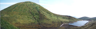
Geological Summary. Two calderas partially filled by basaltic cones cut the summit of Akita-Komagatake volcano. The larger southern caldera is 1.5 x 3 km wide and has a shallow sloping floor that is drained through a narrow gap cutting the SW caldera rim. On its northern side is a smaller more circular 1.2-km-wide caldera whose rim is breached widely to the NE. The two calderas were formed following explosive eruptions at the end of the Pleistocene, between about 13,500 and 11,600 years ago. Two cones, Medake and Kodake, occupy the NE corner of the southern caldera, whose long axis trends NE-SW. The Onamedake cone within the northern caldera has produced lava flows to the north and east; it has a 100-m-wide summit crater. Small-scale historical eruptions have occurred from cones and fissure vents inside the southern caldera. The temperatures of geothermal areas increased beginning in 2005, and some fumarolic plumes were observed in 2011-12.
Information Contacts: Japan Meteorological Agency (JMA), 1-3-4 Otemachi, Chiyoda-ku, Tokyo 100-8122, Japan (URL: http://www.jma.go.jp/jma/en).