Report on Karthala (Comoros) — December 2013
Bulletin of the Global Volcanism Network, vol. 38, no. 12 (December 2013)
Managing Editor: Richard Wunderman.
Karthala (Comoros) Increased nighttime incandescence during 9-10 May 2012
Please cite this report as:
Global Volcanism Program, 2013. Report on Karthala (Comoros) (Wunderman, R., ed.). Bulletin of the Global Volcanism Network, 38:12. Smithsonian Institution. https://doi.org/10.5479/si.GVP.BGVN201312-233010
Karthala
Comoros
11.75°S, 43.38°E; summit elev. 2361 m
All times are local (unless otherwise noted)
Our last report on activity at Karthala, located in the Comoros Islands, covered elevated seismicity and a subsequent eruption in January 2007 (BGVN 32:01). The volcano was then quiet until May 2012.
U.S. Embassy Comoros Officer, Michael Zorick informed us that residents on Karthala's W flank, in the villages of Mde and Mkazi (each ~12 km from the summit), reported observing intensified red glow toward the volcano summit during the night of 9-10 May 2012. He further indicated that there was no perceptible seismic activity.
A search for thermal alerts on the MODVOLC website revealed an absence of alerts after those associated with the 2007 eruption.
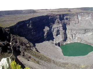
Geological Summary. The southernmost and largest of the two shield volcanoes forming Grand Comore Island (also known as Ngazidja Island), Karthala contains a 3 x 4 km summit caldera generated by repeated collapse. Elongated rift zones extend to the NNW and SE from the summit of the Hawaiian-style basaltic shield, which has an asymmetrical profile that is steeper to the S. The lower SE rift zone forms the Massif du Badjini, a peninsula at the SE tip of the island. Historical eruptions have modified the morphology of the compound, irregular summit caldera. More than twenty eruptions have been recorded since the 19th century from the summit caldera and vents on the N and S flanks. Many lava flows have reached the sea on both sides of the island. An 1860 lava flow from the summit caldera traveled ~13 km to the NW, reaching the W coast to the N of the capital city of Moroni.
Information Contacts: Michael P. Zorick, Comoros Officer, Embassy of the United States of America, Antananarivo, Madagascar; and Hawai'i Institute of Geophysics and Planetology (HIGP), MODVOLC Thermal Alerts System, School of Ocean and Earth Science and Technology (SOEST), Univ. of Hawai'i, 2525 Correa Road, Honolulu, HI 96822, USA (URL: http://modis.higp.hawaii.edu/).

