Report on Chirpoi (Russia) — December 2013
Bulletin of the Global Volcanism Network, vol. 38, no. 12 (December 2013)
Managing Editor: Richard Wunderman.
Chirpoi (Russia) Periodic steam-and-gas emissions and thermal anomalies, November 2012-April 2014
Please cite this report as:
Global Volcanism Program, 2013. Report on Chirpoi (Russia) (Wunderman, R., ed.). Bulletin of the Global Volcanism Network, 38:12. Smithsonian Institution. https://doi.org/10.5479/si.GVP.BGVN201312-290150
Chirpoi
Russia
46.532°N, 150.871°E; summit elev. 742 m
All times are local (unless otherwise noted)
On 6 November 1986, weak fumarolic activity was observed during an aerial survey (SEAN 12:04). The Sakhalin Volcanic Eruption Response Team (SVERT) noted that emissions were again observed in November 2012. This report covers steam-and-gas plumes and emissions and thermal alerts between 20 November 2012 and 30 April 2014.
SVERT's monitoring of Chirpoi is hampered by the lack of surface instruments or seismic network. The volcano is primarily monitored by satellites; cloud cover, however, often prevents space-borne observations. The location of Chirpoi in the Kuril Islands is shown in figure 1.
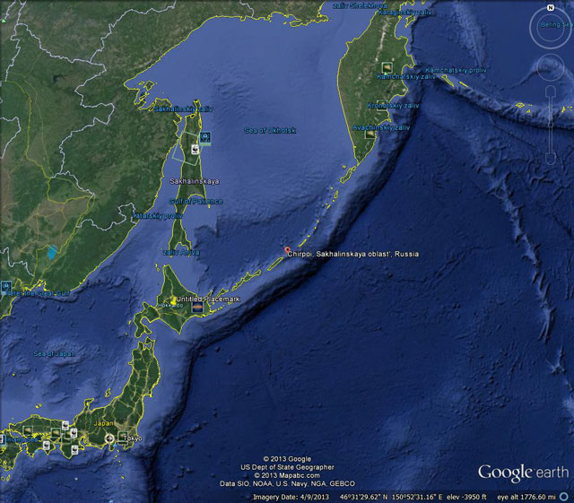 |
Figure 1. Map showing location of Chirpoi. Courtesy of Google Earth. |
SVERT reported thermal anomalies at a volcano of Chirpoi called Snow, starting on 17 November 2012. Periods of steam-and-gas began on 15 December 2012. This activity continued through at least April 2014, based upon analysis of satellite images (table 1). Cloud cover often obscured views of the volcano.
Table 1. Steam-and-gas plumes and emissions from Snow, a Chirpoi volcano, between 21 November 2012 and 30 April 2014, based on analysis of satellite images. Cloud cover frequently prevented observations. Courtesy of SVERT.
| Year | Dates | Plume drift |
| 2012 | 15 and 19 Dec | -- |
| 2013 | 9 and 11 Jan | -- |
| 2013 | 1, 7, 10, 14-15, 19-22, 25 Feb | -- |
| 2013 | 1, 3, 5 Mar | -- |
| 2013 | 23 Jul | -- |
| 2013 | 9 and 12 Aug | -- |
| 2013 | 22-23, 29-31 Oct | -- |
| 2013 | 4, 6, 25 Nov | Drifted 90 km SE on 25 Nov |
| 2014 | 15, 20, and 27 Mar | -- |
| 2014 | 13 Apr | -- |
A search of MODVOLC thermal alerts at Chirpoi since 1980 found no such alerts until a they began at Snow on 11 November 2012. Between that date and 24 December 2012, many thermal alerts were reported. According to SVERT, this may have indicated a lava flow on the SE flank. No further alerts were reported until 8 July 2013; between 8 July and October 2013, thermal alerts were issued on six days. The only alerts between November 2013 and 30 April 2014 were on 10 March, 27-28 March, and 14, 16, 18, 21, 27, 29-30 April 2014.
Based on SVERT weekly reports on 12 and 19 November 2012, the Aviation Color Code increased from Green to Yellow between 5 and 19 November 2012, and remained Yellow through at least April 2014. (Green indicates a normal, non-eruptive state; Yellow indicates elevated unrest above background level.)
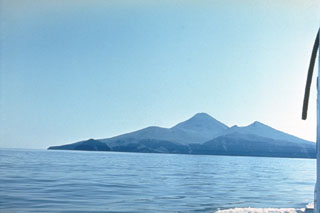
Geological Summary. Chirpoi, a small island lying between the larger islands of Simushir and Urup, contains a half dozen volcanic edifices constructed within an 8-9 km wide, partially submerged caldera. The southern rim of the caldera is exposed on nearby Brat Chirpoev Island. The symmetrical Cherny volcano, which forms the central cone of the island, erupted twice during the 18th and 19th centuries. The youngest volcano, Snow, originated between 1770 and 1810. It is composed almost entirely of lava flows, many of which have reached the sea on the southern coast. No recorded eruptions are known from Brat Chirpoev, but its youthful morphology suggests recent Strombolian activity.
Information Contacts: Sakhalin Volcanic Eruption Response Team (SVERT) (URL in English: http://www.imgg.ru/?id_d=659); and Hawai'i Institute of Geophysics and Planetology (HIGP), MODVOLC Thermal Alerts System, School of Ocean and Earth Science and Technology (SOEST), Univ. of Hawai'i, 2525 Correa Road, Honolulu, HI 96822, USA (URL: http://modis.higp.hawaii.edu/).