Piton de la Fournaise
France
21.244°S, 55.708°E; summit elev. 2632 m
All times are local (unless otherwise noted)
Short pulses of intermittent eruptive activity have characterized Piton de la Fournaise, the large basaltic shield volcano on Reunion Island in the western Indian Ocean, for several thousand years. The most recent episode occurred during 14 July-28 August 2017 with a 450-m-long fissure on the S flank inside the Enclos Fouqué caldera about 850 m W of Château Fort. Three eruptive episodes occurred during March-August 2018, the period covered in this report; two lasted for one day each on the N flank in April and July, and one lasting from late April through May located on the S flank. Information is provided primarily by the Observatoire Volcanologique du Piton de la Fournaise (OVPF) as well as satellite instruments.
The first of three eruptive events during March-August 2018 occurred during 3-4 April and was a 1-km-long fissure that opened in seven segments with two eruptive vents. It was located on the N flank of the central cone, just S of the Nez Coupé de Sainte Rose on the rim of the caldera. A longer lasting eruptive event began on 27 April and was located in the cratère Rivals area on the S flank of the central cone. The main fissure had three eruptive vents initially, only one of which produced lava that flowed in tunnels away from the site toward the S rim of the Enclos Fouqué caldera. The longest flow reached 3 km in length and set fires at the base of the rampart rim of the caldera. Flow activity gradually decreased throughout May, and seismic tremor ceased, indicating the end of the event, on 1 June 2018. A third, brief event on 13 July 2018 produced four fissures with 20-m-high incandescent lava and aa flows that traveled several hundred meters across the NNW flank of the central cone, covering a large section of the most popular hiking trail to the summit. The event only lasted for about 18 hours but caused significant geomorphologic change as the first flow activity in that area in several hundred years.
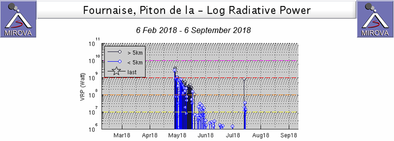
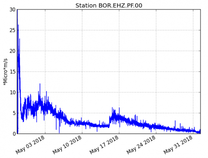
The MIROVA plot of thermal energy from 6 February-1 September 2018 clearly shows two of the three eruptive events that took place during that period. The 27 April to 1 June event produced an initial very strong thermal signature that decreased throughout May. Cooling after the flow ceased continued for most of June. The one-day eruptive event on 13 July was also recorded, but the similarly brief event on 3-4 April was not captured in the thermal data (figure 126).
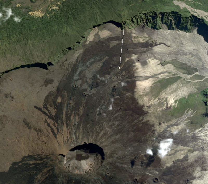
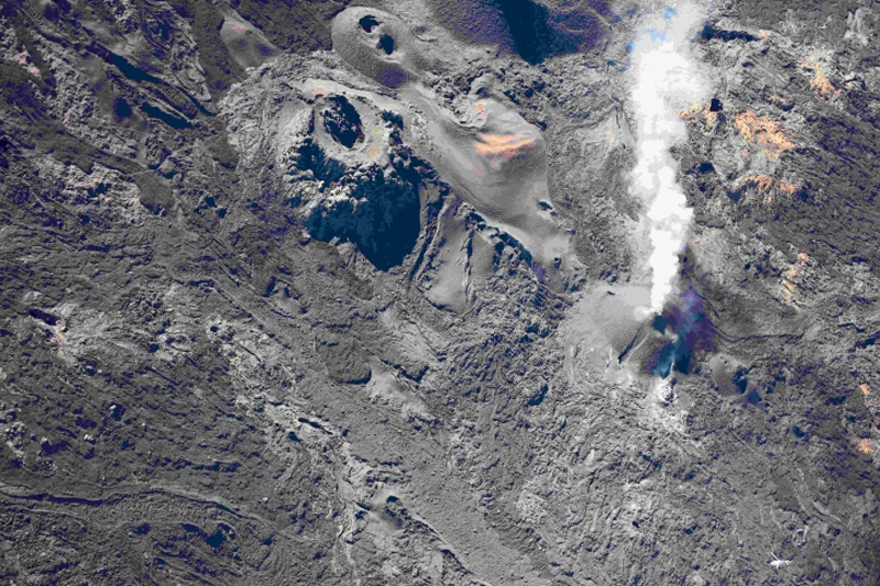
Eruptive event of 3-4 April 2018. Minor inflation and seismicity were intermittent from the end of August 2017 when the last eruptive episode ended. Significant seismic activity around the summit resumed on 23 March 2018 and accelerated through the end of the month. Inflation continued throughout March as well. A change of composition was detected in the summit fumaroles on 23 March 2018; the fluids were enriched in CO2 and SO2. Beginning on 3 April around 0550 local time, OVPF reported a seismic swarm and deformation consistent with magma rising towards the surface. Seismic tremor began around 1040 in an area on the N flank near the Nez Coupé de Sainte Rose. The tremor intensity continued to increase throughout the day; OVPF visually confirmed the eruption around 1150 in the morning on the upper part of the N flank (figure 127).
A helicopter overflight in mid-afternoon revealed a 1-km-long fissure that had opened in seven distinct segments; lava fountains emerged from two of the segments. The last active segment was just below the rampart of the Nez Coupé de Sainte Rose (figure 128). Both seismic and surface eruptive activity stopped abruptly the following day at 0400.
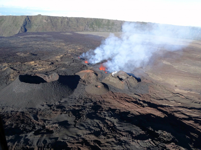
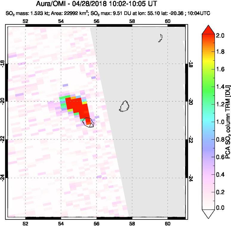
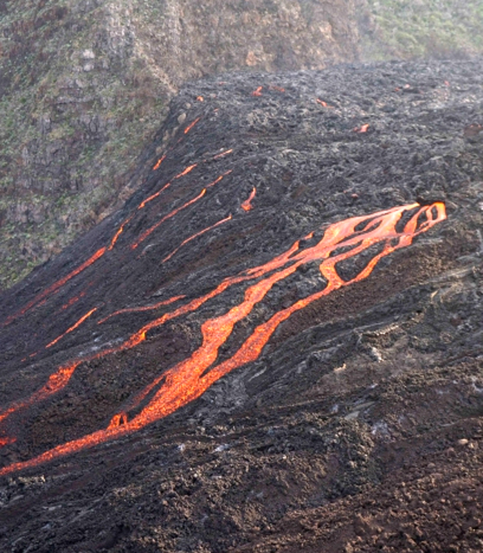
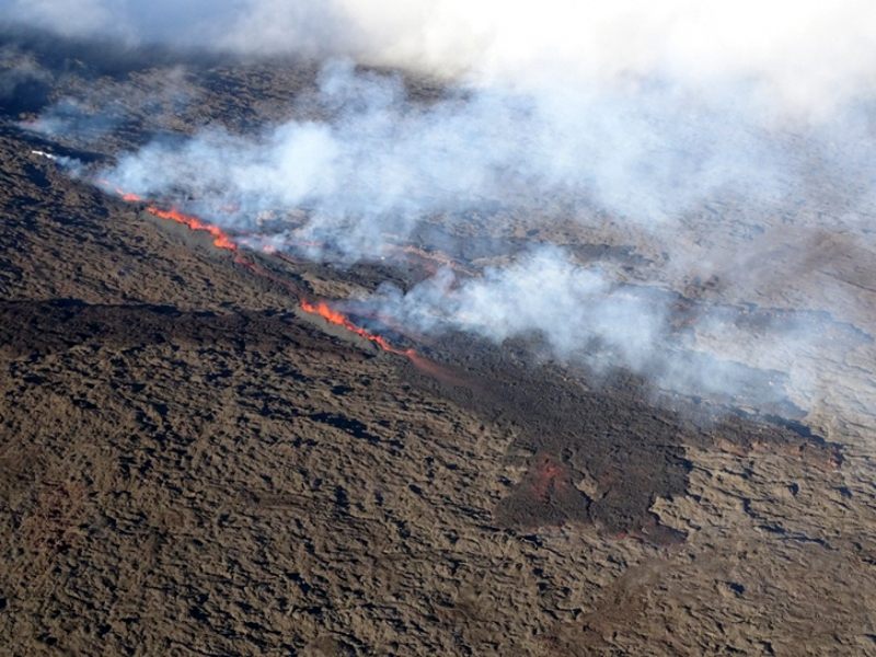
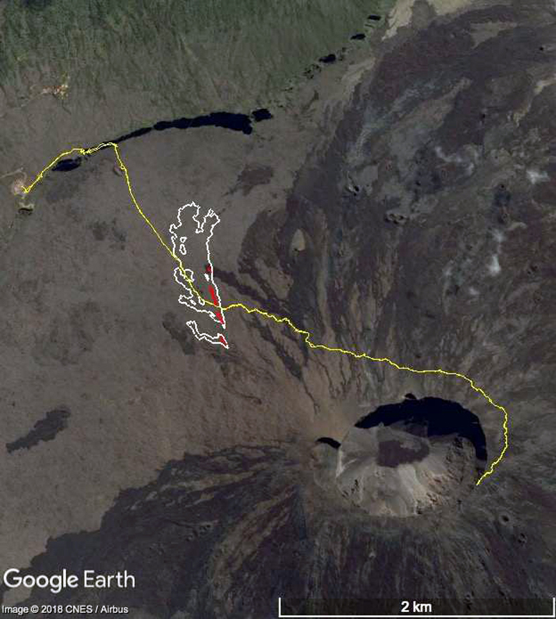
Eruptive event of 27 April-1 June 2018. OVPF reported 2.5 cm of inflation in the 15 days after the 3-4 April eruption. Seismic activity resumed at the base of the summit area on 21 April, and a new seismic swarm began at 2015 local time on 27 April. This was followed three hours later by tremor activity indicating the beginning of a new eruptive event from fissures that opened on the S flank in the area of cratère Rivals (figure 129). Four fissures opened; one on each side of the crater and one cutting across it were initially active, but activity moved the next morning to a fourth fissure just downstream from Rivals crater and extended for less than 300 m. Fountains of lava rose to 30 m during a morning overflight on 28 April. Several streams of lava quickly coalesced into a single flow heading S towards the rampart at the rim of the Enclos Fouqué (figure 130). By 0830 on 28 April the flow was less than 300 m from the rim and had destroyed an OVPF seismic station and a GPS station. The OMI instrument on the Aura satellite recorded a significant SO2 plume from the event on 28 April (figure 131).
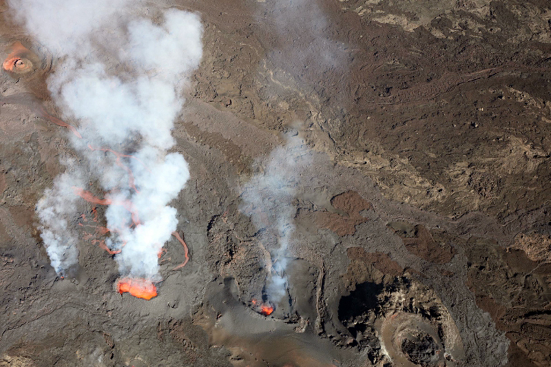
Tremor activity decreased throughout the day on 28 April while the flow continued. The surface flow rate was measured initially at 8-15 m3 per second; it had slowed to 3-7 m3 per second by late that afternoon. Three active vents were observed on the morning of 29 April that continued the next day with fountains rising about 15 m (figure 132). A small cone (less than 5 m high) had grown around the southernmost vent and the larger middle vent contained a small lava lake. Visible lava was flowing only from the middle vent. The flow consisted of three branches; the two spreading to the E were less than 150 m long while the third flow traveled W past the E Cassian crater and had reached 1.2 km in length by 1020 on 30 April. On 30 April OVPF observed a flow from the previous day that had traveled 2.6 km, reaching the foot of the S edge of the l'Enclos Fouqué rampart.
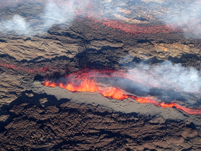
OVPF noted on 2 May 2018 that the intensity of volcanic tremor remained stable, slight deflation was measured, and the surface flow rate was estimated from satellite data at 1-3 m3 per second. Field observations during the afternoon of 3 May indicated that most activity was occurring from the central vent which had grown into a small pyroclastic cone with incandescent ejecta and gas emissions (figure 133). A well-developed lava tunnel had a number of roof breakouts.
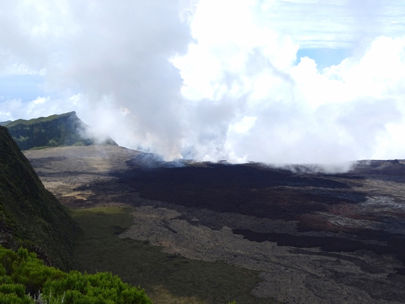
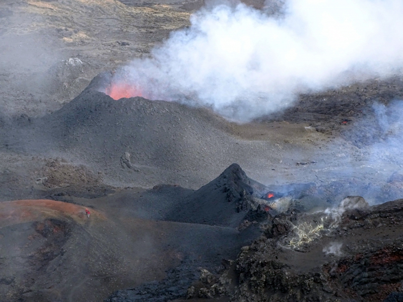
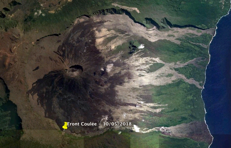
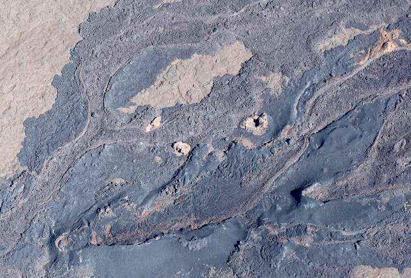
Field reconnaissance during 6-7 May confirmed that most of the activity was concentrated at the central cone with incandescent ejecta rising less than 10 m from the top, and the only source of lava was enclosed in a tunnel. The front of the flow was still active with numerous fires reported at the base of the rampart at the rim of the Enclos Fouqué. The farthest upstream cone was still active, but weak with only occasional bursts of incandescent ejecta. By 10 May the intensity of the volcanic tremor had stabilized at a low level. Two cones remained active, the upstream cone had incandescent ejections rising 10-20 m high. Lava was contained in tunnels near the cones but was exposed below the Piton de Bert (figure 134). The frontal lobe of the flow was located 3 km from the eruptive site, downstream of Piton de Bert (figure 135) at the base of the rampart rim of the Enclos. Numerous fires continued at the base of the rampart due to fresh flows (figure 136).
A minor spike in seismicity was recorded on 15 May 2018; at the same time inflation resumed underneath the caldera. The smaller, farthest upstream cone was the most active on 16 May, with 20-30 m high ejecta. A webcam view on 24 May showed that the vent on the larger pyroclastic cone was nearly closed, and that flow activity was largely contained in tunnels. Field observations that day also confirmed the overall decrease in activity; only a single incandescent zone in the lava field near the vent was observed at nightfall, although persistent degassing continued (figure 137).
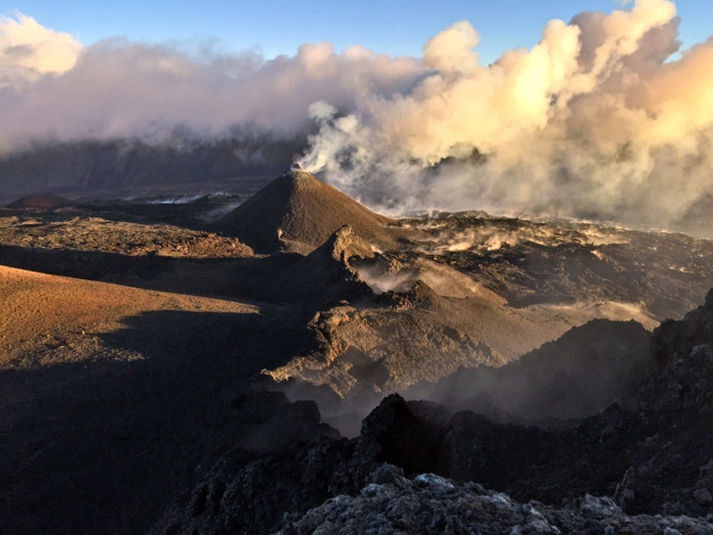
An overflight on 29 May confirmed the decreasing flow activity and continued inflation. Only rare tongues of lava could be observed in the flow field. The flow front had not progressed eastward for the previous 15 days. The main cone remained open at the top with a small eruptive vent less than 5 m in diameter. Small collapses and slumps were visible on the outer flanks of the cone (figure 138). The height of the main cone was estimated at 22-25 m on 31 May and the second vent was observed to be completely closed off. OVPF reported the end of the eruption at 1430 on 1 June 2018 based on the cessation of seismic tremor (figure 139). The MODVOLC thermal alert system recorded multiple thermal alerts from 27 April through 29 May.
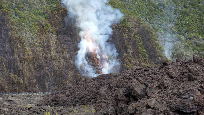
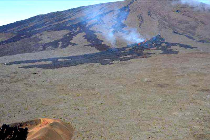
Eruptive event of 13 July 2018. Throughout June 2018, very little activity was reported; only 23 shallow seismic events were recorded during the month and no significant deformation was measured by the OVPF deformation network. OVPF reported that inflation resumed around 1 July. A sharp increase in seismicity was observed beginning at 2340 local time on 12 July followed by a seismic swarm and rapid deformation around midnight. Tremor activity was recorded beginning about 0330 on 13 July and located on the N flank. The first images of the eruption were visible in a webcam at around 0430. Four eruptive fissures were observed in an overflight that morning around 0800 that opened over a 500-m-long zone, spreading from upstream of la Chapelle de Rosemont towards Formica Leo. Incandescent ejecta rose less than 20 m and the aa lava had flowed about 200 m from the fissures (figures 140 and 142). The lava flow propagation rate was estimated at about 6 m per minute during the first hour of activity. Thereafter, the rate continued to decrease to less than 1 m per minute at the end of the eruption. After a progressive decrease of tremor, and about 3 hours of "gas flushes" that are typically observed at the end of Piton de la Fournaise eruptions (according to OVPF), the eruption stopped on 13 July at 2200 local time. Both MIROVA and MODVOLC recorded thermal anomalies from the brief one-day event (figure 126).
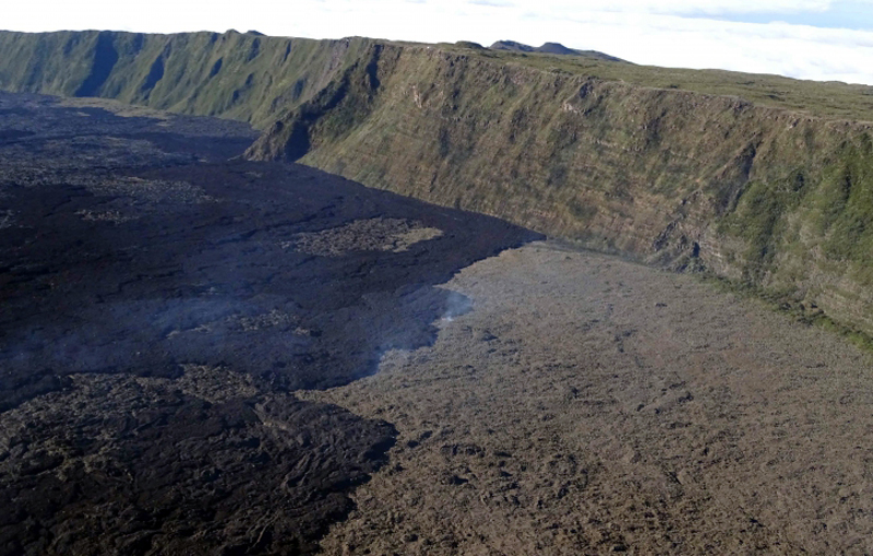
The 13 July 2018 eruption lasted about 18 hours and produced about 0.3 million m3 of lava. Lava flows covered more than 400 m of the popular hiking trail leading to the summit (figure 142 and 143) and almost completely filled the Chapelle de Rosemont (figure 144), an old vent and a characteristic feature within the Enclos Fouqué landscape that was first described in reports of the early volcano expeditions at the end of the 18th century. This area of the volcano on the NNW flank had not experienced active eruptive events for at least the past 400 years. Despite the low volume of lava emitted and its short duration, this event significantly changed the geomorphology of the area, which was quite well known and popular with visitors. Inflation resumed after the eruptive event of 13 July and a brief pulse of seismic activity was reported by OVPF on 26 July. They noted on 13 August that after about a month of inflation, seismicity and inflation both ceased.
Geological Summary. Piton de la Fournaise is a massive basaltic shield volcano on the French island of Réunion in the western Indian Ocean. Much of its more than 530,000-year history overlapped with eruptions of the deeply dissected Piton des Neiges shield volcano to the NW. Three scarps formed at about 250,000, 65,000, and less than 5,000 years ago by progressive eastward slumping, leaving caldera-sized embayments open to the E and SE. Numerous pyroclastic cones are present on the floor of the scarps and their outer flanks. Most recorded eruptions have originated from the summit and flanks of Dolomieu, a 400-m-high lava shield that has grown within the youngest scarp, which is about 9 km wide and about 13 km from the western wall to the ocean on the E side. More than 150 eruptions, most of which have produced fluid basaltic lava flows, have occurred since the 17th century. Only six eruptions, in 1708, 1774, 1776, 1800, 1977, and 1986, have originated from fissures outside the scarps.
Information Contacts: Observatoire Volcanologique du Piton de la Fournaise (OVPF), Institut de Physique du Globe de Paris, 14 route nationale 3, 27 ème km, 97418 La Plaine des Cafres, La Réunion, France (URL: http://www.ipgp.fr/fr); MIROVA (Middle InfraRed Observation of Volcanic Activity), a collaborative project between the Universities of Turin and Florence (Italy) supported by the Centre for Volcanic Risk of the Italian Civil Protection Department (URL: http://www.mirovaweb.it/); Hawai'i Institute of Geophysics and Planetology (HIGP) - MODVOLC Thermal Alerts System, School of Ocean and Earth Science and Technology (SOEST), Univ. of Hawai'i, 2525 Correa Road, Honolulu, HI 96822, USA (URL: http://modis.higp.hawaii.edu/); NASA Goddard Space Flight Center (NASA/GSFC), Global Sulfur Dioxide Monitoring Page, Atmospheric Chemistry and Dynamics Laboratory, 8800 Greenbelt Road, Goddard, Maryland, USA (URL: https://so2.gsfc.nasa.gov/).