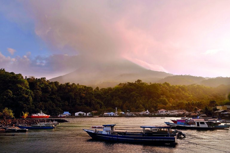
Karangetang
Indonesia
2.781°N, 125.407°E; summit elev. 1797 m
All times are local (unless otherwise noted)
Karangetang (also referred to as Api Siau) is an active volcano on the island of Siau in the Sitaro Regency, North Sulawesi, Indonesia. It produces frequent small eruptions that include gas-and-steam plumes, ash plumes, avalanches, lava flows, incandescent ballistic ejecta, and pyroclastic flows. This report covers May 2018-April 2019 and summarizes reports by Indonesia's Pusat Vulkanologi dan Mitigasi Bencana Geologi (PVMBG, also known as CVGHM, or the Center of Volcanology and Geological Hazard Mitigation), and the Darwin VAAC (Volcanic Ash Advisory Center), and satellite data. During this time, increased activity resulted in a lava flow that reached the ocean and cut road access to communities.
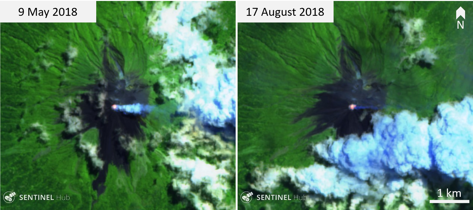
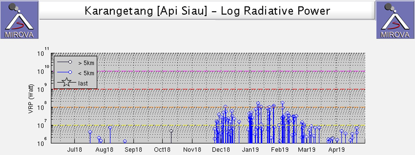
No activity was reported during May through October 2018. During this time, Sentinel-2 thermal images showed elevated temperatures in the main active crater and gas-and-steam plumes dispersing in different directions (figure 17). On 4 July, the Darwin VAAC reported a "weak" ash plume to an altitude of 3 km that drifted NE, only based on satellite imagery. There were few thermal signatures detected by the MIROVA algorithm from May through November (figure 18).
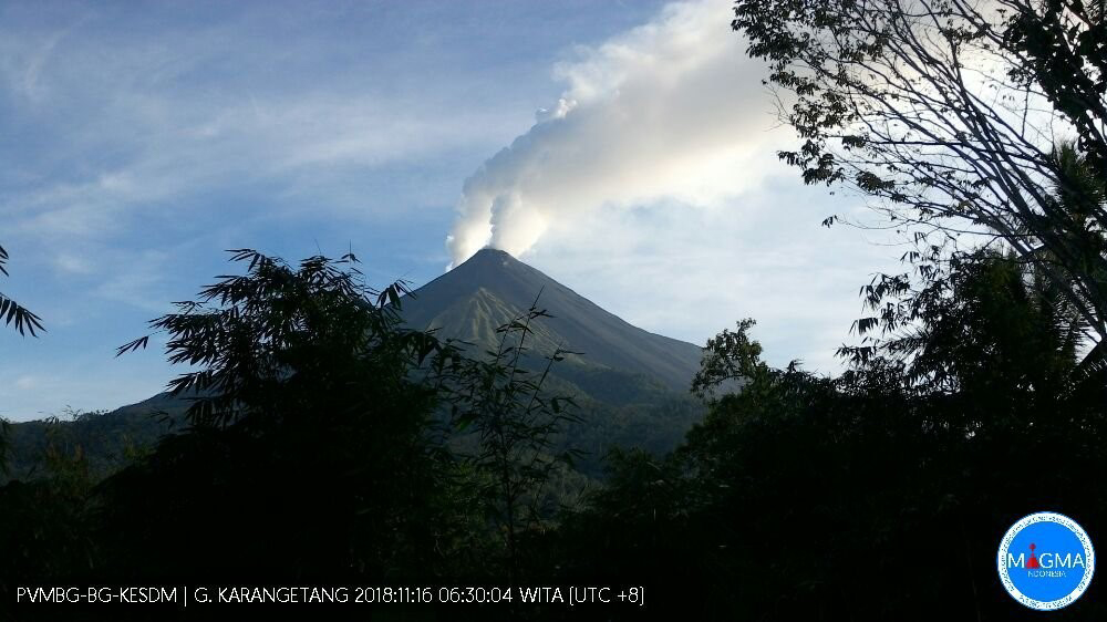
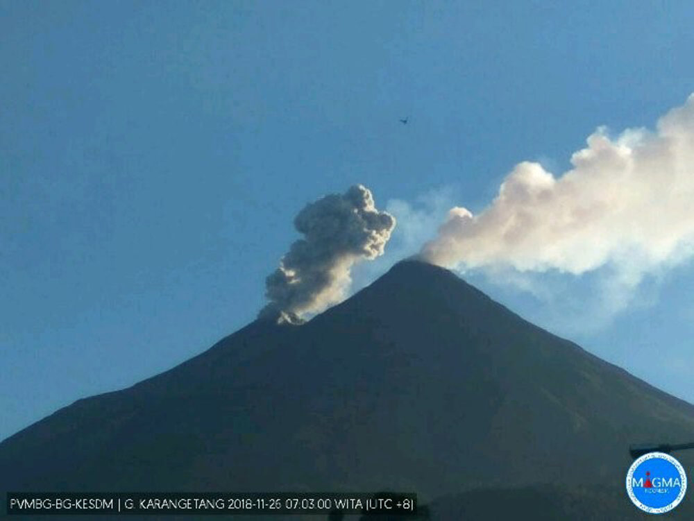
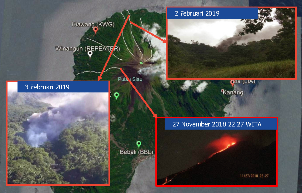
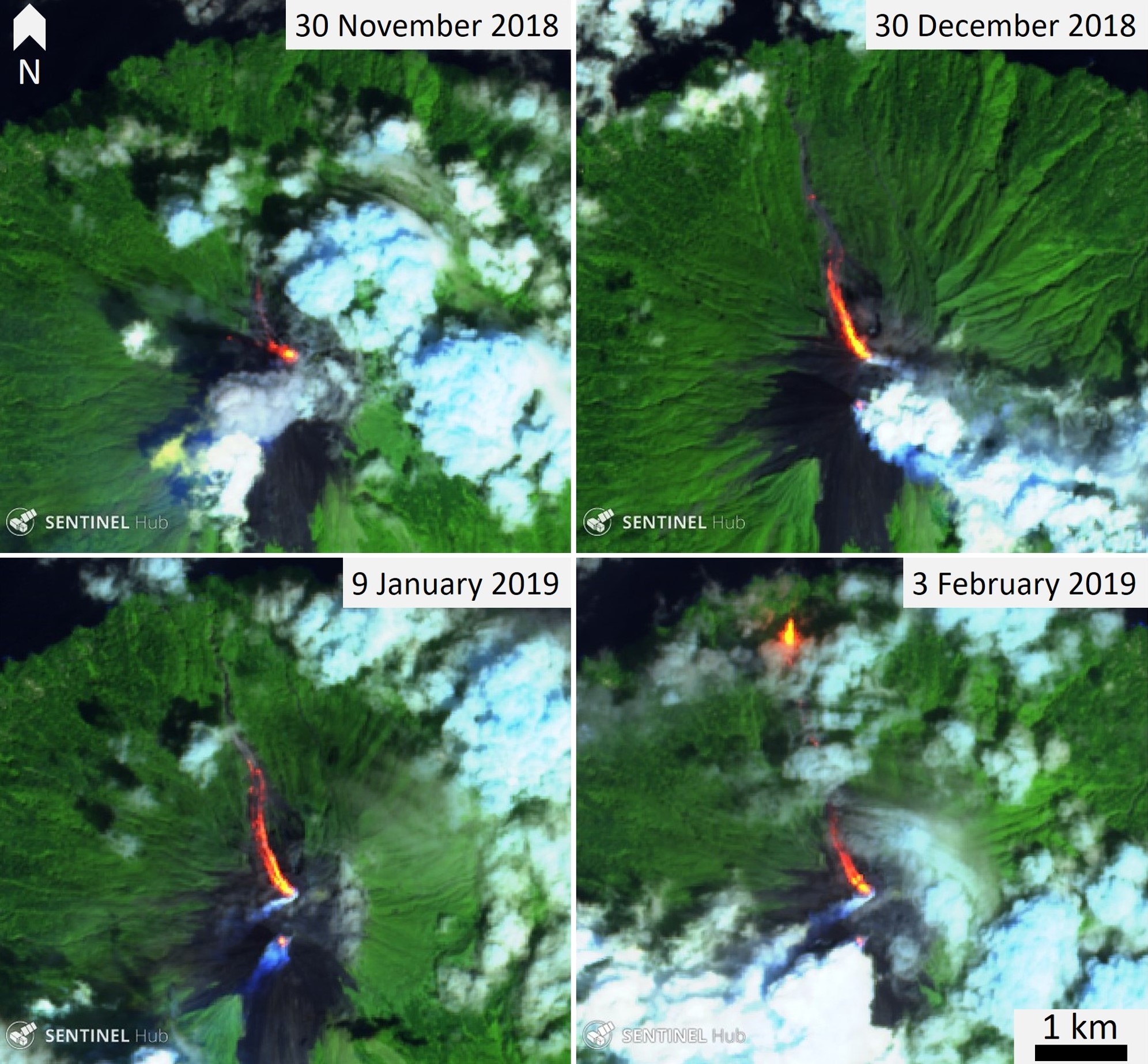
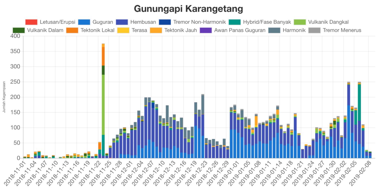
Steam plumes were observed from two craters during November 2018 (figures 19 and 20). There was a significant increase in seismicity on 22 to 23 November, followed by a sharp decline on the 24th. The first MODVOLC thermal alert was issued on 25 November. At 1314 on 25 November an ash plume rose to at least 500 m above the N crater and the Aviation Color Code was raised to Orange. A Sentinel-2 thermal image acquired on this day showed elevated temperatures at both south and north craters, with accompanying gas-and-steam plumes. After the increase in seismicity and detected thermal energy, activity progressed to lava flow extrusion, avalanches, and pyroclastic flows triggered from the lava flow. The lava flow originated from the north crater (Kawah Dua) and moved towards the NNW. Avalanches accompanied the flow from the crater and down the lava flow surface. The Volcano Alert level was increased from II to III on 20 December at 1800 (on a scale of I to IV).
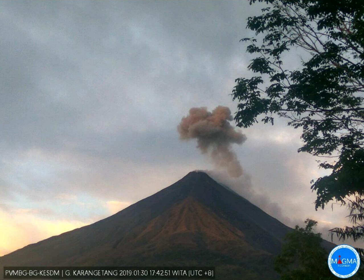
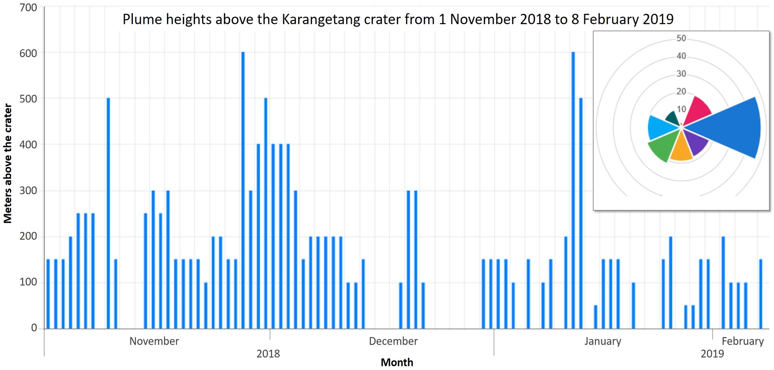
Throughout January 2019 activity consisted of small ash plumes up to 600 m above the N crater (figure 21) and continued lava flow activity. On 17 January Kompas TV reported that heavy ashfall impacted several villages. Lava and avalanches traveled as far as 0.7-1 km W towards the Sumpihi River and 1-2 km NE down the Kali Batuare throughout the month.
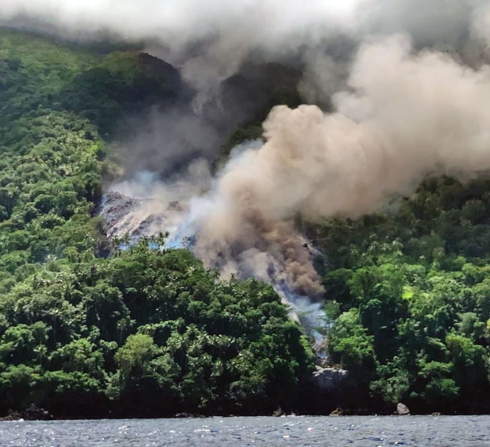
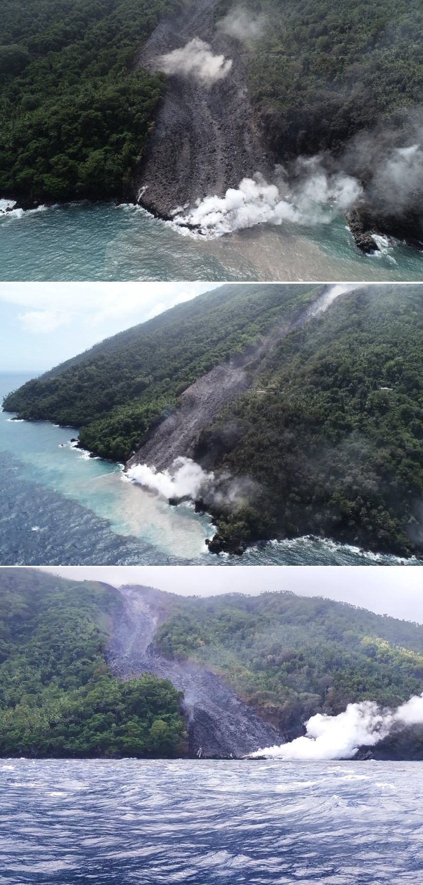
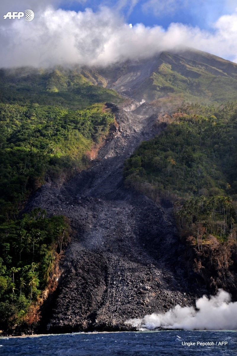
Video taken on 3 February 2019 shows the lava flow covering the road and continuing down the steep slope with multi-meter-scale incandescent blocky lava fragments on the surface dislodging and triggering small avalanches. By 5 February the lava flow reached over 3.5 km down the Malebuhe River drainage on the NW flank and into the ocean where a lava delta was growing with dense steam plume rising above by the 11th (figures 22-26). Drone footage from 9 February shows the lava flow across the section of road had a width of about 160 m and a width of about 140 m at the coast. Gas-and-steam and ash plumes were noted most days, reaching up to 600 m above the crater and dominantly dispersing to the E (figure 27). By 11 February there had been 190 people evacuated.
On 13 February 2019 avalanches continued from the northern crater to 700-1000 m W towards the Sumpihi River and 1-2 km NE towards Kali Batuare. KOMPAS TV reported a statement by PVMBG describing a decrease in activity, including lava avalanches, but with elevated seismicity on the 12 February. Throughout this period of elevated activity both seismicity (figure 28), along with plume heights and directions (figure 29), were variable. On 22 February the Darwin VAAC reported an ash plume, due to a pyroclastic flow, rising to an altitude of 3.7 km.
Throughout March 2019 PVMBG reported the continuation of a low rate of lava effusion at the north crater, avalanches, and gas-and-steam plumes rising up to 500 m above the crater. The Darwin VAAC reported an ash plume on 7 March that rose to an altitude of 2.7 km that dispersed to the SW. Minor ash emissions were reported by the Darwin VAAC on 6 April that rose to 2.1 km altitude and drifted SE. In mid-April, activity increased in the southern crater and on 15 April a pyroclastic flow traveled 2 km towards the Kahetang and Batuawang rivers. Another ash advisory was issued for an ash plume up to 2.4 km altitude on 16 April. Small gas-and-steam plumes continued through the month.
Geological Summary. Karangetang (Api Siau) volcano lies at the northern end of the island of Siau, about 125 km NNE of the NE-most point of Sulawesi. The stratovolcano contains five summit craters along a N-S line. It is one of Indonesia's most active volcanoes, with more than 40 eruptions recorded since 1675 and many additional small eruptions that were not documented (Neumann van Padang, 1951). Twentieth-century eruptions have included frequent explosive activity sometimes accompanied by pyroclastic flows and lahars. Lava dome growth has occurred in the summit craters; collapse of lava flow fronts have produced pyroclastic flows.
Information Contacts: Pusat Vulkanologi dan Mitigasi Bencana Geologi (PVMBG, also known as Indonesian Center for Volcanology and Geological Hazard Mitigation, CVGHM), Jalan Diponegoro 57, Bandung 40122, Indonesia (URL: http://www.vsi.esdm.go.id/); MAGMA Indonesia, Kementerian Energi dan Sumber Daya Mineral (URL: https://magma.vsi.esdm.go.id/); Badan Nasional Penanggulangan Bencana (BNPB), National Disaster Management Agency, Graha BNPB - Jl. Scout Kav.38, East Jakarta 13120, Indonesia (URL: http://www.bnpb.go.id/); Darwin Volcanic Ash Advisory Centre (VAAC), Bureau of Meteorology, Northern Territory Regional Office, PO Box 40050, Casuarina, NT 0811, Australia (URL: http://www.bom.gov.au/info/vaac/); Sentinel Hub Playground (URL: https://www.sentinel-hub.com/explore/sentinel-playground); MIROVA (Middle InfraRed Observation of Volcanic Activity), a collaborative project between the Universities of Turin and Florence (Italy) supported by the Centre for Volcanic Risk of the Italian Civil Protection Department (URL: http://www.mirovaweb.it/); Hawai'i Institute of Geophysics and Planetology (HIGP) - MODVOLC Thermal Alerts System, School of Ocean and Earth Science and Technology (SOEST), Univ. of Hawai'i, 2525 Correa Road, Honolulu, HI 96822, USA (URL: http://modis.higp.hawaii.edu/); Agence France-Presse (URL: http://www.afp.com/); Kompas TV, Menara Kompas Lt. 6, Jl. Palmerah Selatan No.21, Jakarta Pusat 10270 Indonesia (URL: https://www.kompas.tv/article/39190/abu-gunung-karangetang-tutup-permukiman-warga); The New Indian Express (URL: http://www.newindianexpress.com/world/2019/feb/08/emergency-declared-on-indonesian-island-after-volcanic-eruption-1936173.html); Øystein Lund Andersen (Twitter: @OysteinLAnderse, https://twitter.com/OysteinLAnderse, URL: https://www.oysteinlundandersen.com).