Report on Suwanosejima (Japan) — January 2020
Bulletin of the Global Volcanism Network, vol. 45, no. 1 (January 2020)
Managing Editor: Edward Venzke.
Edited by Kadie L. Bennis.
Suwanosejima (Japan) Explosions, ash emissions, and summit incandescence in July-December 2019
Please cite this report as:
Global Volcanism Program, 2020. Report on Suwanosejima (Japan) (Bennis, K.L., and Venzke, E., eds.). Bulletin of the Global Volcanism Network, 45:1. Smithsonian Institution. https://doi.org/10.5479/si.GVP.BGVN202001-282030
Suwanosejima
Japan
29.638°N, 129.714°E; summit elev. 796 m
All times are local (unless otherwise noted)
Suwanosejima, located south of Japan in the northern Ryukyu Islands, is an active andesitic stratovolcano that has had continuous activity since October 2004, typically producing ash plumes and Strombolian explosions. Much of this activity is focused within the Otake crater. This report updates information during July through December 2019 using monthly reports from the Japan Meteorological Agency (JMA), the Tokyo Volcanic Ash Advisory Center (VAAC), and various satellite data.
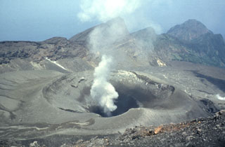
White gas-and-steam plumes rose from Suwanosejima on 26 July 2019, 30-31 August, 1-6, 10, and 20-27 September, reaching a maximum altitude of 2.4 km on 10 September, according to Tokyo VAAC advisories. Intermittent gray-white plumes were observed rising from the summit during October through December (figure 40).
An explosion that occurred at 2331 on 1 August 2019 ejected material 400 m from the crater while other eruptions on 3-6 and 26 August produced ash plumes that rose up to a maximum altitude of 2.1 km and drifted generally NW according to the Tokyo VAAC report. JMA reported eruptions and summit incandescence in September accompanied by white gas-and-steam plumes, but no explosions were noted. Eruptions on 19 and 29 October produced ash plumes that rose 300 and 800 m above the crater rim, resulting in ashfall in Toshima (4 km SW), according to the Toshima Village Office, Suwanosejima Branch Office. Another eruption on 30 October produced a similar gray-white plume rising 800 m above the crater rim but did not result in ashfall. Similar activity continued in November with eruptions on 5-7 and 13-15 November producing grayish-white plumes rising 900 m and 1.5 km above the crater rim and frequent crater incandescence. Ashfall was reported in Toshima Village on 19 and 20 November; the 20 November eruption ejected material 200 m from the Otake crater.
Field surveys on 14 and 18 December using an infrared thermal imaging system to the E of Suwanose Island showed hotspots around the Otake crater, on the N slope of the crater, and on the upper part of the E coastline. GNSS (Global Navigation Satellite Systems) observations on 15 and 17 December showed a slight change in the baseline length. After 2122 on 25-26 and 31 December, 23 eruptions, nine of which were explosive were reported, producing gray-white plumes that rose 800-1,800 m above the crater rim and ejected material up to 600 m from the Otake crater. JMA reported volcanic tremors occurred intermittently throughout this reporting period.
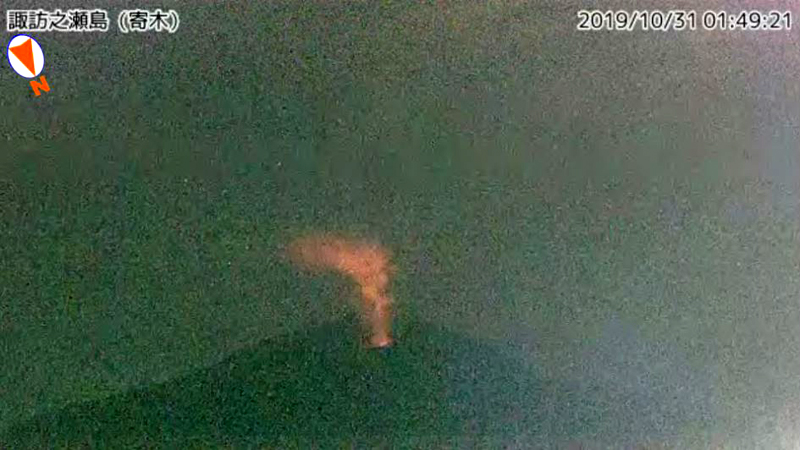
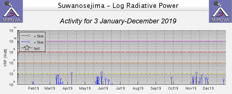
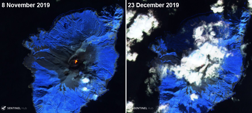
Incandescence at the summit crater was occasionally visible at night during July through December 2019, as recorded by webcam images and reported by JMA (figure 41). MIROVA (Middle InfraRed Observation of Volcanic Activity) analysis of MODIS satellite data showed weak thermal anomalies that occurred dominantly in November with little to no activity recorded between July and October (figure 42). Two Sentinel-2 thermal satellite images in early November and late December showed thermal hotspots within the summit crater (figure 43).
 |
Figure 41. Surveillance camera image of summit incandescence at Suwanosejima on 31 October 2019. Courtesy of JMA. |
Geological Summary. The 8-km-long island of Suwanosejima in the northern Ryukyu Islands consists of an andesitic stratovolcano with two active summit craters. The summit is truncated by a large breached crater extending to the sea on the E flank that was formed by edifice collapse. One of Japan's most frequently active volcanoes, it was in a state of intermittent Strombolian activity from Otake, the NE summit crater, between 1949 and 1996, after which periods of inactivity lengthened. The largest recorded eruption took place in 1813-14, when thick scoria deposits covered residential areas, and the SW crater produced two lava flows that reached the western coast. At the end of the eruption the summit of Otake collapsed, forming a large debris avalanche and creating an open collapse scarp extending to the eastern coast. The island remained uninhabited for about 70 years after the 1813-1814 eruption. Lava flows reached the eastern coast of the island in 1884. Only about 50 people live on the island.
Information Contacts: Japan Meteorological Agency (JMA), 1-3-4 Otemachi, Chiyoda-ku, Tokyo 100-8122, Japan (URL: http://www.jma.go.jp/jma/indexe.html); MIROVA (Middle InfraRed Observation of Volcanic Activity), a collaborative project between the Universities of Turin and Florence (Italy) supported by the Centre for Volcanic Risk of the Italian Civil Protection Department (URL: http://www.mirovaweb.it/); Tokyo Volcanic Ash Advisory Center (VAAC), 1-3-4 Otemachi, Chiyoda-ku, Tokyo 100-8122, Japan (URL: http://ds.data.jma.go.jp/svd/vaac/data/); Sentinel Hub Playground (URL: https://www.sentinel-hub.com/explore/sentinel-playground).


