Report on Kavachi (Solomon Islands) — May 2020
Bulletin of the Global Volcanism Network, vol. 45, no. 5 (May 2020)
Managing Editor: Edward Venzke.
Edited by Kadie L. Bennis.
Kavachi (Solomon Islands) Discolored water plumes seen using satellite imagery in 2018 and 2020
Please cite this report as:
Global Volcanism Program, 2020. Report on Kavachi (Solomon Islands) (Bennis, K.L., and Venzke, E., eds.). Bulletin of the Global Volcanism Network, 45:5. Smithsonian Institution. https://doi.org/10.5479/si.GVP.BGVN202005-255060
Kavachi
Solomon Islands
8.991°S, 157.979°E; summit elev. -20 m
All times are local (unless otherwise noted)
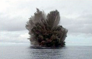
Kavachi is a submarine volcano located in the Solomon Islands south of Gatokae and Vangunu islands. Volcanism is frequently active, but rarely observed. The most recent eruptions took place during 2014, which consisted of an ash eruption, and during 2016, which included phreatomagmatic explosions (BGVN 42:03). This reporting period covers December 2016-April 2020 primarily using satellite data.
Activity at Kavachi is often only observed through satellite images, and frequently consists of discolored submarine plumes for which the cause is uncertain. On 1 January 2018 a slight yellow discoloration in the water is seen extending to the E from a specific point (figure 20). Similar faint plumes were observed on 16 January, 25 February, 2 March, 26 April, 6 May, and 25 June 2018. No similar water discoloration was noted during 2019, though clouds may have obscured views.
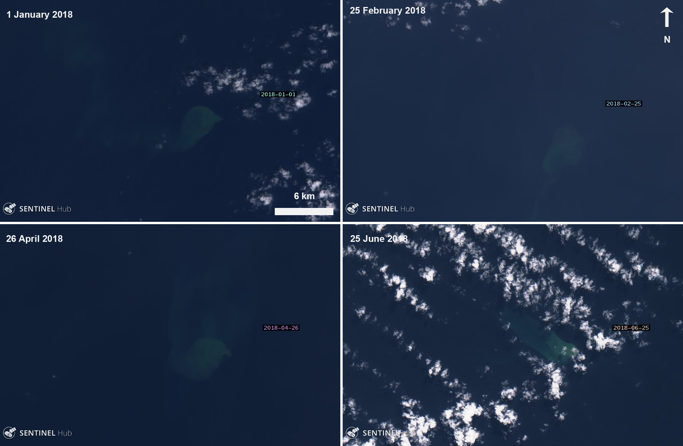 |
Figure 20. Satellite images from Sentinel-2 revealed intermittent faint water discoloration (yellow) at Kavachi during the first half of 2018, as seen here on 1 January (top left), 25 February (top right), 26 April (bottom left), and 25 June (bottom right). Images with “Natural color” rendering (bands 4, 3, 2); courtesy of Sentinel Hub Playground. |
Activity resumed in 2020, showing more discolored water in satellite imagery. The first instance occurred on 16 March, where a distinct plume extended from a specific point to the SE. On 25 April a satellite image showed a larger discolored plume in the water that spread over about 30 km2, encompassing the area around Kavachi (figure 21). Another image on 30 April showed a thin ribbon of discolored water extending about 50 km W of the vent.
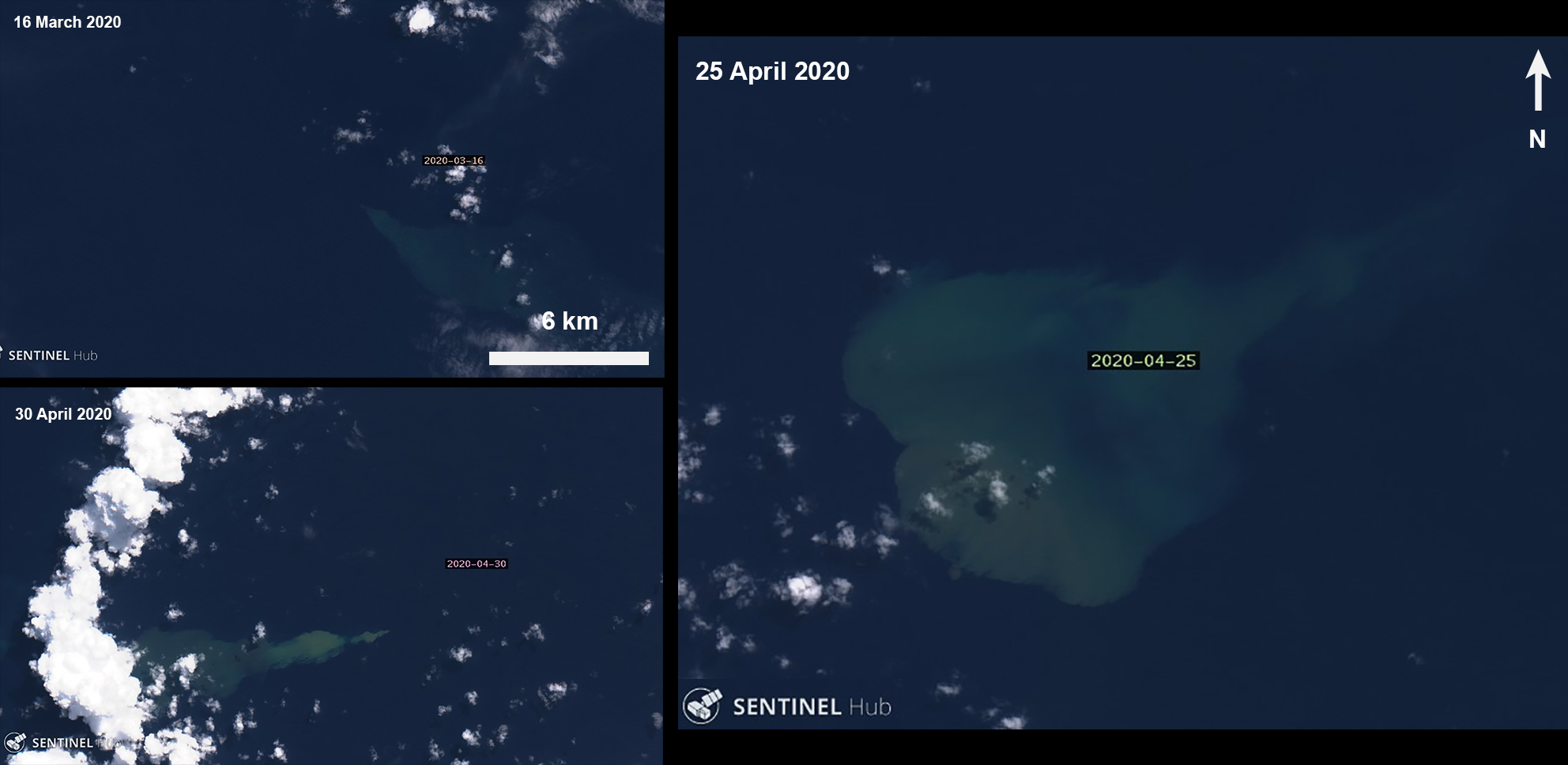 |
Figure 21. Sentinel-2 satellite images of a discolored plume (yellow) at Kavachi beginning on 16 March (top left) with a significant large plume on 25 April (right), which remained until 30 April (bottom left). Images with “Natural color” rendering (bands 4, 3, 2); courtesy of Sentinel Hub Playground. |
Geological Summary. Named for a sea-god of the Gatokae and Vangunu peoples, Kavachi is located in the Solomon Islands south of Vangunu Island. Sometimes referred to as Rejo te Kvachi ("Kavachi's Oven"), this shallow submarine basaltic-to-andesitic volcano has produced ephemeral islands up to 1 km long many times since its first recorded eruption during 1939. Residents of the nearby islands of Vanguna and Nggatokae (Gatokae) reported "fire on the water" prior to 1939, a possible reference to earlier eruptions. The roughly conical edifice rises from water depths of 1.1-1.2 km on the north and greater depths to the SE. Frequent shallow submarine and occasional subaerial eruptions produce phreatomagmatic explosions that eject steam, ash, and incandescent bombs. On a number of occasions lava flows were observed on the ephemeral islands.
Information Contacts: Sentinel Hub Playground (URL: https://www.sentinel-hub.com/explore/sentinel-playground).