Report on Tengger Caldera (Indonesia) — February 2021
Bulletin of the Global Volcanism Network, vol. 46, no. 2 (February 2021)
Managing Editor: Edward Venzke.
Research and preparation by Paul Berger.
Tengger Caldera (Indonesia) Ash plumes during 26-28 December 2020 with ashfall to the NE
Please cite this report as:
Global Volcanism Program, 2021. Report on Tengger Caldera (Indonesia) (Venzke, E., ed.). Bulletin of the Global Volcanism Network, 46:2. Smithsonian Institution. https://doi.org/10.5479/si.GVP.BGVN202102-263310
Tengger Caldera
Indonesia
7.942°S, 112.95°E; summit elev. 2329 m
All times are local (unless otherwise noted)
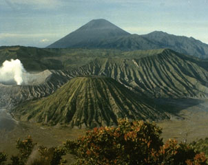
Activity at Bromo, the youngest and only active cone within the 16-km-wide Tengger caldera in East Java, is characterized by occasional explosions with ash plumes followed by periods of relative quiet with only gas-and-steam emissions (BGVN 44:05). There have been more than 30 eruptive periods since 1900. During the first seven months of 2019, ash explosions occurred on 18 February 2019 and became especially numerous in March and April, with more explosive activity in July 2019 (BGVN 44:05, 44:08). The volcano is monitored by the Pusat Vulkanologi dan Mitigasi Bencana Geologi (PVMBG, also known as Indonesian Center for Volcanology and Geological Hazard Mitigation, CVGHM) and by the Darwin Volcanic Ash Advisory Centre (VAAC).
Following the ash explosion on 28 July 2019, satellite observations frequently showed a white gas-and-steam plume in the Bromo crater (figure 19). No additional eruptive activity was reported until 26-27 December 2020 when PVMBG reported white-and-gray plumes rose 50-700 m above the summit of Bromo’s cone. The next day, at 0550 on 28 December, an observer spotted a gas-and-ash emission rising at least 500 m above the summit. The Darwin VAAC was unable to confirm if there was ash in the plume based on satellite data, but ashfall was reported in the Ngadirejo area, about 5 km NE. The Alert Level remained at 2 (on a scale of 1-4), and visitors were warned to stay outside a 1-km radius of the crater.
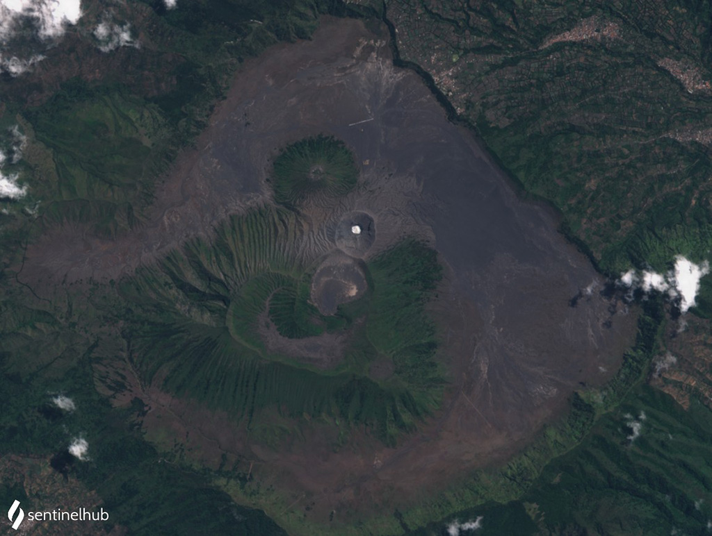 |
Figure 19. Satellite image of the Tengger Caldera on 12 September 2020, with a typical white plume visible in the Bromo crater. Sentinel-2 image with natural color rendering (bands 4, 3, 2). Courtesy of Sentinel Hub Playground. |
Geological Summary. The 16-km-wide Tengger caldera is located at the northern end of a volcanic massif extending from Semeru volcano. The massive volcanic complex dates back to about 820,000 years ago and consists of five overlapping stratovolcanoes, each truncated by a caldera. Lava domes, pyroclastic cones, and a maar occupy the flanks of the massif. The Ngadisari caldera at the NE end of the complex formed about 150,000 years ago and is now drained through the Sapikerep valley. The most recent of the calderas is the 9 x 10 km wide Sandsea caldera at the SW end of the complex, which formed incrementally during the late Pleistocene and early Holocene. An overlapping cluster of post-caldera cones was constructed on the floor of the Sandsea caldera within the past several thousand years. The youngest of these is Bromo, one of Java's most active and most frequently visited volcanoes.
Information Contacts: Pusat Vulkanologi dan Mitigasi Bencana Geologi (PVMBG, also known as Indonesian Center for Volcanology and Geological Hazard Mitigation, CVGHM), Jalan Diponegoro 57, Bandung 40122, Indonesia (URL: http://www.vsi.esdm.go.id/); Darwin Volcanic Ash Advisory Centre (VAAC), Bureau of Meteorology, Northern Territory Regional Office, PO Box 40050, Casuarina, NT 0811, Australia (URL: http://www.bom.gov.au/info/vaac/); Sentinel Hub Playground (URL: https://www.sentinel-hub.com/explore/sentinel-playground).