Report on Saunders (United Kingdom) — February 2021
Bulletin of the Global Volcanism Network, vol. 46, no. 2 (February 2021)
Managing Editor: Edward Venzke.
Edited by Janine B. Krippner.
Saunders (United Kingdom) Elevated crater temperatures and gas emission through May 2020; research expedition
Please cite this report as:
Global Volcanism Program, 2021. Report on Saunders (United Kingdom) (Krippner, J.B., and Venzke, E., eds.). Bulletin of the Global Volcanism Network, 46:2. Smithsonian Institution. https://doi.org/10.5479/si.GVP.BGVN202102-390090
Saunders
United Kingdom
57.8°S, 26.483°W; summit elev. 843 m
All times are local (unless otherwise noted)
The glaciated Saunders Island is located in the remote South Sandwich Volcanic Arc in the South Atlantic between Candlemas (to the north) and Montagu (to the south) islands. The main volcanic features are Mount Michael, lava flows on the northern Blackstone Plain, and the Ashen hills complex near the eastern Nattriss Point (figure 31). The Ashen Hills complex is a group of overlapping craters formed through phreatomagmatic activity, with the largest crater opening towards the NW (figure 32). Gas emissions have been remotely observed from the ice-filled Old crater to the SE, with reports of gas plumes extending back to 1820 (LeMasurier et al., 1990; Patrick and Smellie, 2013; Liu et al., 2021). The current eruption period, centered at the 500-m-diameter Mount Michael summit crater, has been ongoing since at least 12 November 2014, based on remote sensing analysis (Gray et al., 2019). Activity consists of a lava lake, persistent degassing, and intermittent explosions producing ash plumes (Patrick and Smellie 2013; Gray et al. 2019). Visits are infrequent due to the remote location, and cloud and plume cover often prevents satellite observations. This report summarizes activity during June 2019 through May 2020 primarily using satellite data, as well as observations from visiting scientists.
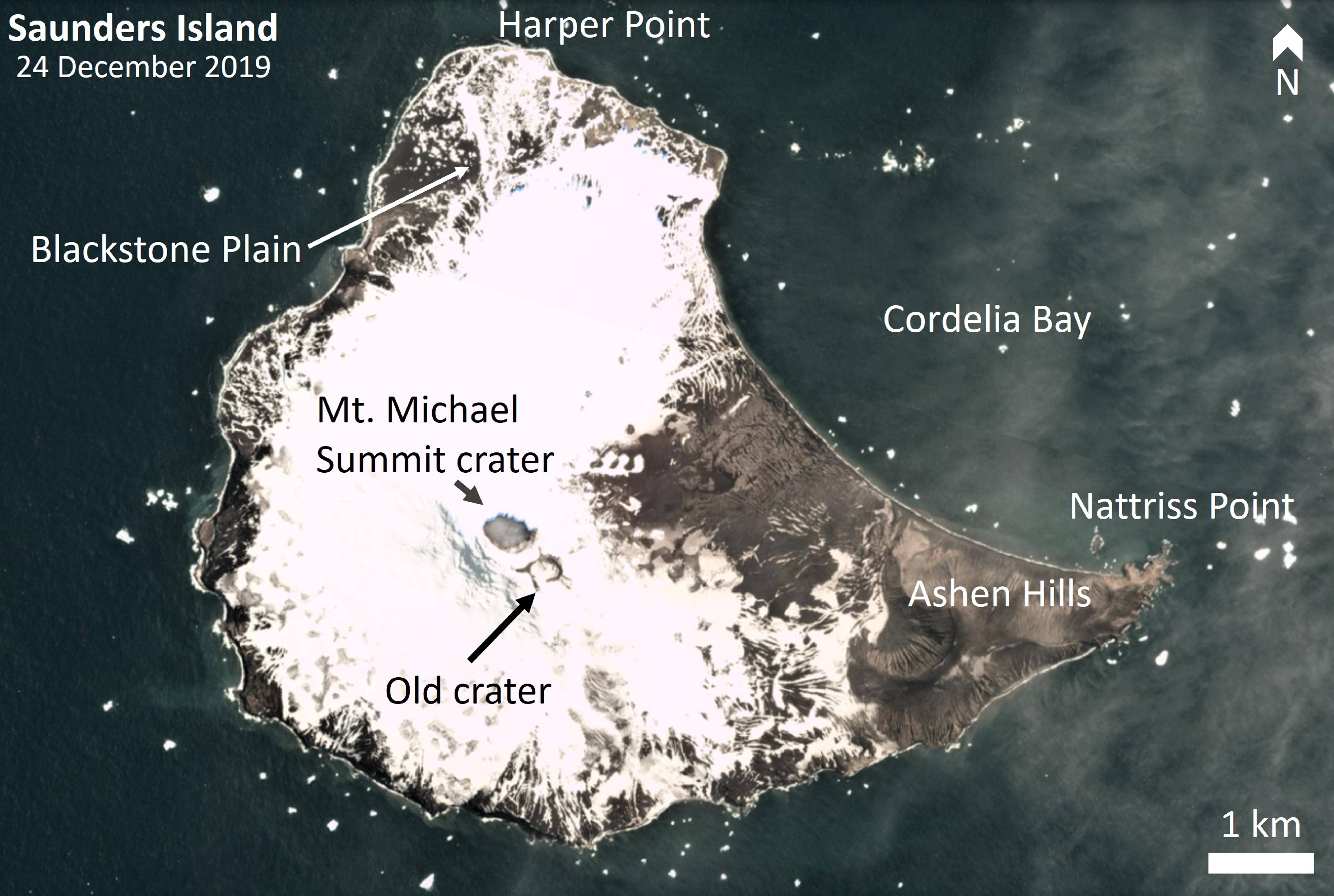 |
Figure 31. This 24 December 2019 satellite image of Saunders Island shows the locations of the active Mount Michael summit crater and other features on the island. Sentinel-2 image with Natural color (bands 4, 3, 2) rendering. Courtesy of Planet Labs. |
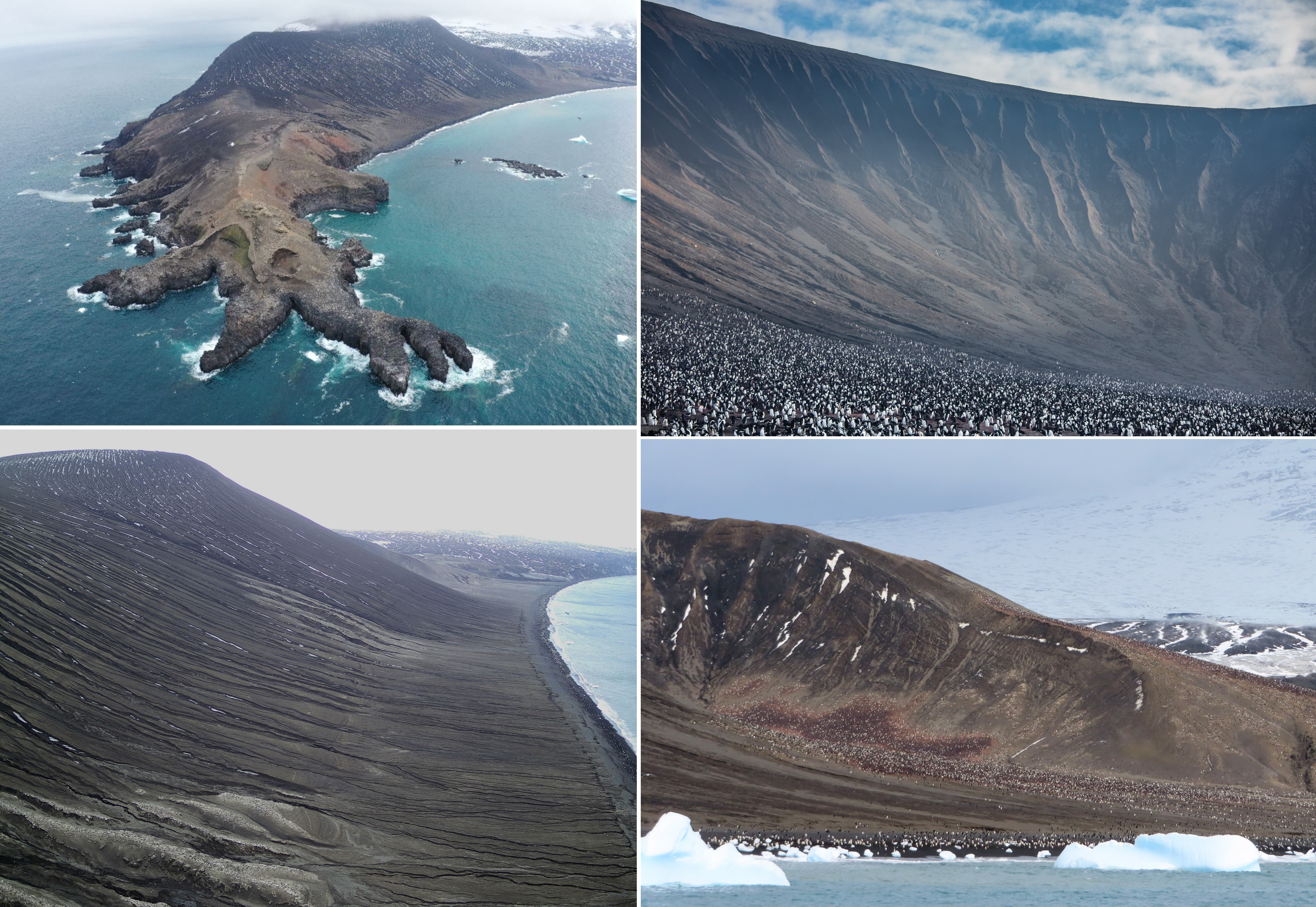 |
Figure 32. Images of the southeastern area of Saunders Island taken in January 2020. The top left image shows Nattriss Point with Ashen Hills in the background. The other photos show the crater and flanks of the Ashen Hills complex with rill and gully features from fluvial erosion. White and black speckled features in the images are penguins. Photos courtesy of Emma Liu and the 2020 Pelagic Australis expedition group. |
Activity during June-December 2019. Ashfall deposits on the flanks were sometimes visible on the snow and ice (figure 33). MIROVA thermal anomaly data during June 2019 through June 2020 showed few days where high temperatures were detected by this sensor, but the active summit crater floor is often obscured by cloud cover or condensed gas-and-steam plumes. The TROPOspheric Monitoring Instrument (TROPOMI) detected frequent sulfur dioxide (SO2) plumes of varying concentrations that are dispersed in different directions by wind (figure 34). Small condensed gas-and-steam plumes are often visible in satellite imagery within the crater, and some larger plumes are also imaged (figure 35). All satellite images where the summit crater was not obscured by either cloud cover or gas-and-steam plumes showed elevated temperatures within the summit crater, with three distinct areas visible possibly indicating multiple active vents (figure 36).
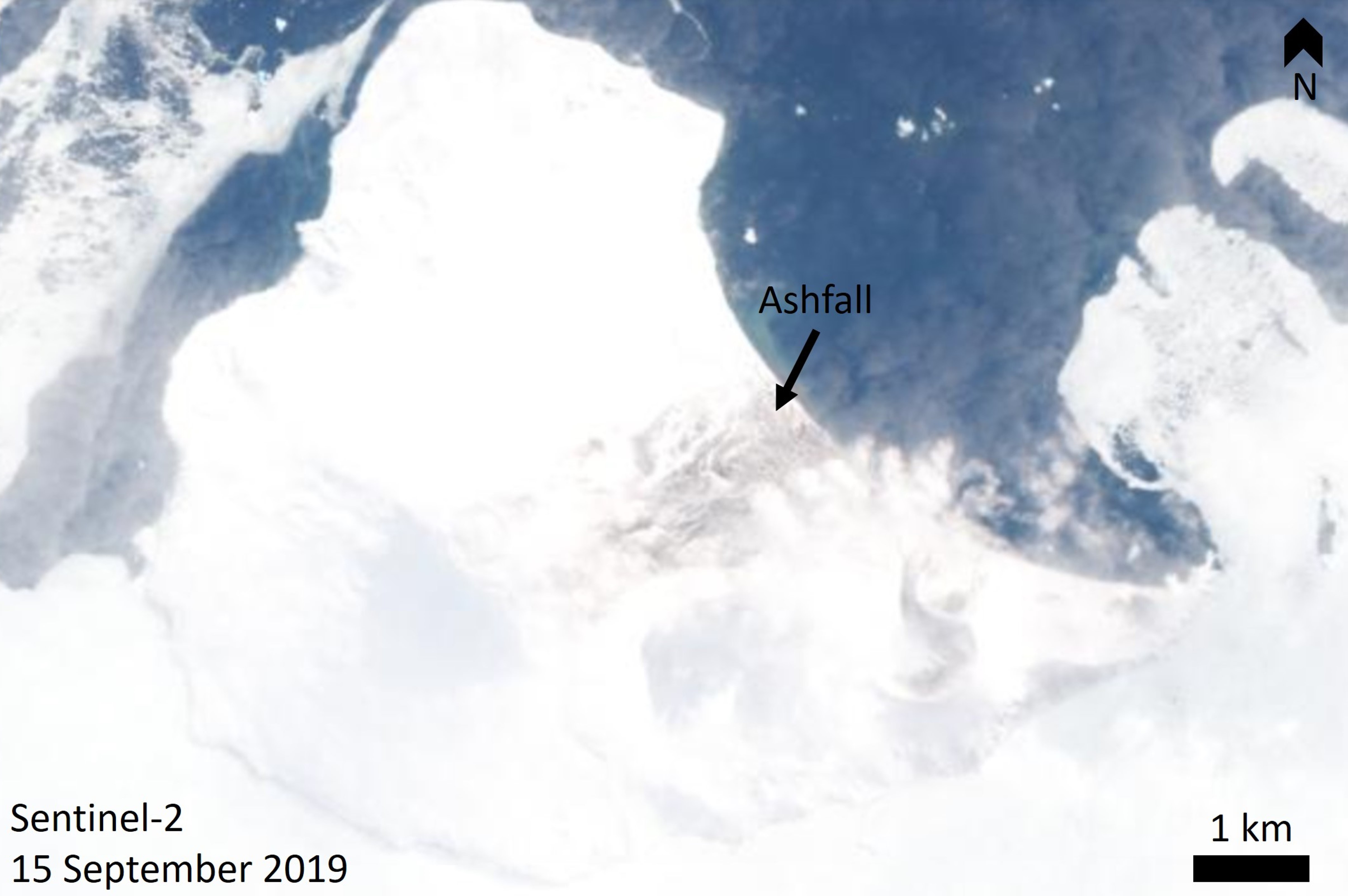 |
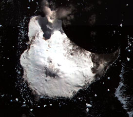
Figure 33. This satellite image of Saunders Island acquired on 15 September 2019 shows the snow and ice-covered island and a recent ashfall deposit on the NE flank towards Cordelia Bay, with a green sediment plume in the water. Sentinel-2 image with Natural color (bands 4, 3, 2) rendering. Courtesy of Planet Labs. |
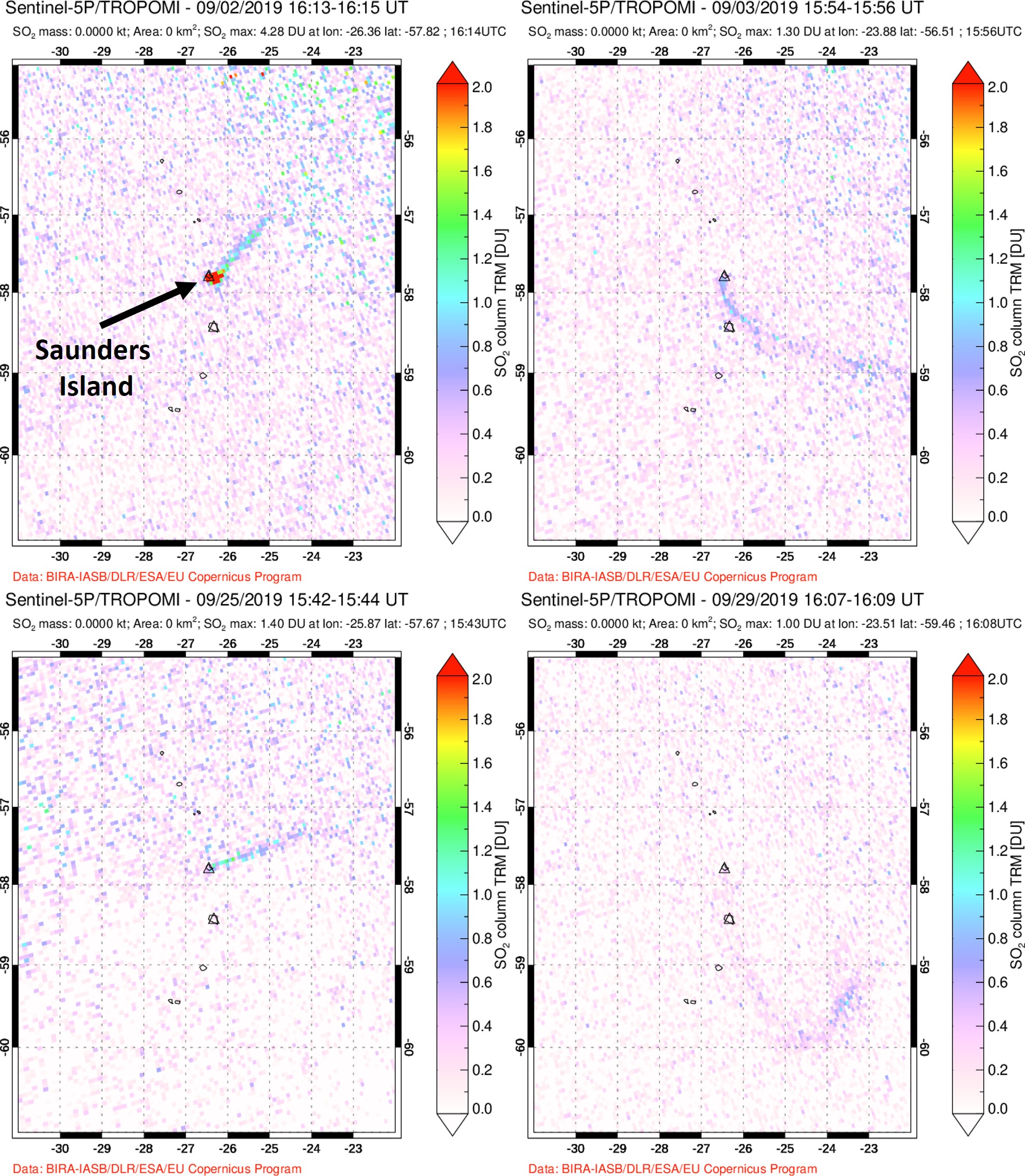 |
Figure 34. These images show data acquired by the TROPOspheric Monitoring Instrument (TROPOMI) that demonstrate detected SO2 (sulfur dioxide) from Mount Michael on Saunders Island on 2, 3, 25, and 29 September 2019. These are examples of gas plumes through the month with wind dispersing the plumes in different directions. Courtesy of NASA Global Sulfur Dioxide Monitoring Page. |
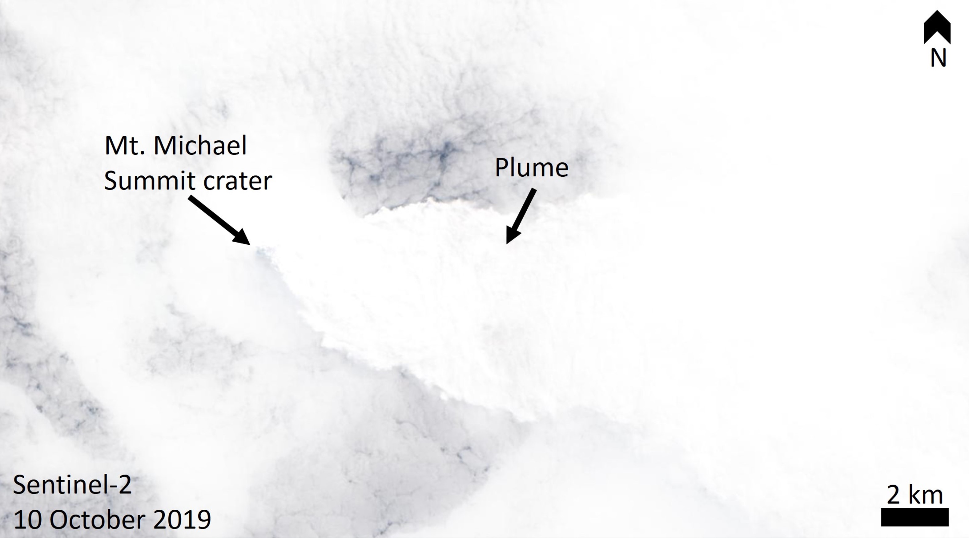 |
Figure 35. This 10 October 2019 satellite image shows Saunders Island and the surrounding area with light cloud cover, and a condensed gas-and-steam plume from the summit crater drifting towards the E to SE. Sentinel-2 image with Natural color (bands 4, 3, 2) rendering. Courtesy of Planet Labs. |
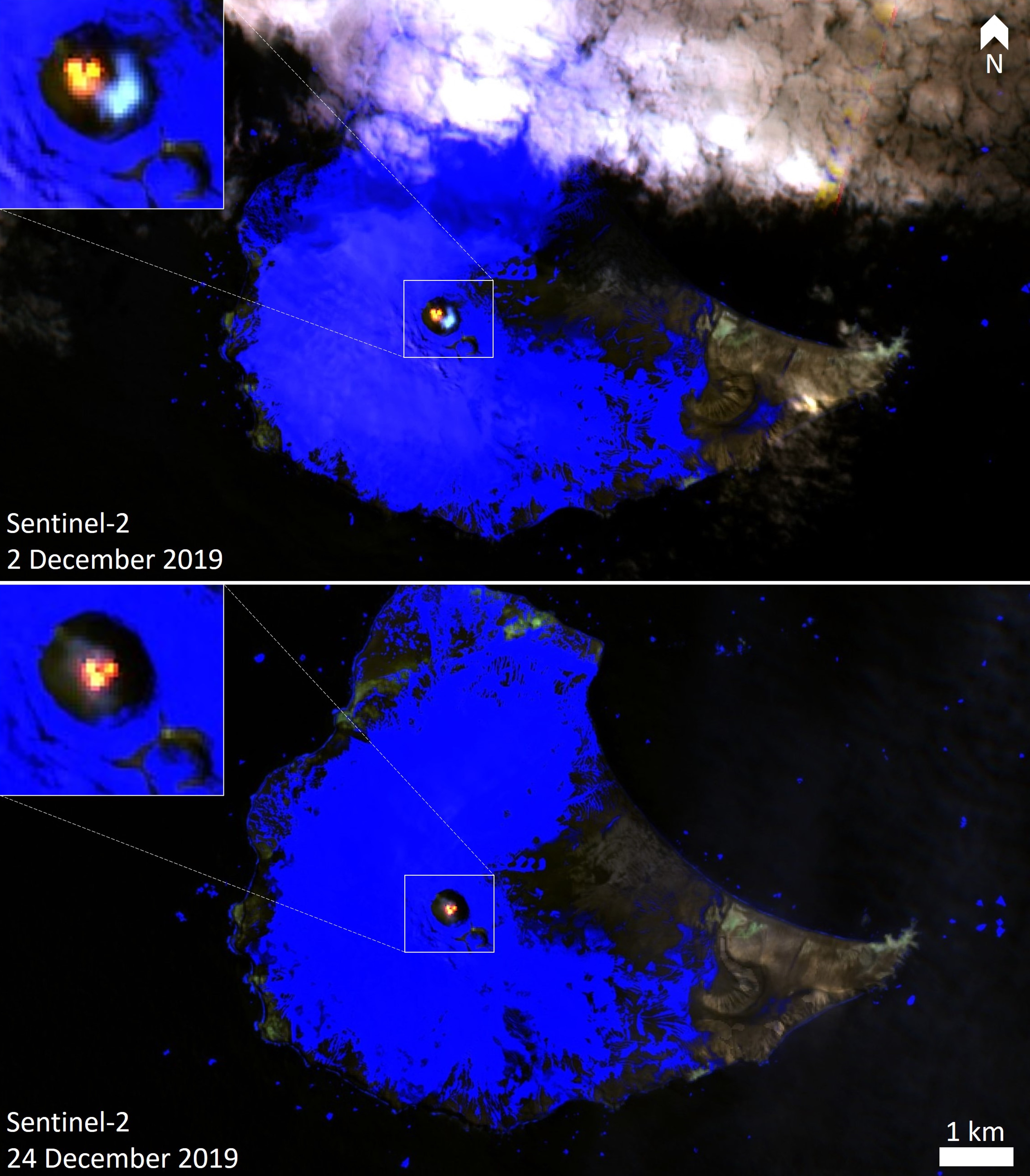 |
Figure 36. These two Sentinel-2 thermal satellite images of Saunders Island acquired on 2 and 24 December 2019 show three distinct areas of elevated temperature within the Mount Michael summit crater (yellow to red). While the locations of the thermal anomalies look different in these images, the angle of the view into the crater is not specified. Blue is Ice, black is ocean water. Sentinel-2 image with False color (Urban) (bands 12, 11, 4) rendering. Courtesy of Sentinel Hub Playground. |
Activity during January-May 2020. During January through May 2020 various remote sensing data showed the same activity as the previous seven months, with abundant cloud cover over the island. The Sentinel-2 satellite imaged a vertical plume on 13 March rising then being dispersed NE (figure 37). Intermittent observations of SO2 plumes continued through TROPOMI data analysis (figure 38). A clear view of the summit area on 29 May showed the ice-free active summit crater producing a weak gas-and-steam plume, and ash deposition on the NE to SE upper flanks (figure 39).
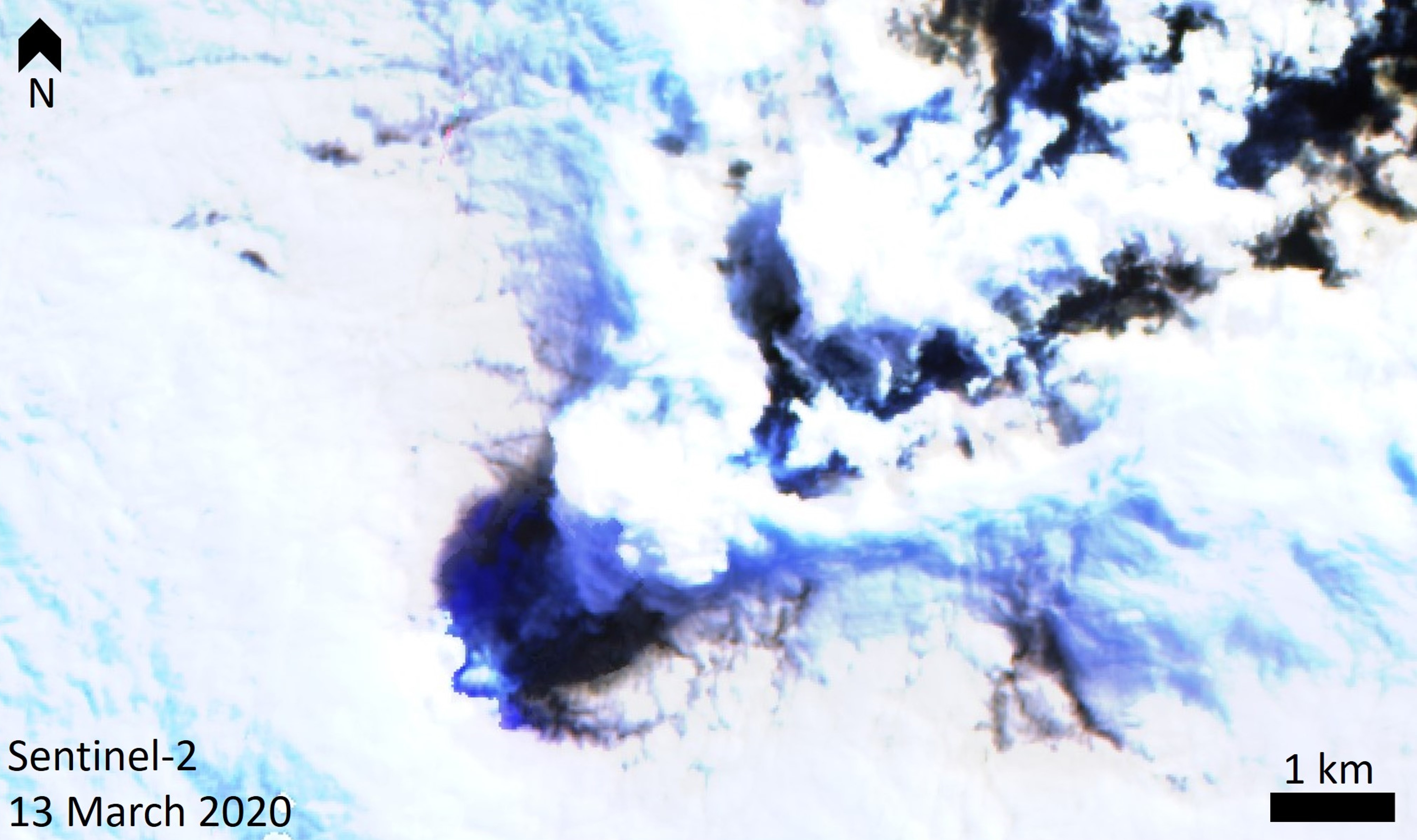 |
Figure 37. This Sentinel-2 satellite image of the Mount Michael summit area on Saunders Island with a gas-and-steam plume rising from the summit crater above the cloud cover, and dispersing NE. The plume and clouds are casting dark shadows below them. Sentinel-2 image with False color (Urban) (bands 12, 11, 4) rendering. Courtesy of Sentinel Hub Playground. |
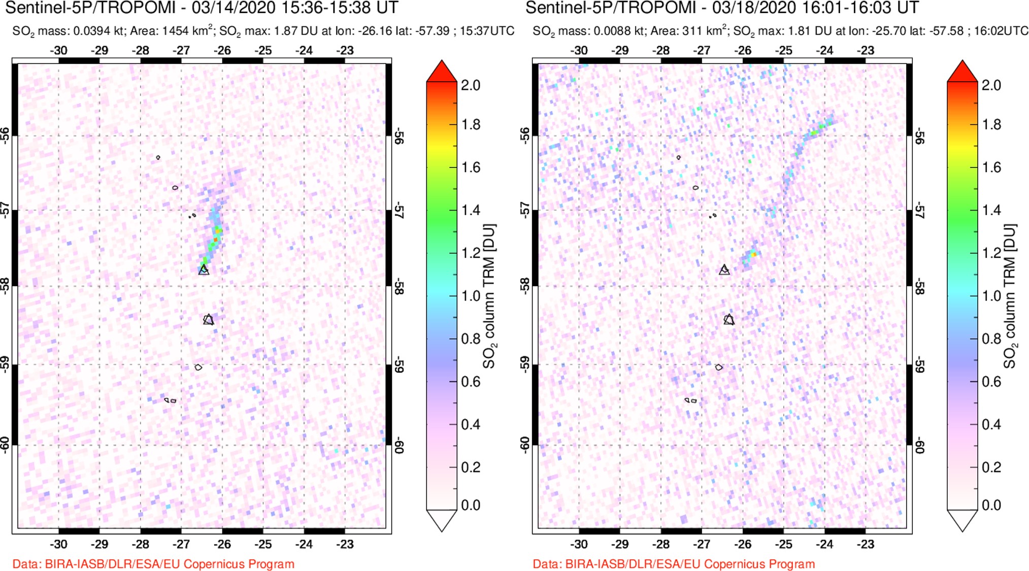 |
Figure 38. Examples of SO2 gas plumes originating from Saunders detected by the TROPOMI instrument on 14 and 18 March 2020. The plumes are dispersing N to NNE. Courtesy of NASA Global Sulfur Dioxide Monitoring Page. |
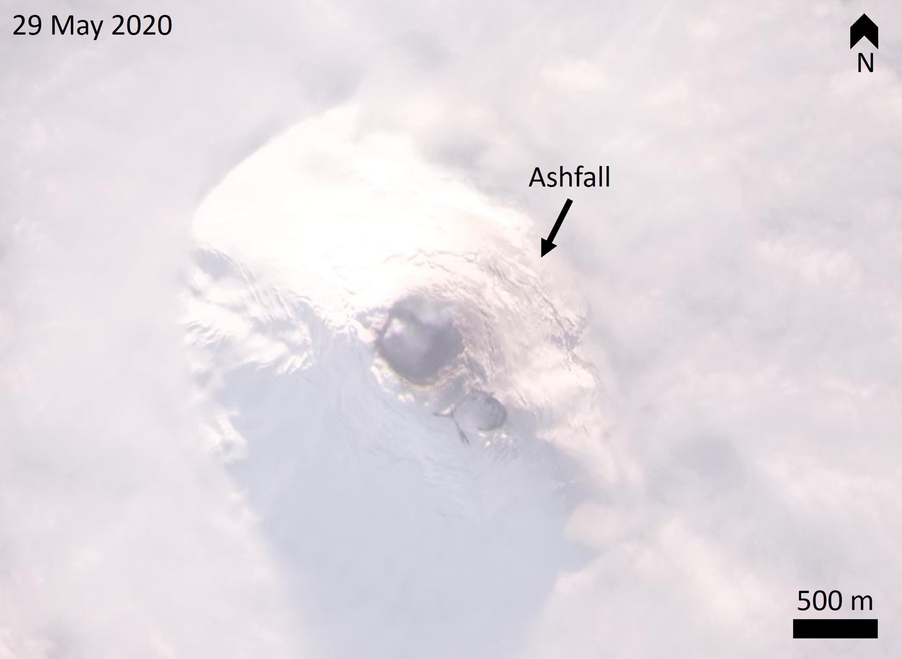 |
Figure 39. This 29 May 2020 Planet Scope satellite image shows the summit area of Mount Michael above cloud cover with the active summit crater and the old crater to the SE. There is a weak gas plume rising from the crater and ashfall on the upper E flank. Courtesy of Planet Labs. |
Research expedition in January 2020. The team of the 2020 Pelagic Australis expedition visited the island on 5-8 January 2020, with shore landings on the last three days, to quantify gas emissions from the island. The following information is from the published expedition results (Liu et al., 2021), with photos supplied by volcanologist Emma Liu.
Across the South Sandwich islands they used a combination of a ground-based and drone-mounted gas detectors (Multi-GAS), a UV imaging camera, sample collection, and NDIR spectrometer analyses to quantify gas output. They confirmed that the summit crater is a persistent source of gas emissions with 145 ± 59 tons per day of SO2 and a CO2 flux of 179 ± 76 tons per day. On the 5th they observed a vertical plume and on the 7th they observed the plume drifting down the E flank before rising (figure 40). They noted that the surface was steaming and was warm to the touch, suggesting widespread geothermal activity. The non-glaciated surfaces of the island contain tephra deposits, with units exposed by erosion and preserved within snow and ice (figure 41). Explosions have emplaced tephra layers across the island as well as ballistic blocks and bombs on the E flank (figure 42; Liu et al., 2021).
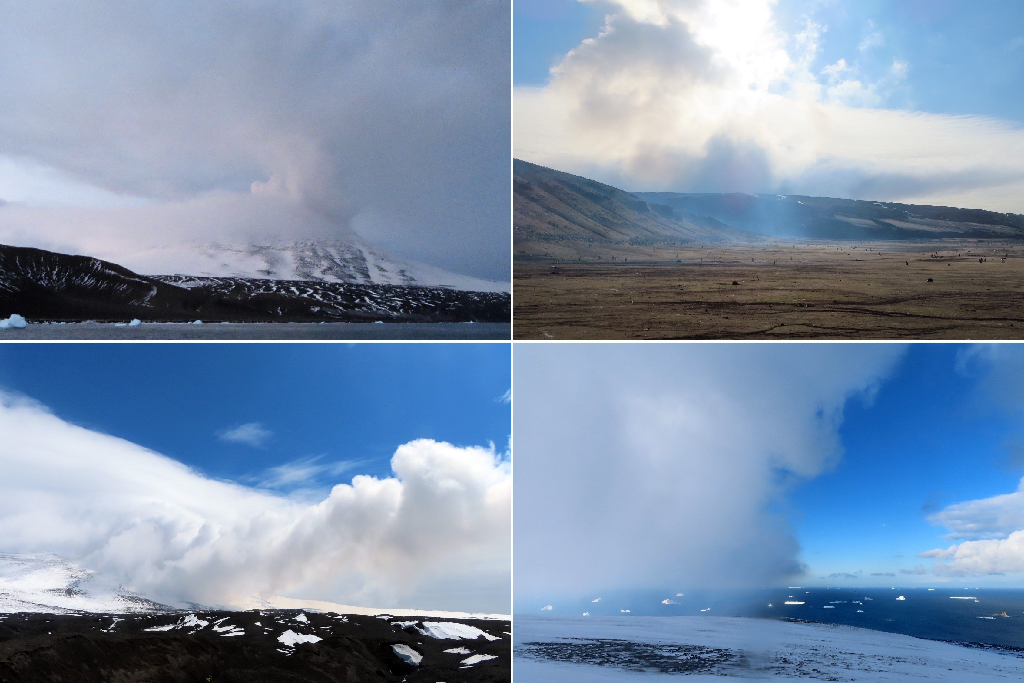 |
Figure 40. These images show the gas emissions from Mount Michael on Saunders Island in January 2020. The top right image is a vertical gas plume rising from the summit crater on the evening of the 5th. The two photos on the right are looking towards the E on the 7th. The bottom left image is a low-lying condensed gas plume on the 8th travelling down the E flank before rising. Courtesy of Emma Liu, and Liu et al. (2021). |
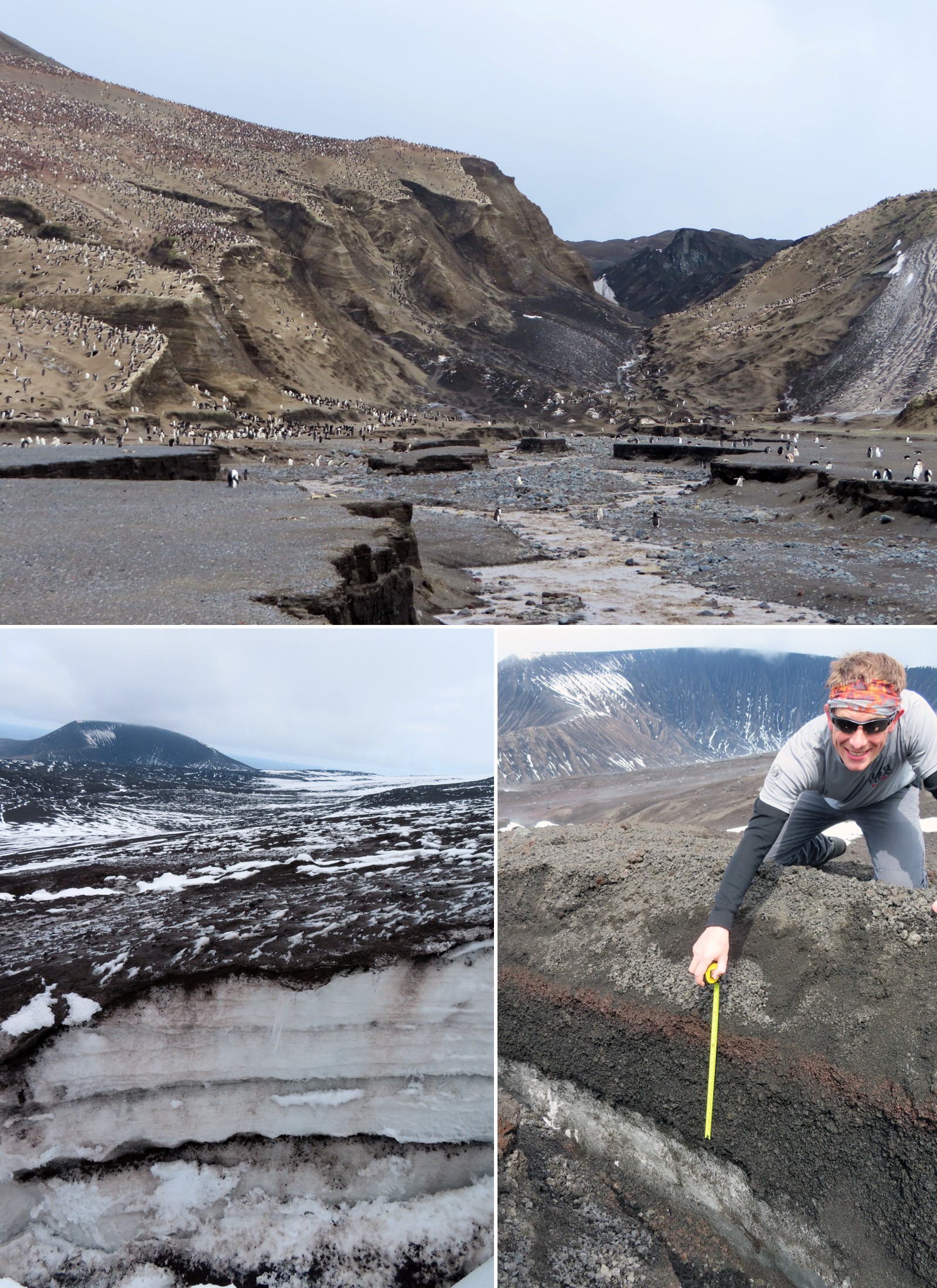 |
Figure 41. Tephra layers are preserved within the stratigraphy of snow and ice on Saunders Island. Scale shown by penguins (top) and volcanologist Kieran Wood (right). Photos courtesy of Emma Liu. |
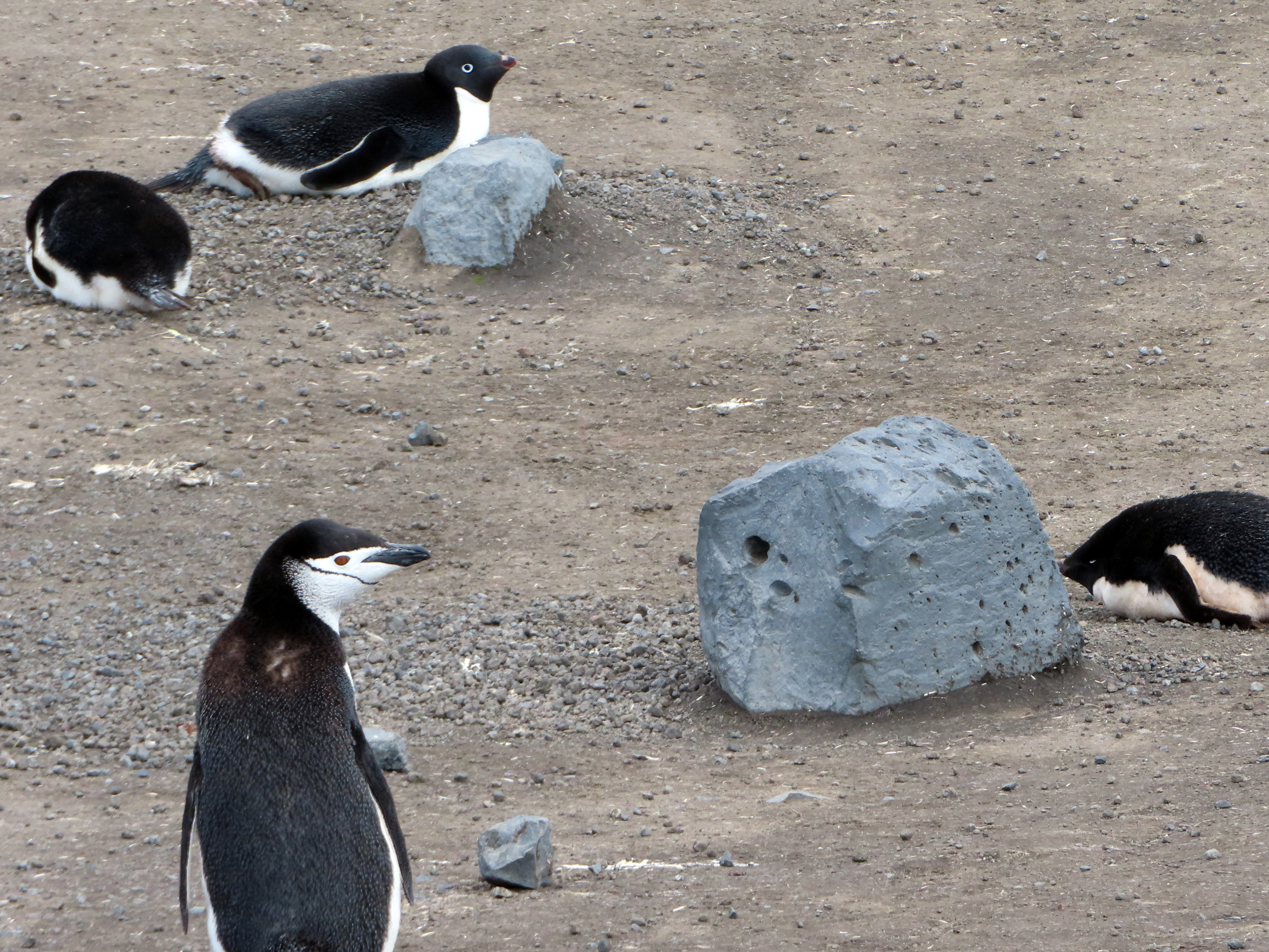 |
Figure 42. Dense volcanic blocks up to a meter in size are widespread on Saunders Island. The block in the foreground has a height of approximately 35 cm; the Chinstrap penguin in the foreground is around 50 cm tall. Courtesy of Emma Liu and Liu et al. (2021). |
References: Liu E J, Wood K, Aiuppa A, Giudice G, Bitetto M, Fischer T P, McCormick Kilbride B T, Plank T, Hart T, 2021. Volcanic activity and gas emissions along the South Sandwich Arc. Bull Volcanol 83. https://doi.org/10.1007/s00445-020-01415-2
LeMasurier W E, Thomson J W, Baker P E, Kyle P R, Rowley P D, Smellie J L, Verwoerd W J, 1990. Volcanoes of the Antarctic Plate and Southern Ocean. American Geophysical Union, Washington, D.C.
Lachlan-Cope T, Smellie J L, Ladkin R, 2001. Discovery of a recurrent lava lake on Saunders Island (South Sandwich Islands) using AVHRR imagery. J. Volcanol. Geotherm. Res. 112: 105-116.
Gray D M, Burton-Johnson A, Fretwell P T, 2019. Evidence for a lava lake on Mt. Michael volcano, Saunders Island (South Sandwich Islands) from Landsat, Sentinel-2 and ASTER satellite imagery. J. Volcanol. Geotherm. Res. 379:60-71. https://doi.org/10.1016/j.volgeores.2019.05.002
Derrien A, Richter N, Meschede M, Walter T, 2019. Optical DSLR camera- and UAV footage of the remote Mount Michael Volcano, Saunders Island (South Sandwich Islands), acquired in May 2019. GFZ Data Services. http://doi.org/10.5880/GFZ.2.1.2019.003
Patrick M R, Smellie J L, 2013. Synthesis A spaceborne inventory of volcanic activity in Antarctica and southern oceans, 2000–10. Antarct Sci 25:475–500. https://doi.org/10.1017/S0954102013000436
Geological Summary. Saunders Island consists of a large central volcanic edifice intersected by two seamount chains, as shown by bathymetric mapping (Leat et al., 2013). The young Mount Michael stratovolcano dominates the glacier-covered island, while two submarine plateaus, Harpers Bank and Saunders Bank, extend north. The symmetrical Michael has a 500-m-wide summit crater and a remnant of a somma rim to the SE. Tephra layers visible in ice cliffs surrounding the island are evidence of recent eruptions. Ash clouds were reported from the summit crater in 1819, and an effusive eruption was inferred to have occurred from a N-flank fissure around the end of the 19th century and beginning of the 20th century. A low ice-free lava platform, Blackstone Plain, is located on the north coast, surrounding a group of former sea stacks. A cluster of cones on the SE flank, the Ashen Hills, appear to have been modified since 1820 (LeMasurier and Thomson, 1990). Analysis of satellite imagery available since 1989 (Gray et al., 2019; MODVOLC) suggests frequent eruptive activity (when weather conditions allow), volcanic clouds, steam plumes, and thermal anomalies indicative of a persistent, or at least frequently active, lava lake in the summit crater. Due to this observational bias, there has been a presumption when defining eruptive periods that activity has been ongoing unless there is no evidence for at least 10 months.
Information Contacts: Emma Liu, University College London, Kathleen Lonsdale Building, 5 Gower Place, London, WC1E 6BS, United Kingdom; Global Sulfur Dioxide Monitoring Page, Atmospheric Chemistry and Dynamics Laboratory, NASA Goddard Space Flight Center (NASA/GSFC), 8800 Greenbelt Road, Goddard, Maryland, USA (URL: https://so2.gsfc.nasa.gov/); MIROVA (Middle InfraRed Observation of Volcanic Activity), a collaborative project between the Universities of Turin and Florence (Italy) supported by the Centre for Volcanic Risk of the Italian Civil Protection Department (URL: http://www.mirovaweb.it/); Planet Labs, Inc. (URL: https://www.planet.com/); Sentinel Hub Playground (URL: https://www.sentinel-hub.com/explore/sentinel-playground).