Report on Kerinci (Indonesia) — July 2021
Bulletin of the Global Volcanism Network, vol. 46, no. 7 (July 2021)
Managing Editor: Edward Venzke.
Edited by Kadie L. Bennis.
Kerinci (Indonesia) Gas-and-steam and occasional ash plumes during December 2020-June 2021
Please cite this report as:
Global Volcanism Program, 2021. Report on Kerinci (Indonesia) (Bennis, K.L., and Venzke, E., eds.). Bulletin of the Global Volcanism Network, 46:7. Smithsonian Institution. https://doi.org/10.5479/si.GVP.BGVN202107-261170
Kerinci
Indonesia
1.697°S, 101.264°E; summit elev. 3800 m
All times are local (unless otherwise noted)
Kerinci is located in Sumatra, Indonesia, and has had numerous moderate explosive eruptions since 1838. Its most recent eruption began in April 2018 and has been characterized by intermittent gas-and-steam and ash plumes through November 2020 (BGVN 45:12). This report covers and similar, but relatively low activity during December 2020 through June 2021 based on information from the Pusat Vulkanologi dan Mitigasi Bencana Geologi (PVMBG, also known as CVGHM, or the Center of Volcanology and Geological Hazard Mitigation), the Darwin Volcanic Ash Advisory Centre (VAAC), and satellite imagery.
Volcanic earthquakes and intermittent white-to-brown gas-and-steam plumes rose 50-800 m above the summit during December 2020 through June 2021 (figure 24); the volcano was often obscured by clouds. Brown ash plumes filling much of the crater could be observed in satellite imagery on 21 and 26 December 2020 and 5 and 8 January 2021. During 21-22 March, PVMBG and the Darwin VAAC reported an ash plume that rose 600 m above the summit and drifted SW. Small plumes of steam and possibly ash were present in a clear satellite view of the crater on 8 April. On 31 May at 0614 an ash plume rose 700 m above the summit and drifted NW, based on ground reports. An ash plume on 6 June rose to 4 km altitude and extended WNW according to HIMAWARI-8 satellite imagery. Another ash plume was reported at 1730 on 13 June that rose 700 m above the summit and drifted W.
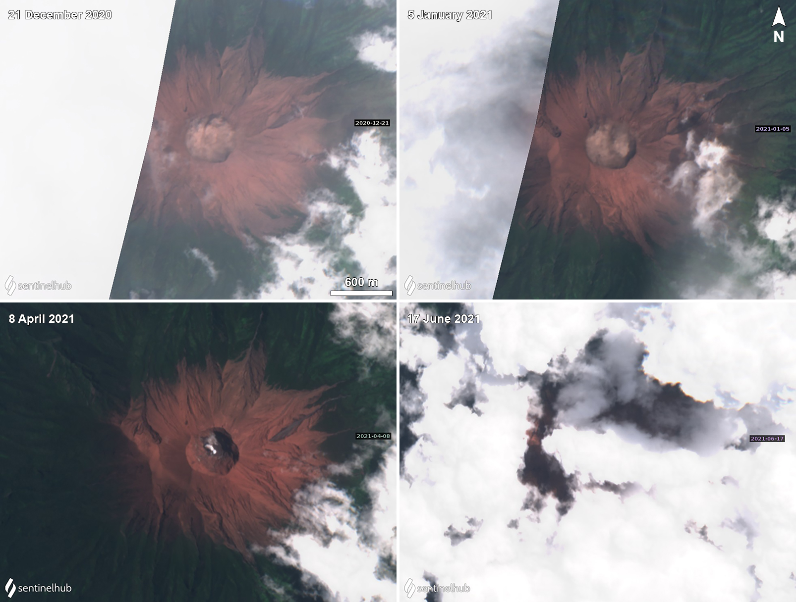 |
Figure 24. Sentinel-2 satellite imagery of brown, white, and gray emissions at Kerinci during 21 December (top left) 2020, 5 January (top right), 8 April (bottom left), and 17 June (bottom right) 2021. The brown emissions mostly remained within the crater area. The gray emissions drifted NE. Images using “Natural Color” rendering (bands 4, 3, 2). Courtesy of Sentinel Hub Playground. |
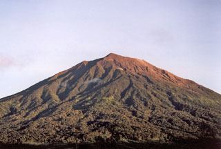
Geological Summary. Gunung Kerinci in central Sumatra forms Indonesia's highest volcano and is one of the most active in Sumatra. It is capped by an unvegetated young summit cone that was constructed NE of an older crater remnant. There is a deep 600-m-wide summit crater often partially filled by a small crater lake that lies on the NE crater floor, opposite the SW-rim summit. The massive 13 x 25 km wide volcano towers 2400-3300 m above surrounding plains and is elongated in a N-S direction. Frequently active, Kerinci has been the source of numerous moderate explosive eruptions since its first recorded eruption in 1838.
Information Contacts: Pusat Vulkanologi dan Mitigasi Bencana Geologi (PVMBG, also known as Indonesian Center for Volcanology and Geological Hazard Mitigation, CVGHM), Jalan Diponegoro 57, Bandung 40122, Indonesia (URL: http://www.vsi.esdm.go.id/); Darwin Volcanic Ash Advisory Centre (VAAC), Bureau of Meteorology, Northern Territory Regional Office, PO Box 40050, Casuarina, NT 0811, Australia (URL: http://www.bom.gov.au/info/vaac/); Sentinel Hub Playground (URL: https://www.sentinel-hub.com/explore/sentinel-playground).