Report on Tengger Caldera (Indonesia) — July 2021
Bulletin of the Global Volcanism Network, vol. 46, no. 7 (July 2021)
Managing Editor: Edward Venzke.
Edited by Kadie L. Bennis.
Tengger Caldera (Indonesia) Weak thermal anomaly in the summit crater during April-June 2021
Please cite this report as:
Global Volcanism Program, 2021. Report on Tengger Caldera (Indonesia) (Bennis, K.L., and Venzke, E., eds.). Bulletin of the Global Volcanism Network, 46:7. Smithsonian Institution. https://doi.org/10.5479/si.GVP.BGVN202107-263310
Tengger Caldera
Indonesia
7.942°S, 112.95°E; summit elev. 2329 m
All times are local (unless otherwise noted)
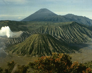
Tengger Caldera, located at the N end of a volcanic massif in East Java, consists of five overlapping stratovolcanoes that are truncated by a caldera. An overlapping cluster of post-caldera cones was constructed on the floor of the Sandsea caldera within the last several thousand years, the youngest of which is Bromo, the only currently active cone in the 16-km-wide caldera. Its most recent eruption period occurred during late December 2020 and was characterized by ash plumes and ashfall (BGVN 46:02). This report covers low-level activity consisting of thermal anomalies in the Bromo crater during April through June 2021, with information provided by the Pusat Vulkanologi dan Mitigasi Bencana Geologi (PVMBG, also known as Indonesian Center for Volcanology and Geological Hazard Mitigation, CVGHM) and satellite imagery.
Activity was relatively low during January through June 2021 and was dominantly white-to-gray gas-and-steam emissions that rose 50-700 m above the summit along with rare volcanic earthquakes. Weather conditions often obscured views of the volcano. A slight sulfur smell was occasionally reported in the Bromo area. Starting on 15 April a persistent weak thermal anomaly was identified in the Bromo crater, continuing through 9 June, based on Sentinel-2 infrared satellite imagery (figure 20).
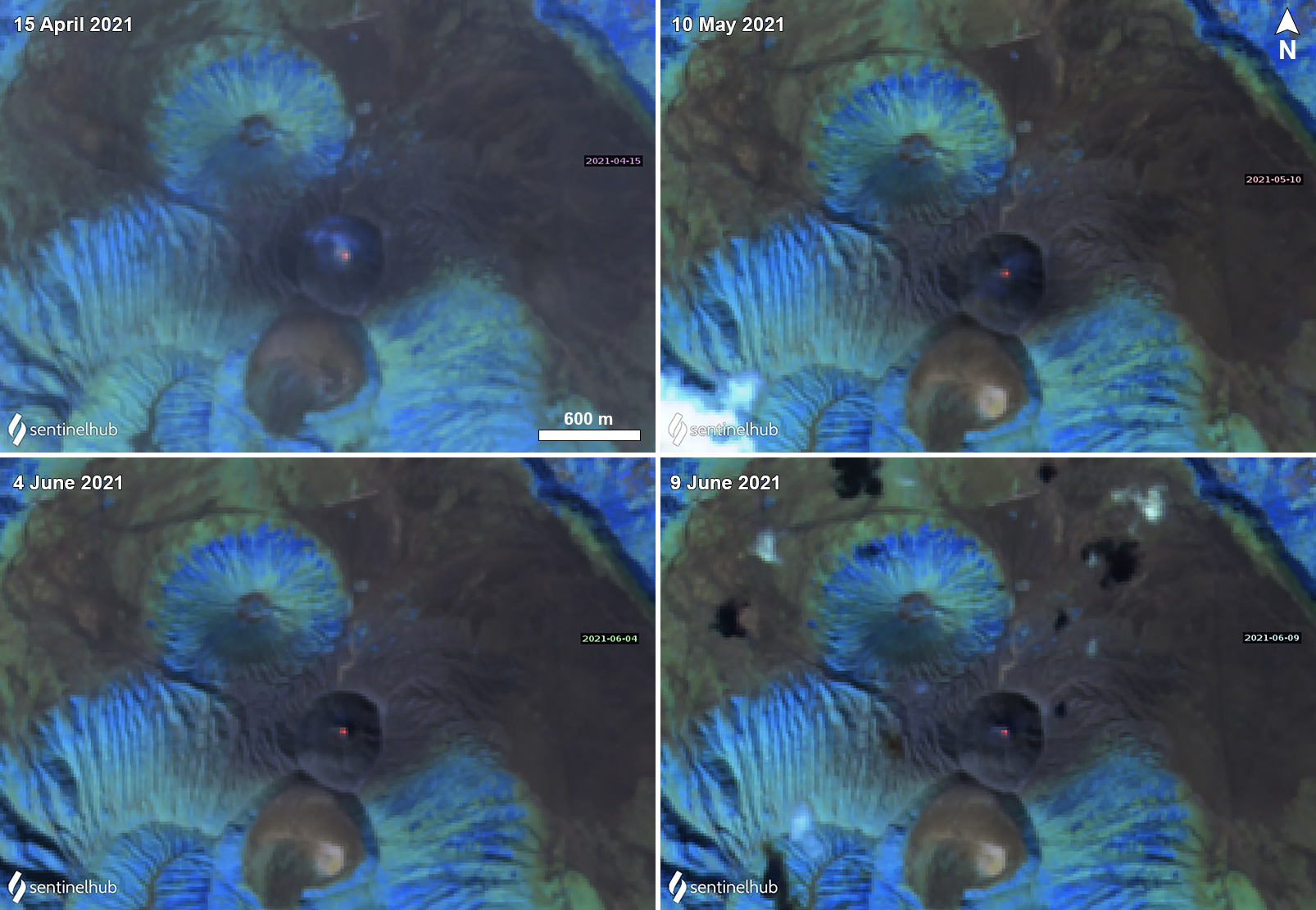 |
Figure 20. Sentinel-2 infrared satellite images showing a weak thermal anomaly in the summit crater of Bromo in the Tengger Caldera on 15 April (top left), 10 May (top right), 4 June (bottom left) and 9 June (bottom right) 2021. Images using “Atmospheric penetration” rendering (bands 12, 11, 8a). Courtesy of Sentinel Hub Playground. |
Geological Summary. The 16-km-wide Tengger caldera is located at the northern end of a volcanic massif extending from Semeru volcano. The massive volcanic complex dates back to about 820,000 years ago and consists of five overlapping stratovolcanoes, each truncated by a caldera. Lava domes, pyroclastic cones, and a maar occupy the flanks of the massif. The Ngadisari caldera at the NE end of the complex formed about 150,000 years ago and is now drained through the Sapikerep valley. The most recent of the calderas is the 9 x 10 km wide Sandsea caldera at the SW end of the complex, which formed incrementally during the late Pleistocene and early Holocene. An overlapping cluster of post-caldera cones was constructed on the floor of the Sandsea caldera within the past several thousand years. The youngest of these is Bromo, one of Java's most active and most frequently visited volcanoes.
Information Contacts: Pusat Vulkanologi dan Mitigasi Bencana Geologi (PVMBG, also known as Indonesian Center for Volcanology and Geological Hazard Mitigation, CVGHM), Jalan Diponegoro 57, Bandung 40122, Indonesia (URL: http://www.vsi.esdm.go.id/); Sentinel Hub Playground (URL: https://www.sentinel-hub.com/explore/sentinel-playground).