Report on Pagan (United States) — October 2021
Bulletin of the Global Volcanism Network, vol. 46, no. 10 (October 2021)
Managing Editor: Benjamin Andrews.
Edited by Kadie L. Bennis.
Pagan (United States) Gas-and-ash plumes during 1-6 September 2021
Please cite this report as:
Global Volcanism Program, 2021. Report on Pagan (United States) (Bennis, K.L., and Andrews, B., eds.). Bulletin of the Global Volcanism Network, 46:10. Smithsonian Institution. https://doi.org/10.5479/si.GVP.BGVN202110-284170
Pagan
United States
18.13°N, 145.8°E; summit elev. 570 m
All times are local (unless otherwise noted)
Mount Pagan is one of two stratovolcanoes that make up Pagan Island and is one of the most historically active volcanoes in the Northern Mariana Islands. Both North and South Pagan were constructed within calderas 7 and 4 km in diameter, respectively. Almost all the recorded historical eruptions dating back to the 17th century have originated from North Pagan; its largest eruption occurred in 1981, resulting in evacuation of the island. Intermittent activity followed this eruption. Activity prior to 2016 was characterized by vigorous gas-and-steam plumes and minor ash emissions. This report covers activity from January through September 2021 and includes new gas-and-ash plumes during 1-6 September. The volcano is not monitored by ground-based instruments, but rather satellite imagery, distal geophysical data, and mariner reports through weekly reports of the Northern Mariana Islands Volcano Observatory posted by the U.S. Geological Survey, as well as the Washington Volcanic Ash Advisory Center (VAAC).
According to NASA VIIRS thermal data, a thermal anomaly was visible on 6 and 8 June, and 21 August 2021. Ground-based observations from local residents described earthquakes and minor emissions at 1430 on 28 July, causing the Aviation Color Code to be raised to Yellow and the Volcano Alert Status to be raised to Advisory. A Planet Labs satellite image showed a brownish plume drifting W from the volcano on 22 August (figure 17). No additional activity was reported by 6 August, because seismic, infrasound, and web camera data was unavailable; the ACC and VAL remained the same.
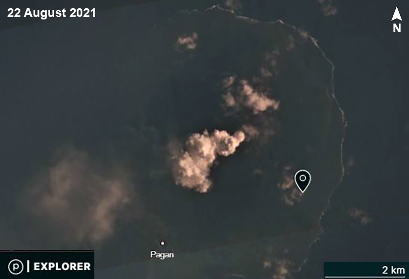 |
Figure 17. The summit area of Pagan showing a brownish plume drifting SW on 22 August 2021, the day after a thermal anomaly was detected in NASA VIIRS thermal data. Courtesy of PlanetScope, copyright Planet Labs 2021. |
Continuous low-level gas-and-ash emissions were observed in satellite data for most of the day on 1 September that extended up to 150 km NW and SW at an altitude of 3 km; emissions had stopped by 2300. This activity prompted the USGS to raise the ACC and VAL to Orange and Watch, respectively. After a brief pause, gas-and-ash emissions resumed the next day on 2 September (figure 18), extending 650 km W during the morning and rising to 1.2 km altitude, based on satellite images from the Washington VAAC. Early on 3 September, an ash-and-sulfur dioxide plume was identified in satellite data that drifted 150 km W at an altitude of 1.2 km. Ash deposits in and around the crater and on the downwind parts of the island were observed in satellite images taken on 4 September. During 4-6 September gas-and-ash plumes rose to an altitude of up to 5 km and drifted 400 km W. Sulfur dioxide emissions were observed in satellite data on 6 September extending up to 250 km W at an altitude of less than 1.5 km; ash emissions paused sometime during 6-7 September, which indicated a decrease in activity. A steam plume possibly containing a minor amount of ash was identified in satellite data on 7 September that drifted 24 km W at an altitude of 1.5 km; sulfur dioxide emissions were not observed, nor were ash emissions. According to the USGS, ash-and-sulfur dioxide emissions were last detected on 6 September, though robust occasional steam plumes continued to be visible through at least 14 September. As a result, the ACC and VAL were lowered to Yellow and Advisory, respectively on 11 September. Due to the lack of unrest since 6 September, the USGS lowered both the ACC and VAL to Unassigned on 24 September.
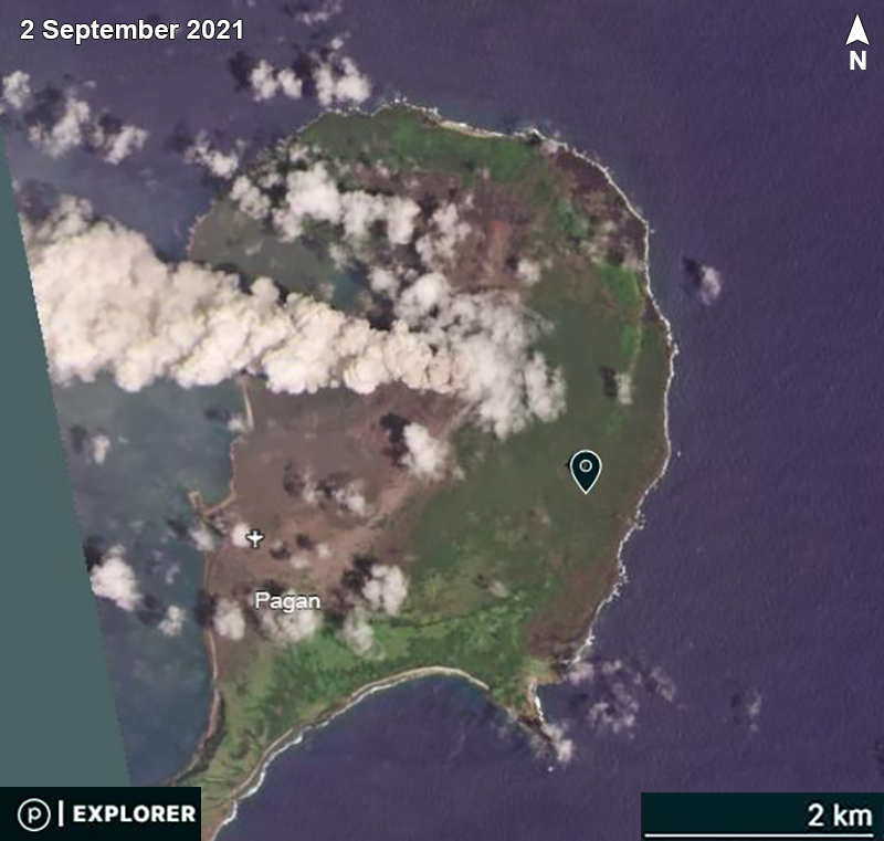 |
Figure 18. A strong ash plume was detected rising from Pagan and drifting W on 2 September 2021. Courtesy of PlanetScope, copyright Planet Labs 2021. |
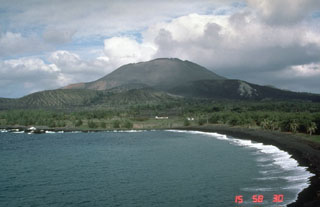
Geological Summary. Pagan Island, the largest and one of the most active of the Mariana Islands volcanoes, consists of two stratovolcanoes connected by a narrow isthmus. Both North and South Pagan stratovolcanoes were constructed within calderas, 7 and 4 km in diameter, respectively. North Pagan at the NE end of the island rises above the flat floor of the northern caldera, which may have formed less than 1,000 years ago. South Pagan is a stratovolcano with an elongated summit containing four distinct craters. Almost all of the recorded eruptions, which date back to the 17th century, have originated from North Pagan. The largest eruption during historical time took place in 1981 and prompted the evacuation of the sparsely populated island.
Information Contacts: Emergency Management Office of the Commonwealth of the Northern Mariana Islands (EMO-CNMI) and USGS Volcano Hazards Program, PO Box 100007, Saipan, MP 96950, USA (URL: http://www.cnmiemo.gov.mp/ and http://volcanoes.usgs.gov/nmi/activity/index.php); Washington Volcanic Ash Advisory Center (VAAC), Satellite Analysis Branch (SAB), NOAA/NESDIS OSPO, NOAA Science Center Room 401, 5200 Auth Rd, Camp Springs, MD 20746, USA (URL: www.ospo.noaa.gov/Products/atmosphere/vaac, archive at: http://www.ssd.noaa.gov/VAAC/archive.html); NASA Worldview (URL: https://worldview.earthdata.nasa.gov/); Planet Labs, Inc. (URL: https://www.planet.com/).