Report on Kavachi (Solomon Islands) — November 2021
Bulletin of the Global Volcanism Network, vol. 46, no. 11 (November 2021)
Managing Editor: Benjamin Andrews.
Edited by Kadie L. Bennis.
Kavachi (Solomon Islands) Discolored water plumes observed in satellite imagery during October 2021
Please cite this report as:
Global Volcanism Program, 2021. Report on Kavachi (Solomon Islands) (Bennis, K.L., and Andrews, B., eds.). Bulletin of the Global Volcanism Network, 46:11. Smithsonian Institution. https://doi.org/10.5479/si.GVP.BGVN202111-255060
Kavachi
Solomon Islands
8.991°S, 157.979°E; summit elev. -20 m
All times are local (unless otherwise noted)
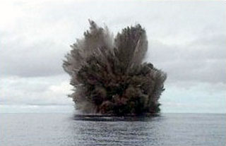
Kavachi is an active submarine volcano in the SW Pacific, located in the Solomon Islands south of Gatokae and Vangunu islands. Volcanism has been characterized by phreatomagmatic explosions that ejected steam, ash, and incandescent bombs. The previous report described intermittent discolored plumes extending from a single point during October 2020 through 10 April 2021 (BGVN 46:06); similar activity was recorded for this reporting period covering May through October 2021 using satellite data.
Activity at Kavachi is primarily observed through Sentinel-2 natural color satellite imagery and has shown occasional discolored (light yellow-green) submarine plumes during late 2020 and into early 2021. After a period of no visible discolored water, the first observation of faint discoloration occurred on 7 October that originated from a specific point and extended generally E (figure 25). Another narrow plume was visible on 12 October that was more defined and stronger in color, extending initially SE and then turning E for several kilometers. Two other plumes that seemed to originate from the same location as the previous 7 and 12 October plumes were faintly visible on 17 and 27 October that extended E and SE, respectively for several kilometers. The one on the 27th extended over a broader area to the SE.
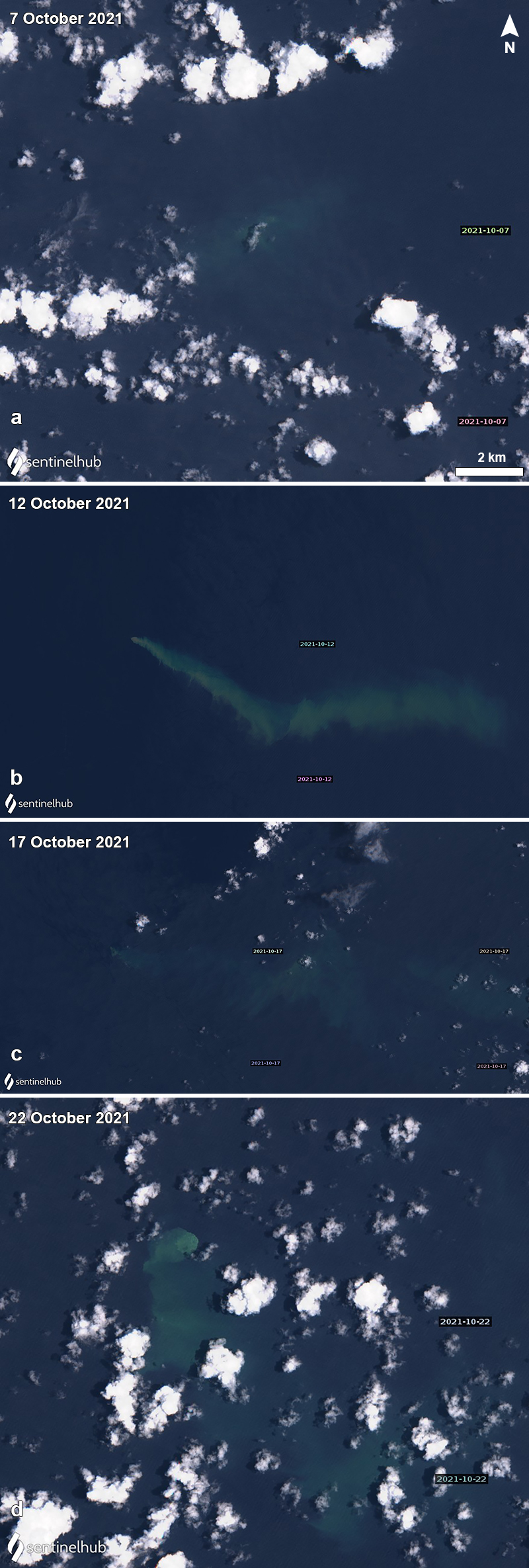 |
Figure 25. Sentinel-2 satellite imagery of discolored plumes (light yellow-green) at Kavachi during October 2021. On 7 October (a) the plume was a faint yellow-green and drifted from a single origin point. On 12 October (b) the plume was stronger and extended SE and then E. The plume continued to drift E on 17 October (c), though it was weaker compared to the previous capture. Then, on 27 October (d) a strong yellow-green plume was visible drifting S from its point of origin for several kilometers. Images with “Natural color” rendering (bands 4, 3, 2). Courtesy of Sentinel Hub Playground. |
Geological Summary. Named for a sea-god of the Gatokae and Vangunu peoples, Kavachi is located in the Solomon Islands south of Vangunu Island. Sometimes referred to as Rejo te Kvachi ("Kavachi's Oven"), this shallow submarine basaltic-to-andesitic volcano has produced ephemeral islands up to 1 km long many times since its first recorded eruption during 1939. Residents of the nearby islands of Vanguna and Nggatokae (Gatokae) reported "fire on the water" prior to 1939, a possible reference to earlier eruptions. The roughly conical edifice rises from water depths of 1.1-1.2 km on the north and greater depths to the SE. Frequent shallow submarine and occasional subaerial eruptions produce phreatomagmatic explosions that eject steam, ash, and incandescent bombs. On a number of occasions lava flows were observed on the ephemeral islands.
Information Contacts: Sentinel Hub Playground (URL: https://www.sentinel-hub.com/explore/sentinel-playground).