Report on Kadovar (Papua New Guinea) — June 2022
Bulletin of the Global Volcanism Network, vol. 47, no. 6 (June 2022)
Managing Editor: Benjamin Andrews.
Edited by Kadie L. Bennis.
Kadovar (Papua New Guinea) Occasional ash plumes and weak thermal anomalies during September 2021-May 2022
Please cite this report as:
Global Volcanism Program, 2022. Report on Kadovar (Papua New Guinea) (Bennis, K.L., and Andrews, B., eds.). Bulletin of the Global Volcanism Network, 47:6. Smithsonian Institution. https://doi.org/10.5479/si.GVP.BGVN202206-251002
Kadovar
Papua New Guinea
3.608°S, 144.588°E; summit elev. 365 m
All times are local (unless otherwise noted)
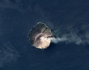
Kadovar is a 2-km-wide island located in the Bismarck Sea off the coast of New Guinea about 25 km NNE from the mouth of the Sepik River. The current eruption began in January 2018, which has recently consisted of intermittent ash and gas-and-steam plumes and weak summit thermal anomalies (BGVN 46:09). Similar activity persisted during this reporting period of September 2021 through May 2022 using information from the Darwin Volcanic Ash Advisory Center (VAAC) and satellite data.
Activity during the reporting period was relatively low, although intermittent ash plumes were reported by satellite and wind model data from the Darwin VAAC. Ash plumes rose to 1.5 km altitude on 8-9 October 2021, 3, 5, and 9 November 2021, and 8 April 2022. Occasional white gas-and-steam plumes that drifted in different directions were also visible in Sentinel-2 satellite images on clear weather days throughout the reporting period (figure 63). Thermal activity was generally low; two thermal anomalies were detected on 2 May, according to data from MODVOLC’s infrared satellite data. Sentinel-2 infrared satellite imagery showed an anomaly at the summit, often accompanied by a gas-and-steam plume (figure 64).
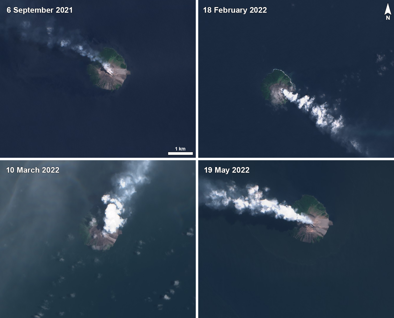 |
Figure 63. Sentinel-2 satellite images showing intermittent white gas-and-steam plumes rising from Kadovar and drifted NW on 6 September 2021 (top left), SE on 18 February 2022 (top right), NE on 10 March 2022 (bottom left), and NE on 19 May 2022 (bottom right). Images with “Natural color” (bands 4, 3, 2) rendering. Courtesy of Sentinel Hub Playground. |
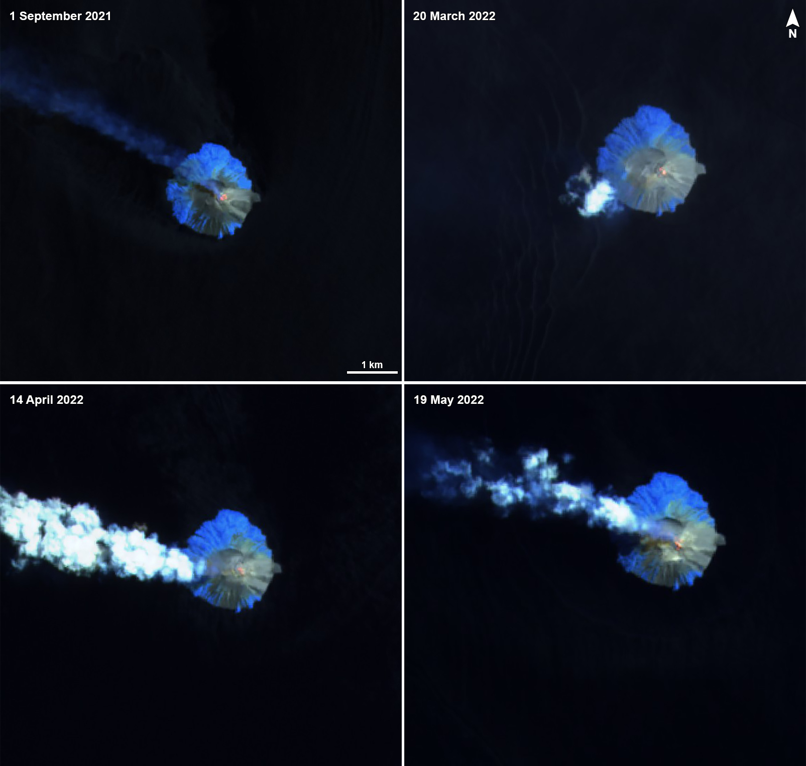 |
Figure 64. Sentinel-2 infrared satellite images showing some thermal activity at the summit crater of Kadovar on 1 September 2021 (top left), 20 March 2022 (top right), 14 April 2022 (bottom left), and 19 May 2022 (bottom right), accompanied by gas-and-steam emissions that drifted generally W. Images with “Atmospheric penetration” (bands 12, 11, 8A) rendering. Courtesy of Sentinel Hub Playground. |
Geological Summary. The 2-km-wide island of Kadovar is the emergent summit of a Bismarck Sea stratovolcano of Holocene age. It is part of the Schouten Islands, and lies off the coast of New Guinea, about 25 km N of the mouth of the Sepik River. Prior to an eruption that began in 2018, a lava dome formed the high point of the andesitic volcano, filling an arcuate landslide scarp open to the south; submarine debris-avalanche deposits occur in that direction. Thick lava flows with columnar jointing forms low cliffs along the coast. The youthful island lacks fringing or offshore reefs. A period of heightened thermal phenomena took place in 1976. An eruption began in January 2018 that included lava effusion from vents at the summit and at the E coast.
Information Contacts: Darwin Volcanic Ash Advisory Centre (VAAC), Bureau of Meteorology, Northern Territory Regional Office, PO Box 40050, Casuarina, NT 0811, Australia (URL: http://www.bom.gov.au/info/vaac/); Hawai'i Institute of Geophysics and Planetology (HIGP) - MODVOLC Thermal Alerts System, School of Ocean and Earth Science and Technology (SOEST), Univ. of Hawai'i, 2525 Correa Road, Honolulu, HI 96822, USA (URL: http://modis.higp.hawaii.edu/); Sentinel Hub Playground (URL: https://www.sentinel-hub.com/explore/sentinel-playground).