Report on Purace (Colombia) — June 2022
Bulletin of the Global Volcanism Network, vol. 47, no. 6 (June 2022)
Managing Editor: Benjamin Andrews.
Edited by Kadie L. Bennis.
Purace (Colombia) Frequent seismicity and degassing during March-July 2022
Please cite this report as:
Global Volcanism Program, 2022. Report on Purace (Colombia) (Bennis, K.L., and Andrews, B., eds.). Bulletin of the Global Volcanism Network, 47:6. Smithsonian Institution. https://doi.org/10.5479/si.GVP.BGVN202206-351060
Purace
Colombia
2.3095°N, 76.3948°W; summit elev. 4650 m
All times are local (unless otherwise noted)
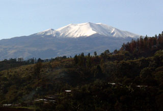
Puracé, located in Colombia, is a stratovolcano that contains a 500-m-wide summit crater. It is part of the Los Coconucos volcanic chain that is a NW-SE trending group of seven cones and craters. The previous eruption occurred during March 1977, with more recent activity characterized by small white gas-and-steam plumes on the NW edge of the crater during October 2011 and intermittent elevated volcano-tectonic and long-period seismicity during January-April 2008 and January 2010-April 2012 (see table 2 in BGVN 37:09). This report updates similar seismic information and fumarolic activity from March through July 2022 based on weekly reports from the Popayán Observatory, part of the Servicio Geologico Colombiano (SGC).
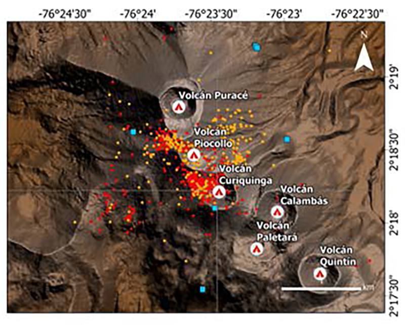
Activity during this reporting period primarily consisted of elevated seismic events and fumaroles (table 3). On 28 March starting at 2000 and continuing through the night, there were 479 volcano-tectonic-type (VT) events, indicating rock fracturing events, 183 long-period-type (LP) events, and 119 volcanic tremor-type (TR) events, indicating fluid movement. Seismicity was detected 800 m SE from the crater at average depths of 2 km (figure 12). A magnitude 3.3 earthquake occurred at 1214 on 29 March. That same day, two cracks approximately 40 m long and located along Coconucos Volcanic Chain, between Puracé and Curiquinga, and produced gas-and-steam emissions. Ash was also reported by observers in the area. There was also an increase in sulfur dioxide gas emission. On 30 March the Volcano Alert Level rose to 3 or Yellow (the second lowest on a four-color scale).
Table 3. Seismicity at Puracé during March-July 2022. Volcano-tectonic (VT), long-period (LP), hybrid (HB), tremor (TR), and low frequency (BF) events are reported each month. Courtesy of SGC.
| Month | Volcano-tectonic | Long-period | Hybrid | Tremor | Low frequency |
| Mar 2022 | 479 | 183 | -- | 119 | -- |
| Apr 2022 | 489 | 2,554 | 39 | 104 | 12 |
| May 2022 | 276 | 1,502 | 12 | 416 | 337 |
| Jun 2022 | 312 | 2,674 | 46 | 664 | 302 |
| Jul 2022 | 161 | 1,120 | 90 | 80 | 26 |
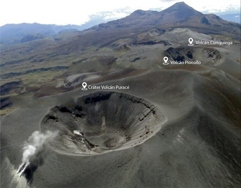
During April, seismicity increased to 3,198 events, which included 489 VT-type events, 2,554 LP-type events, 39 hybrid-type (HB) events, 104 TR-type events, and 12 low frequency-type (BF) events. Millimeter-to-centimeter-scale inflation was detected, according to the GNSS (Global Navigation Satellite System) geodetic network and DInSAR (Differential Interferometry by Synthetic Aperturn Radar) data. The measured sulfur dioxide emissions ranged from 937-2,389 tons/day (t/d). Occasional gas-and-steam emissions were emitted from the N flank and drifted NW (figure 13). Seismicity in May persisted with 276 VT-type events, 1,502 LP-type events, 12 HB-type events, 416 TR-type events, and 337 BF-type events. Sulfur dioxide emissions during May ranged from 523-1,841 t/d. White gas-and-steam emissions occasionally were visible drifting NW during the second half of the month. A drone overflight over Curiquinga occurred on 11 May showing cracks in the volcano that were 45 m long, 6 m deep, and 10-20 m wide. No emissions were observed rising from these cracks at the time.
Seismicity in June continued, with 312 VT-type events, 2,674 LP-type events, 46 HB-type events, 664 TR-type events, and 302 BF-type events. Sulfur dioxide emissions ranged from 544-1,573 t/d, the largest measurement of which occurred on 23 June. Intermittent white gas-and-steam emissions continued to drift NW. In July, the number of seismic events decreased slightly and included 161 VT-type events, 1,120 LP-type events, 90 HB-type events, 80 TR-type events, and 26 BF-type events. White gas-and-steam emissions continued to occasionally be visible through the first half of July.
Geological Summary. Puracé is an active andesitic volcano with a 600-m-diameter summit crater at the NW end of the Los Coconucos Volcanic Chain. This volcanic complex includes nine composite and five monogenetic volcanoes, extending from the Puracé crater more than 6 km SE to the summit of Pan de Azúcar stratovolcano. The dacitic massif which the complex is built on extends about 13 km NW-SE and 10 km NE-SW. Frequent small to moderate explosive eruptions reported since 1816 CE have modified the morphology of the summit crater, with the largest eruptions in 1849, 1869, and 1885.
Information Contacts: Servicio Geologico Colombiano (SGC), Diagonal 53 No. 34-53 - Bogotá D.C., Colombia (URL: https://www.sgc.gov.co/volcanes).


