Report on Kaitoku Seamount (Japan) — February 2023
Bulletin of the Global Volcanism Network, vol. 48, no. 2 (February 2023)
Managing Editor: Edward Venzke.
Edited by Kadie L. Bennis.
Kaitoku Seamount (Japan) New eruption with strongly discolored water during August 2022-January 2023
Please cite this report as:
Global Volcanism Program, 2023. Report on Kaitoku Seamount (Japan) (Bennis, K.L., and Venzke, E., eds.). Bulletin of the Global Volcanism Network, 48:2. Smithsonian Institution.
Kaitoku Seamount
Japan
26.1217°N, 141.0955°E; summit elev. -95 m
All times are local (unless otherwise noted)
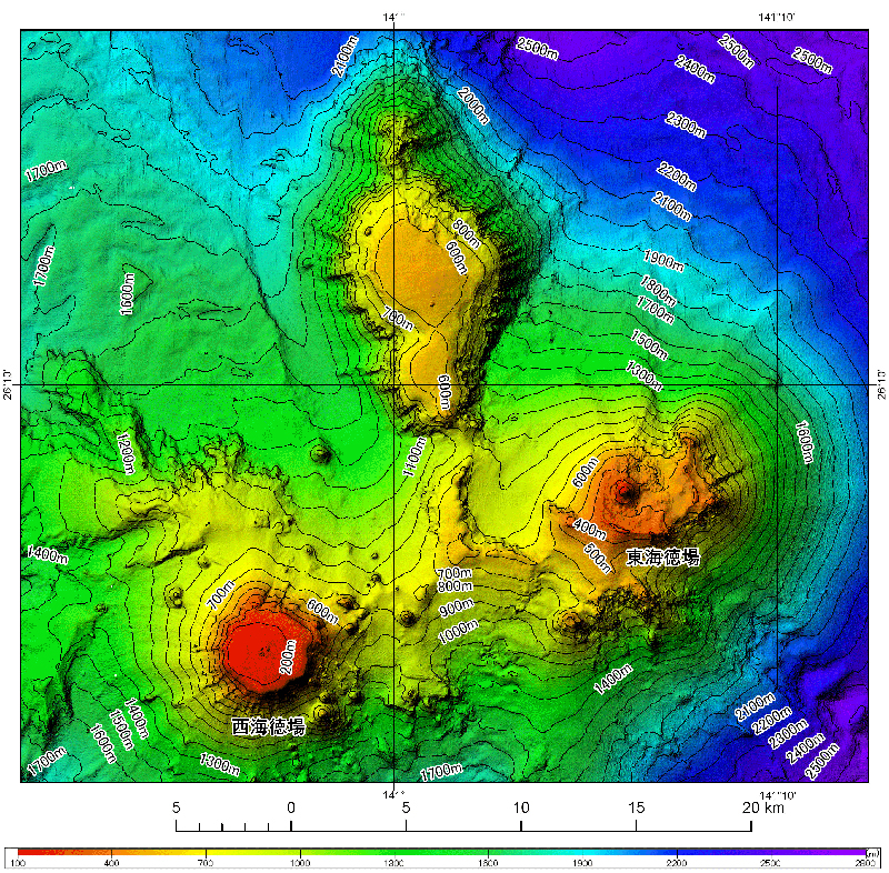
Kaitoku Seamount is a three-peaked submarine volcano located about 1 km S of Tokyo, Japan. The base of the seamount has a diameter of 40 km and a height of 2.5 km above the ocean floor. The two peaks in the south are called Tokai Tokuba and Nishi Tokuba (figure 2). The most recent previous confirmed eruption was in 1984, when discolored water, gas-and-steam plumes, and floating pumice was reported (SEAN 09:10). Water discoloration was observed in December 1984 and June 1986, and the Japan Coast Guard (JCG) described activity in July 2001 which mainly consisted of bubbles. This report covers a new eruption that was characterized by strongly discolored water during August 2022 through January 2023 based on information from the Japan Meteorological Agency (JMA), Japan Coast Guard (JCG), and satellite data.
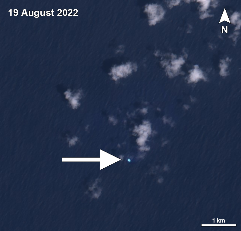
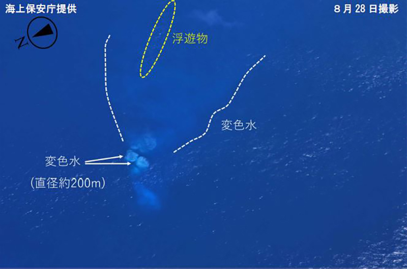
The JCG received a report on 19 August that discolored water was observed near the volcano on 18 and 19 August. This was also visible in a Sentinel-2 satellite image (figure 3). According to aerial observations by the JCG on 23 and 28 August, both discolored water and floating material were observed. The discolored water was yellow-white, approximately 100 m in diameter, and located near the Tokai Tokuba peak. On 28 August multiple zones of white discolored water were observed directly above the volcano and floating material covered an area approximately 200-m-wide and 6-km-long to the SE (figure 4).
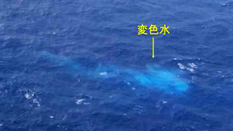
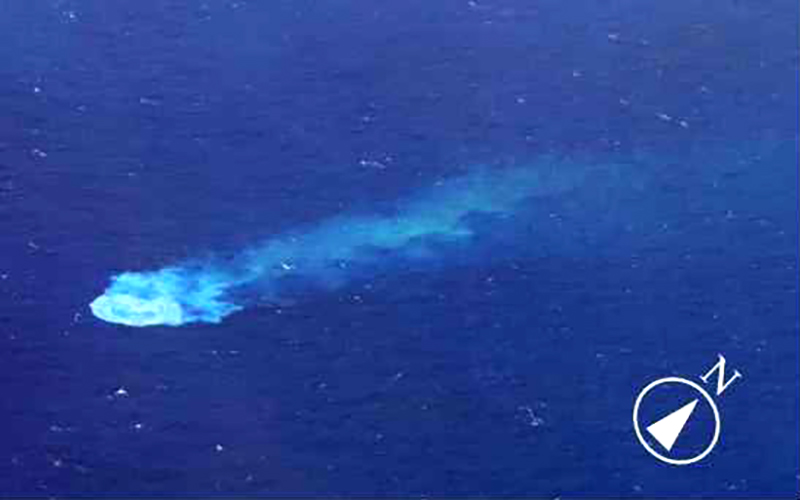
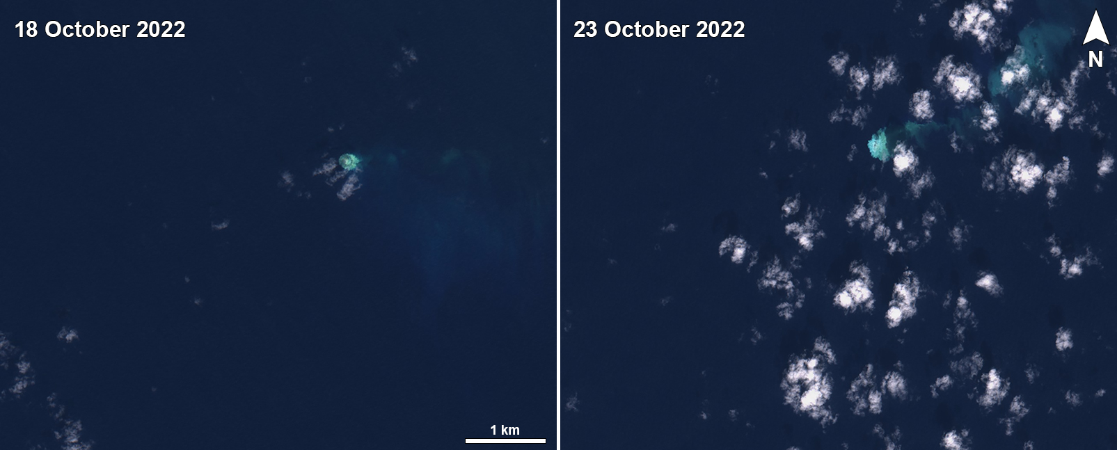
Discolored water observations continued during September and October, which was interpreted as ongoing volcanic activity. Sentinel-2 satellite images showed small blue-white discolored plumes on 3, 8, 23, and 28 September that drifted SE, S, SW, and N from a single point. On 16 September an aerial observation conducted by JCG showed blue-white discolored water approximately 20 m wide and 30 m long (figure 5). Strong yellow-blue discolored water was visible on 28 September that mainly occurred around a single point, but a faint plume extended to the N. Though weather clouds sometimes prevented clear views of the vent area, discolored water plumes appeared more frequently in October. On 12 October there was a zone of dense yellow-white discolored water approximately 200 m in diameter; no floating material was observed (figure 6). Sentinel-2 satellite images captured discolored plumes on 3, 8, 13, 18, and 23 October, that mainly encompassed a single area. Part of the plumes extended SW, NW, E, and NE (figure 7).
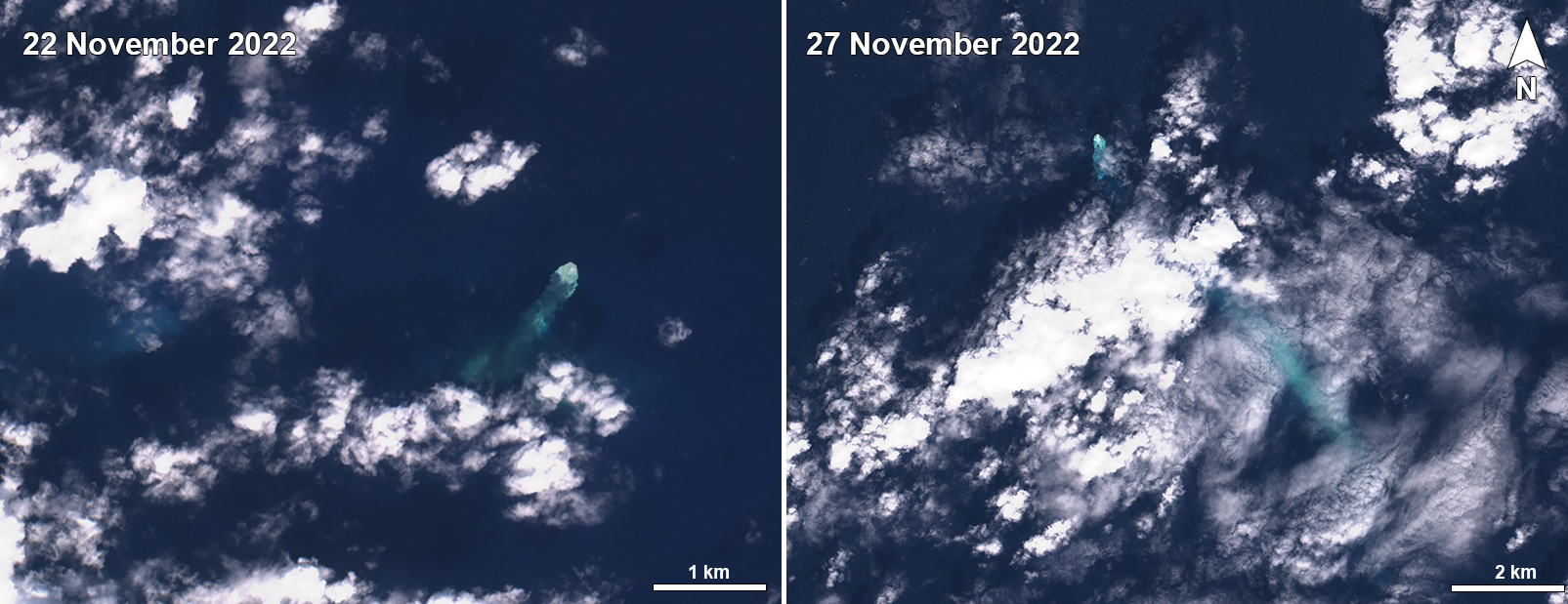
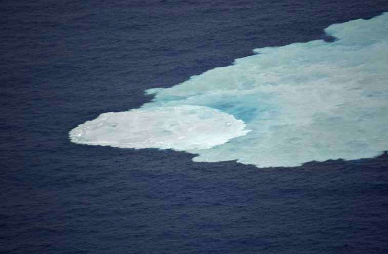
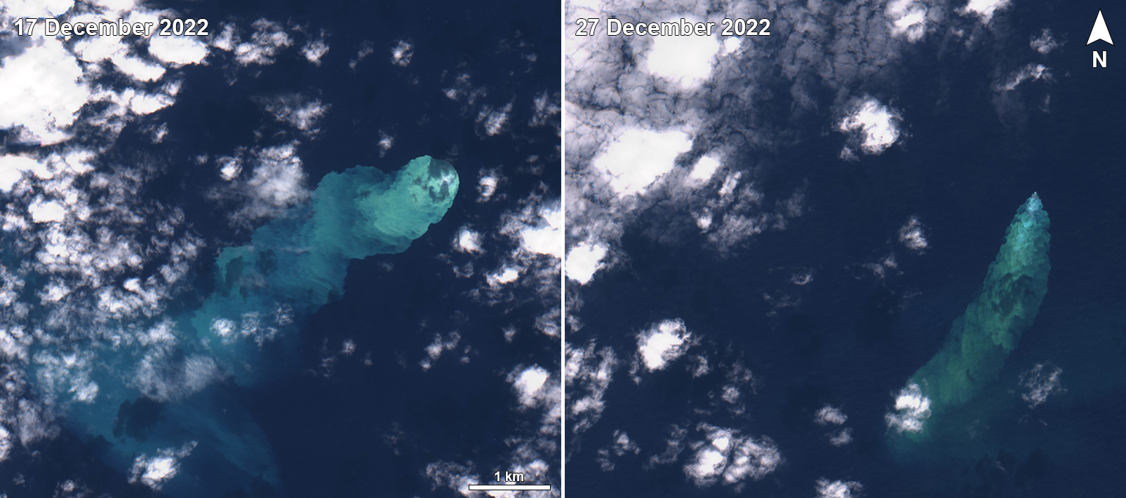
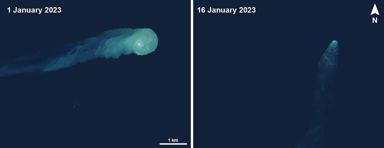
During November 2022 through January 2023 occasional strongly discolored plumes persisted. Sentinel-2 satellite images captured green-yellow discolored plumes on 22 and 27 November that drifted several kilometers SW and SE (figure 8). An aerial observation conducted by JCG on 25 November showed a yellow-white circular shape of discolored water approximately 300 m in diameter (figure 9). Additionally, blue-white discolored water was observed extending 1 km SW from the volcano and was about 10 km in length. Strong green-yellow discolored plumes were visible in Sentinel-2 satellite images on 17 and 27 December that drifted SE and S as far as 10 km from the vent area (figure 10). Frequent strongly discolored plumes were captured in satellite imagery on 1, 6, 11, 16, and 26 January 2023 that drifted in different directions for several kilometers. On 1 and 16 January white bubbles were also visible around the vent area (figure 11).
Geological Summary. Submarine eruption have been observed during March 1984 and August 2022-January 2023 from Kaitoku Seamount (Kaitoku Kaizan), a three-peaked submarine volcano 80 km NNW of Kita-Ioto. The type of activity related to other observations of discolored water or bubbling, including an observation from 1543 CE, is uncertain.
Information Contacts: Japan Meteorological Agency (JMA), 1-3-4 Otemachi, Chiyoda-ku, Tokyo 100-8122, Japan (URL: http://www.jma.go.jp/jma/indexe.html); Japan Coast Guard (JCG) Volcano Database, Hydrographic and Oceanographic Department, 3-1-1, Kasumigaseki, Chiyoda-ku, Tokyo 100-8932, Japan (URL: https://www1.kaiho.mlit.go.jp/kaiikiDB/kaiyo20-2.htm); Sentinel Hub Playground (URL: https://www.sentinel-hub.com/explore/sentinel-playground).


