Report on Bagana (Papua New Guinea) — April 2023

Bulletin of the Global Volcanism Network, vol. 48, no. 4 (April 2023)
Managing Editor: Edward Venzke.
Research and preparation by Paul Berger.
Bagana (Papua New Guinea) Ongoing lava extrusion and ash emissions, September 2022-March 2023
Please cite this report as:
Global Volcanism Program, 2023. Report on Bagana (Papua New Guinea) (Venzke, E., ed.). Bulletin of the Global Volcanism Network, 48:4. Smithsonian Institution.
Bagana
Papua New Guinea
6.137°S, 155.196°E; summit elev. 1855 m
All times are local (unless otherwise noted)
The remote Bagana volcano on central Bougainville Island, Papua New Guinea, has been erupting almost continuously since February 2000 and consists of frequent non-explosive lava flows, gas and sulfur dioxide emissions, occasional emissions of ash, and thermal anomalies. Infrequently, explosions producing pyroclastic flows occur (BGVN 46:09, 47:09). The current report describes activity during September 2022-March 2023 using information from the Darwin Volcanic Ash Advisory Center (VAAC) and satellite data.
Eruptive activity continued throughout the reporting period, with persistent thermal activity as seen in satellite images. When visibility allowed, Sentinel-2 images revealed persistent thermal activity in the NE part of the summit crater, with weaker thermal signals on the SE flank, just below the summit (figure 1). Strong activity on 18 November (figure 45) included what appear to be lava flows in the crater and extending down the NW flank, and on the lower SE flank. Gas-and-steam emissions were also visible in most Sentinel-2 images, usually drifting NE.
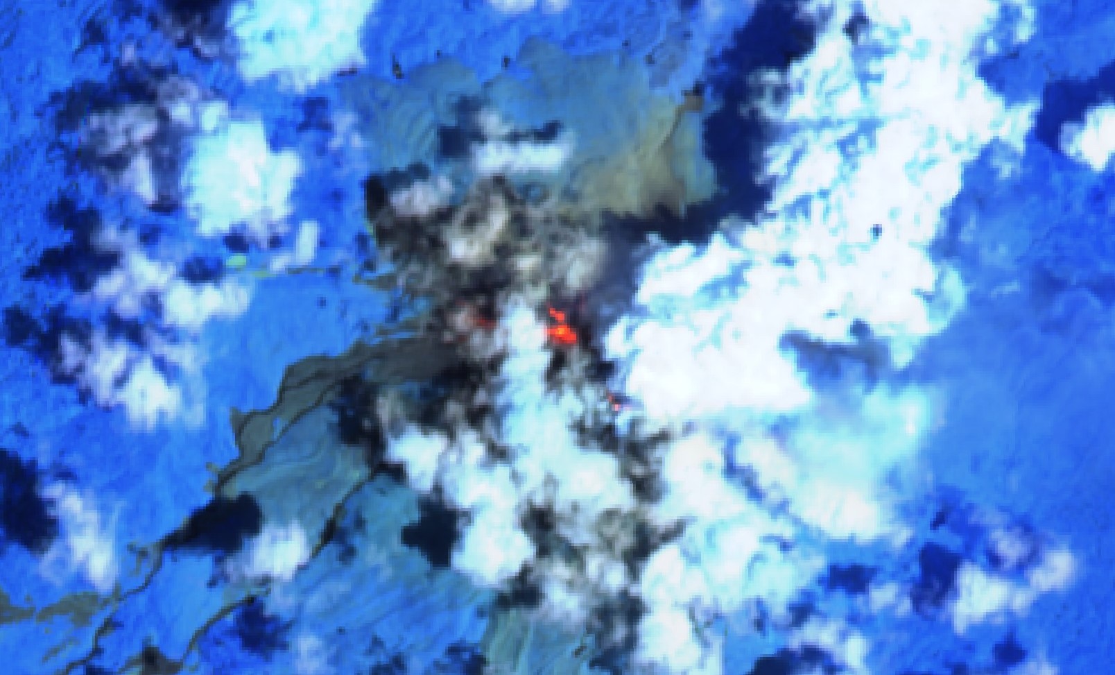 |
Figure 45. Sentinel-2 infrared satellite image of Bagana showing a strong thermal signal in the NE part of the summit crater and extending down the NW flank, with weaker hotspots on the lower SE flank. Images use “Atmospheric penetration” (bands 12, 11, 8A) rendering. Courtesy of Sentinel Hub Playground. |
Consistent with the Sentinel-2 images, the MIROVA thermal detection system showed a persistent low to moderate power anomaly in both MODIS (Moderate Resolution Imaging Spectroradiometer) and VIIRS (Visible Infrared Imaging Radiometer Suite) data, with more frequent and stronger activity during October-November 2022 (figure 46). Hotspots were only detected on three days by the MODIS-MODVOLC system (23 October, 13 November, and 20 November).
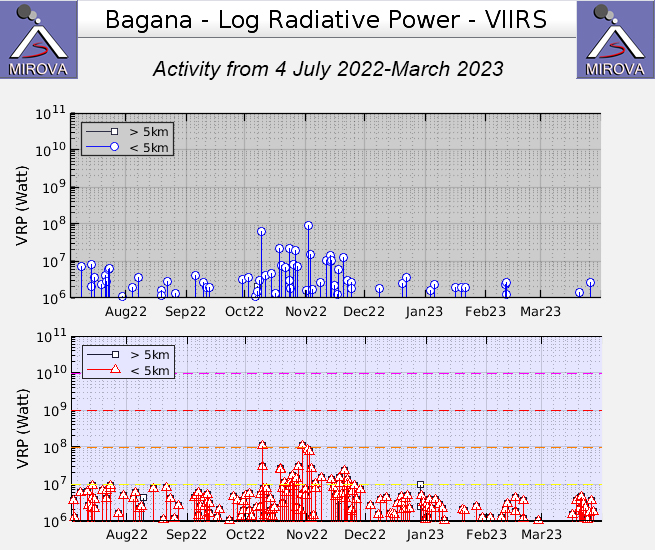 |
Figure 46. Graphs showing thermal anomalies near the crater summit at Bagana during September 2022-March 2023, as recorded by the MIROVA system (Log Radiative Power) using MODIS (top) and VIIRS (bottom) data. Nearly persistent low-to-moderate hotspots were recorded during September through the first part of January, with more persistent and higher power signals during October and November 2022. Courtesy of MIROVA. |
A few strong SO2 plumes were observed by the TROPOMI instrument aboard the Sentinel-5P satellite, mostly during November. They were most prominent during 28 October-5 November 2022, consistent with ash plumes reported by the Darwin VAAC that rose to an altitude of 2.1-2.7 km (or 200-600 m above the summit) during 31 October-2 November.
Geological Summary. Bagana volcano, in a remote portion of central Bougainville Island, is frequently active. This massive symmetrical cone was largely constructed by an accumulation of viscous andesitic lava flows. The entire edifice could have been constructed in about 300 years at its present rate of lava production. Eruptive activity is characterized by non-explosive effusion of viscous lava that maintains a small lava dome in the summit crater, although occasional explosive activity produces pyroclastic flows. Lava flows with tongue-shaped lobes up to 50 m thick and prominent levees descend the flanks on all sides.
Information Contacts: MIROVA (Middle InfraRed Observation of Volcanic Activity), a collaborative project between the Universities of Turin and Florence (Italy) supported by the Centre for Volcanic Risk of the Italian Civil Protection Department (URL: http://www.mirovaweb.it/); Sentinel Hub Playground (URL: https://www.sentinel-hub.com/explore/sentinel-playground); Hawai'i Institute of Geophysics and Planetology (HIGP) - MODVOLC Thermal Alerts System, School of Ocean and Earth Science and Technology (SOEST), Univ. of Hawai'i, 2525 Correa Road, Honolulu, HI 96822, USA (URL: http://modis.higp.hawaii.edu/); Darwin Volcanic Ash Advisory Centre (VAAC), Bureau of Meteorology, Northern Territory Regional Office, PO Box 40050, Casuarina, NT 0811, Australia (URL: http://www.bom.gov.au/info/vaac/); NASA Global Sulfur Dioxide Monitoring Page, Atmospheric Chemistry and Dynamics Laboratory, NASA Goddard Space Flight Center (NASA/GSFC), 8800 Greenbelt Road, Goddard, Maryland, USA (URL: https://so2.gsfc.nasa.gov/).