Report on Great Sitkin (United States) — May 2023
Bulletin of the Global Volcanism Network, vol. 48, no. 5 (May 2023)
Managing Editor: Edward Venzke.
Research and preparation by Paul Berger.
Great Sitkin (United States) Continued slow lava effusion in the summit crater during November 2022-April 2023
Please cite this report as:
Global Volcanism Program, 2023. Report on Great Sitkin (United States) (Venzke, E., ed.). Bulletin of the Global Volcanism Network, 48:5. Smithsonian Institution.
Great Sitkin
United States
52.076°N, 176.13°W; summit elev. 1740 m
All times are local (unless otherwise noted)
Following minor explosive activity at Great Sitkin in June-August 2018 and June 2019, the first eruptions since 1974, an ash explosion on 25 May 2021 preceded the growth of a lava dome in the summit crater starting in mid-July. Continued lava effusion overtopped the summit crater wall and flowed down the N, S, and W flanks (BGVN 46:08, 47:05). This activity waned during January-April 2022, although slow lava effusion continued through October 2022. Since 23 July 2021, the Volcano Alert Level has remained at Watch (the second highest on a four-level scale) and the Aviation Color Code remained at Orange (the second highest on a four-color scale). This volcano in the central Aleutian Islands is monitored by the Alaska Volcano Observatory (AVO) using local seismic and infrasound sensors, satellite data, web cameras, and remote infrasound and lightning networks.
AVO reported that slow lava effusion within the summit crater, centered about 1.5 km E of the peak and 300 m lower, continued during November 2022-April 2023. Weather clouds usually obscured satellite and webcam observations. Elevated surface temperatures were sometimes identified in satellite images, and occasional steam plumes were observed rising from the lava flow. Seismicity was low with occasional detection of weak earthquakes.
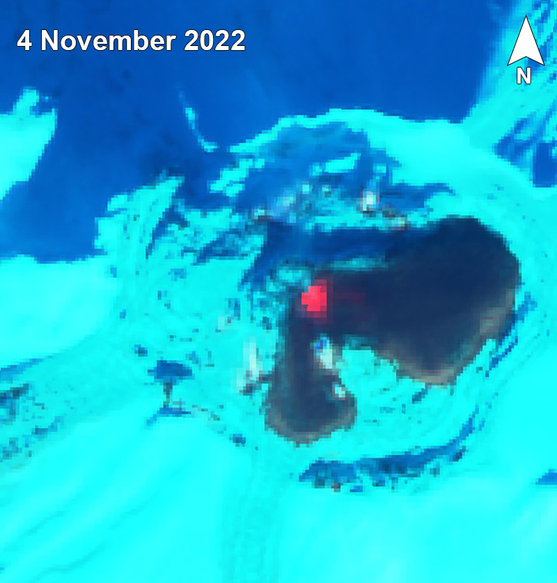
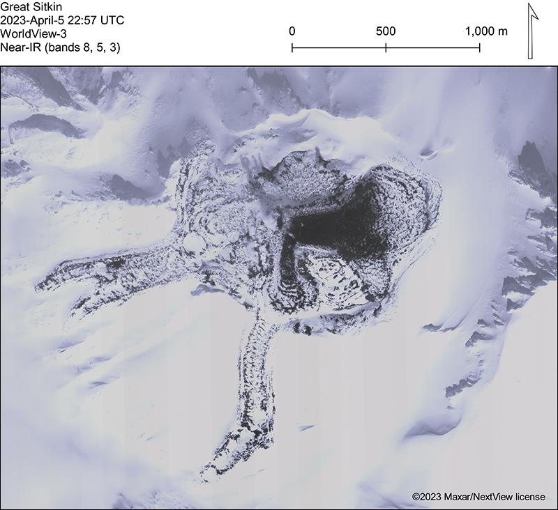
By the end of the first week of November (figure 24), the flow field had extended more than 600 m E and about 430 m S from the vent into the remaining crater icefield. By the end of November, satellite images showed that the lobes had advanced an additional 25-30 m along the S edge of the flow field and about 15 m SE. The E lobe continued to advance slowly during December-April, while a smaller lobe to the S advanced towards the crater rim, burying an earlier lava flow. A satellite radar image on 2 April showed that the lava flow was primarily expanding E and more slowly S into the summit crater ice field, as seen in visual imagery on 5 April (figure 25).
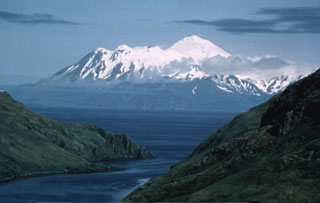
Geological Summary. The Great Sitkin volcano forms much of the northern side of Great Sitkin Island. A younger volcano capped by a small, 0.8 x 1.2 km ice-filled summit caldera was constructed within a large late-Pleistocene or early Holocene scarp formed by massive edifice failure that truncated an older edifice and produced a submarine debris avalanche. Deposits from this and an even older debris avalanche from a source to the south cover a broad area of the ocean floor north of the volcano. The summit lies along the eastern rim of the younger collapse scarp. Deposits from an earlier caldera-forming eruption of unknown age cover the flanks of the island to a depth up to 6 m. The small younger caldera was partially filled by lava domes emplaced in 1945 and 1974, and five small older flank lava domes, two of which lie on the coastline, were constructed along northwest- and NNW-trending lines. Hot springs, mud pots, and fumaroles occur near the head of Big Fox Creek, south of the volcano. Eruptions have been recorded since the late-19th century.
Information Contacts: Alaska Volcano Observatory (AVO), a cooperative program of a) U.S. Geological Survey, 4200 University Drive, Anchorage, AK 99508-4667 USA (URL: https://avo.alaska.edu/), b) Geophysical Institute, University of Alaska, PO Box 757320, Fairbanks, AK 99775-7320, USA, and c) Alaska Division of Geological & Geophysical Surveys, 794 University Ave., Suite 200, Fairbanks, AK 99709, USA (URL: http://dggs.alaska.gov/); Sentinel Hub Playground (URL: https://www.sentinel-hub.com/explore/sentinel-playground).


