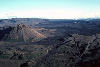
Report on Krafla (Iceland) — November 1977
Natural Science Event Bulletin, vol. 2, no. 11 (November 1977)
Managing Editor: David Squires.
Krafla (Iceland) Harmonic tremor, deflation, and increased geothermal activity
Please cite this report as:
Global Volcanism Program, 1977. Report on Krafla (Iceland) (Squires, D., ed.). Natural Science Event Bulletin, 2:11. Smithsonian Institution. https://doi.org/10.5479/si.GVP.NSEB197711-373080
Krafla
Iceland
65.715°N, 16.728°W; summit elev. 800 m
All times are local (unless otherwise noted)
"Two continuously recording tiltmeters, of a new type designed and built by the Nordic Volcanological Institute, have been installed in the Krafla-Mývatn area. One, close to the power house in Krafla, has been in operation since August, and replicates the water tiltmeter which has been operated at this location for over a year. A second tiltmeter was installed in late October close to a hotel at Reykjahlid and the recorders are placed at a nearby temporary observatory. This tiltmeter shows inflation towards the SE, confirming inflation between Reykjahlid and Hverfjall (just off figure 1, SE of Reykjahlid and SW of Námafjall) discovered by dry tilt levelling in October.
"At 0600 on 2 November, all seismometers started to show harmonic tremor, the continuous tiltmeter in Krafla showed deflation towards the NW, and the Reykjahlid tiltmeter a slight deflation towards the SE. At about noon, both harmonic tremor and deflation in Krafla had stopped. Total deflation within the caldera was about 3 cm and had been fully reversed by 5 November. The 8 September tilt change at the Krafla power house should be fully reversed by early December. Only a few small earthquakes were recorded, none of which was felt. Increased thermal activity in Gjástykki, N of the 8 September eruption site (2:9), indicated magma intrusion N of the caldera.
"At Lake Mývatn, geothermal activity has increased and steam causes considerable problems in the area. The main road to eastern Iceland passes through the steam field, where visibility is usually only a couple of meters. The Mývatn area is enveloped in fog in calm weather, and, with the advent of winter, telephone and power lines are continuously threatened by accumulating ice. The diatomite factory near Mývatn has now been encircled by a dam 3-4 m high in order to divert lava flows. Equipment for water pumping has been installed on the dam for additional security. Civil defense is in a state of top alertness, access roads have been partially rebuilt to insure that they can be kept passable under any weather conditions, and the telecommunication system has been greatly improved."
Geological Summary. The Krafla volcanic system in the Northern Volcanic Zone (NVZ) of Iceland is about 100 km long, consisting of a fissure swarm and a central volcano with a 7 x 9 km caldera formed about 110,000 years ago that deposited a rhyolitic welded tuff. It has been moderately active in the Holocene, over three distinct eruptive periods; the current one has lasted about 2,800 years with six volcano-tectonic episodes, each with one or more basaltic fissure eruptions. Lava volumes (DRE) have been in the 0.1-1 km3 range. The Hverfjall and Ludent tuff rings east of Myvatn were erupted along the fissure system. Myvatn lake formed during the eruption of the older Laxarhraun lava flow from the Ketildyngja shield volcano of the Fremrinamur volcanic system about 3,800 years before present (BP); The present Myvatn lake is constrained by the roughly 2,000 years BP younger Laxarhraun lava flow from the Krafla volcanic system. The abundant pseudocraters that form a prominent part of the Myvatn landscape were created when the younger Laxarhraun lava flow entered the lake. The last eruption took place in 1975-1984 CE when nine small basaltic fissure eruptions produced 0.25 km3 of lava.
Information Contacts: G. Sigvaldason, NVI.

