Report on Mayon (Philippines) — May 1978
Scientific Event Alert Network Bulletin, vol. 3, no. 5 (May 1978)
Managing Editor: David Squires.
Mayon (Philippines) Moderate eruption: lava flow, ash clouds, and evacuation
Please cite this report as:
Global Volcanism Program, 1978. Report on Mayon (Philippines) (Squires, D., ed.). Scientific Event Alert Network Bulletin, 3:5. Smithsonian Institution. https://doi.org/10.5479/si.GVP.SEAN197805-273030
Mayon
Philippines
13.257°N, 123.685°E; summit elev. 2462 m
All times are local (unless otherwise noted)
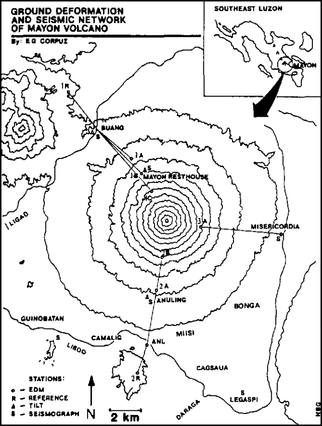
"An eruption started at about 2030 on 7 May and gradually increased in intensity, reaching a maximum on 22 May. The event was characterized by weak lava flow extrusion at the start, and at the height of the eruption there was a fascinating night display as incandescent basaltic [andesite] lava flowed down the SW flank. Strong earthquakes were felt at the Mayon Rest House Observatory (on the N flank, elevation 760 m, figure 1) on 26 May, accompanied by voluminous ejection of ash-laden clouds and spattering of incandescent pyroclastic materials. From then on, activity began to decline, punctuated at first by short lulls, which became longer each day until ash ejections, rumblings, and volcanic tremor ceased on 29 May. Small amounts of lava continued to be extruded as of 2 June. This decline in activity suggests that the critical period of the eruption has apparently passed.
 |
Figure 1. Location map of Mayon volcano showing ground deformation and seismic network, after Corpuz (1985). |
"No casualties were reported during the eruption, but 8,000 people on the SW sector of the volcano and within an 8 km radius had to be evacuated. An additional 15,000 people evacuated voluntarily due to their fear of the eruption, even though they were not within the declared danger zone." Activity briefly intensified early on 7 March, when ash-laden clouds and a little incandescent material were ejected.
The following information was provided by Chris Newhall. The new aa lava flow emerged from a breach in the summit crater wall and traveled down the SW flank directly over the 1968 flow. By 26 May, the nose of the new lava was about 200 m beyond the end of the 1968 flow. The breach grew to about 1/3 of the crater's circumference and about 100 m depth before it began to fill in during the later stages of the eruption. Maximum eruption cloud height was about 3 km above the summit. Ash contents were low and maximum ashfalls were only a few millimeters. Harmonic tremor was nearly continuous during the period of maximum activity and shallow explosion earthquakes were also recorded.
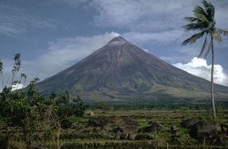
Geological Summary. Symmetrical Mayon, which rises above the Albay Gulf NW of Legazpi City, is the most active volcano of the Philippines. The steep upper slopes are capped by a small summit crater. Recorded eruptions since 1616 CE range from Strombolian to basaltic Plinian, with cyclical activity beginning with basaltic eruptions, followed by longer periods of andesitic lava flows. Eruptions occur predominately from the central conduit and have also produced lava flows that travel far down the flanks. Pyroclastic density currents and mudflows have commonly swept down many of the approximately 40 ravines that radiate from the summit and have often damaged populated lowland areas. A violent eruption in 1814 killed more than 1,200 people and devastated several towns.
Information Contacts: G. Andal, COMVOL, Quezon City; C. Newhall, Dartmouth College.

