Report on Shasta (United States) — September 1978
Scientific Event Alert Network Bulletin, vol. 3, no. 9 (September 1978)
Managing Editor: David Squires.
Shasta (United States) Daily seismcity declines; no evidence of volcanic activity
Please cite this report as:
Global Volcanism Program, 1978. Report on Shasta (United States) (Squires, D., ed.). Scientific Event Alert Network Bulletin, 3:9. Smithsonian Institution. https://doi.org/10.5479/si.GVP.SEAN197809-323010
Shasta
United States
41.409°N, 122.193°W; summit elev. 4317 m
All times are local (unless otherwise noted)
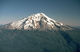
Seismic activity E of Mt. Shasta had declined by late September to about six locatable events per day, most stronger than M 2. Hypocenters extended E from surface fissures 28 km E of Shasta, along a pre-existing N-S-trending fault zone. Focal depths were very shallow near the surface fissures, but increased to 4-6 km along an inclined seismic zone dipping 35-45° E. The events have not been migrating, nor has there been any evidence of volcanic activity associated with the swarm.
Further Reference. Bennett, J.H., et al., 1979, Stephens Pass earthquakes, Mount Shasta—August 1978; California Geology, February, 1979, p. 27-33.
Geological Summary. The most voluminous of the Cascade volcanoes, northern California's Mount Shasta is a massive compound stratovolcano composed of at least four main edifices constructed over a period of at least 590,000 years. An older edifice was destroyed by a large debris avalanche which filled the Shasta River valley to the NW. The Hotlum cone, forming the present summit, the Shastina lava dome complex, and the SW flank Black Butte lava dome, were constructed during the early Holocene. Eruptions from these vents have produced pyroclastic flows and mudflows that affected areas as far as 20 km from the summit. Eruptions from Hotlum cone continued throughout the Holocene.
Information Contacts: R. Sherburne, California Division of Mines & Geology.