Report on Toya (Japan) — December 1978
Scientific Event Alert Network Bulletin, vol. 3, no. 12 (December 1978)
Managing Editor: David Squires.
Toya (Japan) Activity declines, but deformation and seismicity continue
Please cite this report as:
Global Volcanism Program, 1978. Report on Toya (Japan) (Squires, D., ed.). Scientific Event Alert Network Bulletin, 3:12. Smithsonian Institution. https://doi.org/10.5479/si.GVP.SEAN197812-285030
Toya
Japan
42.544°N, 140.839°E; summit elev. 733 m
All times are local (unless otherwise noted)
The number of days per month in which one or more explosions were recorded has dropped sharply, from 21 in August to three in October.
As of early December, there had been no explosions since 27 October. Local seismicity declined to an average of 79 earthquakes per day in November, and I. Yokoyama reported that the rate of cryptodome uplift decreased to 6.5 cm/day. Both seismicity and cryptodome uplift rates had increased slightly in September and October but have been on a general downward trend since February.
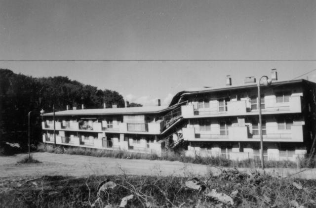
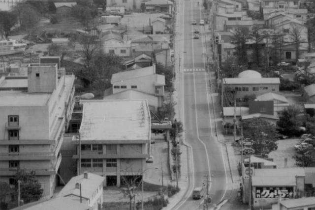
Since the initial explosions of August 1977, the N portion of Usu's somma has been slowly moving outward, causing severe local faulting at the N foot of the volcano. The distance between the N rim of the somma and the shore of Lake Toya decreased by about 65 m September 1977-March 1978 (Yokoyama, 1978). Numerous small faults have formed, damaging or destroying buildings in the area (figure 14). Some roads have been cut by faults (figure 15), and underground water pipes, telephone cables, and tubes for hot spring water have been cut at several hundred points.
 |
Figure 14. Apartment building near Usu damaged by faulting (and now abandoned). Photo taken in October 1978. Courtesy of Manabu Komiya. |
Further References. Imagawa, T., 1986, Mud and debris flows on Mt. Usu after the 1977-1978 eruptions: Environmental Science, Hokkaido, v. 9, no. 1, p. 113-135.
Katsui, Y., Yokoyama, I., Watanabe, H., and Murozumi, M., 1981, Usu volcano, in Katsui, Y. (ed.), Symposium on Arc Volcanism Field Excursion guide to Usu and Tarumai Volcanoes and Noboribetsu Spa, Part I: Volcanological Society of Japan, Tokyo, p. 1-37.
Niida, K., Katsui, Y., Suzuki, T., and Kondo, Y., 1980, The 1977-1978 eruption of Usu volcano: Journal of the Faculty of Science, Hokkaido University, ser. IV, v. 19, p. 357-394.
Seki, K. (ed.), 1978, Usu eruption and its impact on environment: Hokkaido University, Sapporo, 496 p. (41 papers).
Yokoyama, I., Yamashita, H., Watanabe, H., and Okada, H., 1981, Geophysical characteristics of dacite volcanism - 1977-1978 eruption of Usu volcano: JVGR, v. 9, p. 335-358.
Japan Meterological Agency, 1980, The eruption of Usu volcano (August 1977-December 1978): Technical Reports of the JMA, v. 99, 203 p.
Geological Summary. Usuzan, one of Hokkaido's most well-known volcanoes, is a small stratovolcano located astride the southern topographic rim of the 110,000-year-old Toya caldera. The center of the 10-km-wide, lake-filled caldera contains Nakajima, a group of forested Pleistocene andesitic lava domes. The summit of the basaltic-to-andesitic edifice of Usu is cut by a somma formed about 20-30,000 years ago when collapse of the volcano produced a debris avalanche that reached the sea. Dacitic domes erupted along two NW-SE-trending lines fill and flank the summit caldera. Three of these domes, O-Usu, Ko-Usu and Showashinzan, along with seven crypto-domes, were erupted during historical time. The 1663 eruption of Usu was one of the largest in Hokkaido during historical time. The war-time growth of Showashinzan from 1943-45 was painstakingly documented by the local postmaster, who created the first detailed record of growth of a lava dome.
Information Contacts: JMA, Tokyo; I. Yokoyama, Hokkaido Univ.


