Report on Lateiki (Tonga) — May 1979
Scientific Event Alert Network Bulletin, vol. 4, no. 5 (May 1979)
Managing Editor: David Squires.
Lateiki (Tonga) Large areas of pumice sighted between the Tonga and Fiji islands
Please cite this report as:
Global Volcanism Program, 1979. Report on Lateiki (Tonga) (Squires, D., ed.). Scientific Event Alert Network Bulletin, 4:5. Smithsonian Institution. https://doi.org/10.5479/si.GVP.SEAN197905-243070
Lateiki
Tonga
19.18°S, 174.87°W; summit elev. 43 m
All times are local (unless otherwise noted)
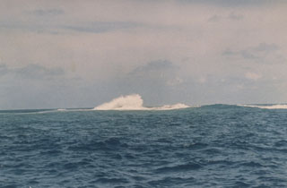
A large body of floating pumice was first reported on 10 May by a Soviet vessel, in the area from 17.80-18°S and 176.45-176.67°W. On 14 May, a U.S. Naval Research Laboratory aircraft flew over continuous 30-45 m-wide patches of dirty rust-brown pumice from 17-17.45°S and 174.13-177.60°W. Four days later, the same aircraft flew over Late Island (18.810°S, 174.65°W), last reported to erupt in 1854. White material, apparently ash, covered the cone, and streaks of pumice extended back to the island from the main body of the raft [but see 4:12].
While enroute from Nandi, Fiji NE to Apia, Western Samoa on 22 May, Captain Gallagher of Polynesian Airlines observed pumice extending about 30 km SE from 16.2°S, 178.38°W. On the 24th, Captain Gallagher again observed pumice, in large areas at about 15.8°S, 177.5°W. An Air Pacific plane flew over pumice that extended about 25 km N-S and about 45 km E-W from 16.37°S, 177.63°W on 28 May.
Captain F. R. Sutherland of Polynesian Airlines reported pumice between about 15.58°S, 176.50°W and 16.10°S, 178.18°W on 30 May, as he flew SW from Apia to Nandi. He first saw several long, thin, mustard-brown streaks, then the pumice became more concentrated. The largest area of pumice, about 5 x 1 km, extended NW-SE and tapered to the SE.
During the afternoon of 4 June, Fijian naval vessels collected samples of the pumice from just inside the Tonga entrance to Vanua Balavu (17.3°S, 178.9°W), an island of the Lau Group about 135 km ESE of Vanua Levu, one of the two main Fiji islands. Pumice fragments in this area were greenish-gray, ranged from 2.5-500 cm across, and carried coarse barnacles 0.5-0.7 cm long. There have been no reports of pumice washing ashore at any location but the samples were collected within the reef surrounding Vanua Balavu.
The rate of drift of the pumice is estimated by Ronald Richmond at about 3 km/day, to the NW. Its source was apparently Late Island (see above), but residents of nearby islands in the Tonga chain did not report an eruption. A thick, odorless haze covering the Tonga and Fiji Islands early in the week beginning 6 May reduced visibility to 3 km or less in Nandi, Fiji. Such haze is very unusual in this area and may have been caused by volcanic activity. On 10 May, what appears to be a volcanic plume could be seen on NOAA weather satellite imagery, drifting SE from about 18°S, 174°W between 1200 and 2100-2200, when the source of the plume was cut off. However, an earlier eruption must be postulated as the source for at least some of the pumice, given the sighting on 10 May.
Geological Summary. Lateiki, previously known as Metis Shoal, is a submarine volcano midway between the islands of Kao and Late that has produced a series of ephemeral islands since the first confirmed activity in the mid-19th century. An island, perhaps not in eruption, was reported in 1781 and subsequently eroded away. During periods of inactivity following 20th-century eruptions, waves have been observed to break on rocky reefs or sandy banks with depths of 10 m or less. Dacitic tuff cones formed during the eruptions in 1967 and 1979 were soon eroded beneath the ocean surface. An eruption in 1995 produced an island with a diameter of 280 m and a height of 43 m following growth of a lava dome above the surface.
Information Contacts: R. Richmond, Mineral Resources Dept., Fiji; Capt. Gallagher and T. Sutherland, Polynesian Airlines; N. Cherkis, US Naval Research Lab; A. Krueger, NOAA.