Report on Fukutoku-Oka-no-Ba (Japan) — July 1979
Scientific Event Alert Network Bulletin, vol. 4, no. 7 (July 1979)
Managing Editor: David Squires.
Fukutoku-Oka-no-Ba (Japan) Discolored water observed in 1978 and 1979
Please cite this report as:
Global Volcanism Program, 1979. Report on Fukutoku-Oka-no-Ba (Japan) (Squires, D., ed.). Scientific Event Alert Network Bulletin, 4:7. Smithsonian Institution. https://doi.org/10.5479/si.GVP.SEAN197907-284130
Fukutoku-Oka-no-Ba
Japan
24.285°N, 141.481°E; summit elev. -29 m
All times are local (unless otherwise noted)
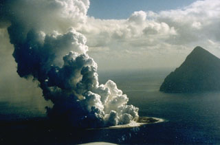
Activity has been observed at six submarine volcanoes in the Volcano Island chain in 1978 and 1979 (figure 1). Discolored water has often been visible . . . during frequent overflights by JMSDF and JMSA aircraft. [Discolored water was noted, in an included table of observations, by almost every overflight during January 1978-July 1979 (see table 1 below).]
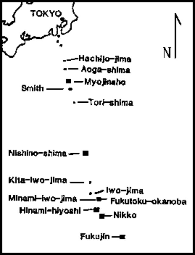 |
Figure 1. Map showing Japan and the Volcano Island chain. Volcanoes active in 1978 or 1979 are indicated by black squares. Courtesy of JMA. |
Geological Summary. Fukutoku-Oka-no-ba is a submarine volcano located 5 km NE of the island of Minami-Ioto. Water discoloration is frequently observed, and several ephemeral islands have formed in the 20th century. The first of these formed Shin-Ioto ("New Sulfur Island") in 1904, and the most recent island was formed in 1986. The volcano is part of an elongated edifice with two major topographic highs trending NNW-SSE, and is a trachyandesitic volcano geochemically similar to Ioto.
Information Contacts: JMSA, Tokyo; JMA, Tokyo.