Report on Ontakesan (Japan) — October 1979
Scientific Event Alert Network Bulletin, vol. 4, no. 10 (October 1979)
Managing Editor: David Squires.
Ontakesan (Japan) First eruption in historical time
Please cite this report as:
Global Volcanism Program, 1979. Report on Ontakesan (Japan) (Squires, D., ed.). Scientific Event Alert Network Bulletin, 4:10. Smithsonian Institution. https://doi.org/10.5479/si.GVP.SEAN197910-283040
Ontakesan
Japan
35.893°N, 137.48°E; summit elev. 3067 m
All times are local (unless otherwise noted)
[JMA and Tokiko Tiba have made substantial revisions to this report.] On-take's first eruption in historic time began early on [28] October. Vapor emission apparently started at about 0500, then activity strengthened at about 0800 to emission of an [ash] column . . . [Activity increased further from around 1100.] A tephra column that included ash and lapilli . . . was rising 1,500 m, and ash was falling on the E flank. Tephra clouds were ejected [continuously] during the afternoon. [Only white vapor was emitted the next day.]
Tephra was ejected from several craters that [formed in a fissure about 300 m S of the summit (figure 1). There had been no fumaroles in the area]. . . .
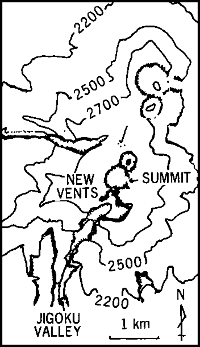 |
Figure 1. Map of On-Take, courtesy of JMA. The 500-m-long zone of 28 October 1979 vents is shown by a heavy NW-SE line immediately S of the summit. The four large craters trending NNE from the summit were formed during an eruption 14C dated at 23,000 BP. The short north-northeasterly line 1 km N of the summit represents a succession of small prehistoric explosion craters. |
The Kyodo radio network reported that officials were assessing damage caused by the eruption; damage was particularly heavy at Kaida, about [12 km NE of the summit (Kenga-mine)]. Some livestock had to be evacuated because of ashfall on pastureland.
An earthquake swarm, including a magnitude [5.3 shallow] event, was recorded in the On-take area in October 1978. . . .
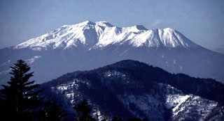
Geological Summary. The massive Ontakesan stratovolcano, the second highest volcano in Japan, lies at the southern end of the Northern Japan Alps. Ascending this volcano is one of the major objects of religious pilgrimage in central Japan. It is constructed within a largely buried 4 x 5 km caldera and occupies the southern end of the Norikura volcanic zone, which extends northward to Yakedake volcano. The older volcanic complex consisted of at least four major stratovolcanoes constructed from about 680,000 to about 420,000 years ago, after which Ontakesan was inactive for more than 300,000 years. The broad, elongated summit of the younger edifice is cut by a series of small explosion craters along a NNE-trending line. Several phreatic eruptions post-date the roughly 7300-year-old Akahoya tephra from Kikai caldera. The first historical eruption took place in 1979 from fissures near the summit. A non-eruptive landslide in 1984 produced a debris avalanche and lahar that swept down valleys south and east of the volcano. Very minor phreatic activity caused a dusting of ash near the summit in 1991 and 2007. A significant phreatic explosion in September 2014, when a large number of hikers were at or near the summit, resulted in many fatalities.
Information Contacts: T. Tiba, National Science Museum, Tokyo; Kyodo Radio, Tokyo; USGS/NEIS, Denver CO.