Report on Tupungatito (Chile-Argentina) — February 1980
Scientific Event Alert Network Bulletin, vol. 5, no. 1 (February 1980)
Managing Editor: David Squires.
Tupungatito (Chile-Argentina) Ash eruption and seismicity
Please cite this report as:
Global Volcanism Program, 1980. Report on Tupungatito (Chile-Argentina) (Squires, D., ed.). Scientific Event Alert Network Bulletin, 5:1. Smithsonian Institution. https://doi.org/10.5479/si.GVP.SEAN198002-357010
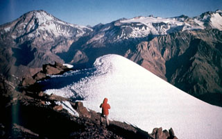
Tupungatito
Chile-Argentina
33.425°S, 69.797°W; summit elev. 5660 m
All times are local (unless otherwise noted)
A series of subterranean noises at 0623 on 10 January was followed by an explosion that ejected a 1,500-m-high cloud of gas and ash from Tupungatito's SW crater. The next day, Oscar González-Ferrán and Sergio Barrientos flew over the volcano, observing that ash covered the snow NE of the vent and that the eruption was continuing, but with decreased intensity.
The Seismologic Service of the Geophysics Department, University of Chile, recorded considerable seismic activity near Tupungatito. The principal earthquake, at 1851 on 14 January, was a shallow event with an epicenter calculated at 33.2°S, 69°W, 78 km NE of the volcano. It was felt at intensity 3 in Santiago, about 150 km from the calculated epicenter. In the next 2 hours, 17 similar events were recorded, of which three were located with the same epicenter. Between 2100 on 14 January and 0100 on 16 January, 13 more local events were recorded, one of which was fairly large. As of 18 January, both seismic and eruptive activity had diminished. Tupungatito's last eruption, in 1964, consisted of explosions from the central crater.
Geological Summary. Tupungatito volcano, the northernmost historically active volcano of the central Chilean Andes, is located along the Chile-Argentina border about 90 km E of Santiago and immediately SW of the Pleistocene Tupungato volcano. Tupungatito consists of a group of 12 Holocene andesitic and basaltic andesite craters and a pyroclastic cone at the NW end of the 4-km-wide, Pleistocene dacitic Nevado Sin Nombre caldera, which is filled by glaciers at its southern end and is breached to the NW. Lava flows from the northernmost vent have traveled down the NW flank breach. Tupungatito has produced frequent mild explosive eruptions during the 19th and 20th centuries.
Information Contacts: O. González-Ferrán, Univ. de Chile, Santiago.