Report on Erebus (Antarctica) — February 1981
Scientific Event Alert Network Bulletin, vol. 6, no. 2 (February 1981)
Managing Editor: Lindsay McClelland.
Erebus (Antarctica) Lava lake revisited; seismic and acoustic monitoring begin
Please cite this report as:
Global Volcanism Program, 1981. Report on Erebus (Antarctica) (McClelland, L., ed.). Scientific Event Alert Network Bulletin, 6:2. Smithsonian Institution. https://doi.org/10.5479/si.GVP.SEAN198102-390020
Erebus
Antarctica
77.53°S, 167.17°E; summit elev. 3794 m
All times are local (unless otherwise noted)
"The summit crater was visited by Japanese, New Zealand and U.S. scientists during late December and early January. A 1-day visit was also made in November. The anorthoclase phonolite lava lake was still present, although its level may have been slightly lower than that observed over the last 2 years. The 120-m-long oval-shaped lava lake still showed a simple convection pattern with lava apparently welling up from two centers about 1/3 of the way from each end.
"Small Strombolian eruptions continued at a frequency of 2-6/day. The noise associated with the eruptions consisted of a long drawn-out roar, contrasted with the strong explosive eruptions heard in previous years. Although no eruptions were witnessed they are believed to occur from the small Active Vent, adjacent to the lava lake. Very few bombs were found on the main crater rim during December, but in January there were a few sharper explosive eruptions and these ejected material onto the rim.
"The three nations commenced a new project and installed three permanent seismometers on the mountain. The seismometers have radio-telemetry links with Scott Base (the New Zealand research station on Ross Island). Two seismometer are on the W flank of the volcano at altitudes between 1,500 and 1,900 m about 5 km from the crater rim. It is anticipated that these stations will run until April, when darkness sets in. The stations should be reactivated in October, when new batteries will be installed and the solar panels will function. The third station is at the summit, and has its batteries buried in warm ground. It is hoped that it will operate all year round. The summit station is also transmitting the output from an acoustic sensor (a microphone which monitors the sounds of volcanic eruptions) and a large wire loop around the crater, which monitors induced currents. A fourth permanent seismic station will be installed in December 1981.
"Preliminary observations from the seismic network, which can detect events with magnitudes less than 1, indicate a surprisingly high level of microearthquake activity, with up to 10 events/day. Some of these are apparently tectonic earthquakes occurring some distance from Mt. Erebus. Antarctica has been considered aseismic, but this is apparently not the case, at least not for microearthquakes with magnitudes less than 3."
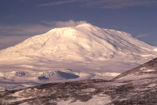
Geological Summary. Mount Erebus, the world's southernmost historically active volcano, overlooks the McMurdo research station on Ross Island. It is the largest of three major volcanoes forming the crudely triangular Ross Island. The summit of the dominantly phonolitic volcano has been modified by one or two generations of caldera formation. A summit plateau at about 3,200 m elevation marks the rim of the youngest caldera, which formed during the late-Pleistocene and within which the modern cone was constructed. An elliptical 500 x 600 m wide, 110-m-deep crater truncates the summit and contains an active lava lake within a 250-m-wide, 100-m-deep inner crater; other lava lakes are sometimes present. The glacier-covered volcano was erupting when first sighted by Captain James Ross in 1841. Continuous lava-lake activity with minor explosions, punctuated by occasional larger Strombolian explosions that eject bombs onto the crater rim, has been documented since 1972, but has probably been occurring for much of the volcano's recent history.
Information Contacts: P. Kyle, Ohio State Univ.

