Report on Karkar (Papua New Guinea) — March 1981
Scientific Event Alert Network Bulletin, vol. 6, no. 3 (March 1981)
Managing Editor: Lindsay McClelland.
Karkar (Papua New Guinea) Fumarolic activity continues; possible minor deflation
Please cite this report as:
Global Volcanism Program, 1981. Report on Karkar (Papua New Guinea) (McClelland, L., ed.). Scientific Event Alert Network Bulletin, 6:3. Smithsonian Institution. https://doi.org/10.5479/si.GVP.SEAN198103-251030
Karkar
Papua New Guinea
4.647°S, 145.976°E; summit elev. 1839 m
All times are local (unless otherwise noted)
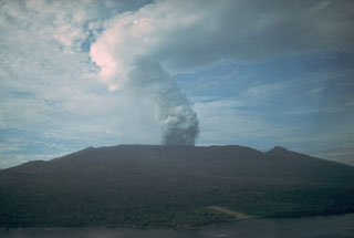
"Aerial and ground inspections were made 6-8 March and other aerial inspections were carried out on 19 and 26 March. Conditions in the caldera appeared similar to those during inspections in November and December 1980. Hydrothermal activity was continuing at the base of the 1979 crater and maximum measured temperatures were 97.5°C. The other main source was on the W part of Bagiai Cone. During the 26 March aerial inspection the volume of emission was reportedly greater than previously observed.
"Gravity measurements and levelling were carried out 6-8 March. The gravity measurements were consistent with previous sets in 1980, and might indicate summit deflation. Levelling up to the end of 1980 showed possible small deflationary trends of several µrad at the 3 mid- and upper-flank tilt arrays. However the changes were very small and similar in size to the limits of error in making the measurements."
Geological Summary. Karkar is a 19 x 25 km forest-covered island that is truncated by two nested summit calderas. The 5.5 km outer caldera was formed during one or more eruptions, the last of which occurred 9,000 years ago. The steep-walled 300-m-deep, 3.2 km diameter, inner caldera was formed sometime between 1,500 and 800 years ago. Cones are present on the N and S flanks of this basaltic-to-andesitic volcano; a linear array of small cones extends from the northern rim of the outer caldera nearly to the coast. Recorded eruptions date back to 1643 from Bagiai, a pyroclastic cone constructed within the inner caldera, the floor of which is covered by young, mostly unvegetated andesitic lava flows.
Information Contacts: C. McKee, RVO.

