Report on Pacaya (Guatemala) — February 1982
Scientific Event Alert Network Bulletin, vol. 7, no. 2 (February 1982)
Managing Editor: Lindsay McClelland.
Pacaya (Guatemala) Lava flows from flank hornito
Please cite this report as:
Global Volcanism Program, 1982. Report on Pacaya (Guatemala) (McClelland, L., ed.). Scientific Event Alert Network Bulletin, 7:2. Smithsonian Institution. https://doi.org/10.5479/si.GVP.SEAN198202-342110
Pacaya
Guatemala
14.382°N, 90.601°W; summit elev. 2569 m
All times are local (unless otherwise noted)
Geologists climbed to Pacaya's summit on 12 February. During their observations, lava from a 10-m-high hornito at about 2,100 m altitude on the SW flank flowed into a lava tube that extended about 0.5 km downslope. Lava emerged from the end of the tube and continued several kilometers farther down the SSW flank, forming an aa flow about 10 m wide, incandescent in daylight, that was bordered by levees. Two smaller subflows branched from the main flow 0.5-1 km below the end of the lava tube. Lava flowing through the tube appeared to be of pahoehoe type when viewed through a skylight just upslope from its distal end. A considerable quantity of blue fume escaped through the skylight. Near the active hornito, two smaller ones, each a few meters high, were no longer emitting lava. Loud booming from the area of the hornitos was heard every few seconds. According to a security guard working on Pacaya, activity from the hornitos had begun about 3 weeks earlier.
Since geologists visited Pacaya in March 1981, several additional lava flows had spilled over the rim and moved down the flank. Residents of the area said that lava effusion had stopped a few months prior to the February 1982 visit but Strombolian explosions had continued until activity began at the SW flank hornitos in early 1982. In February 1982, MacKenney Crater contained a single spatter cone, elongate NE-SW, 50-60 m in diameter, and 30-35 m high, breached on the NE side by a fissure that was vigorously emitting vapor. Lava had apparently flowed through this breach in the past. No incandescent rock was visible within the spatter cone, which had a crater no more than 50 m deep. Considerable sublimate deposition had occurred on the spatter cone's NW side. Intense booming from within the spatter cone occurred every 10-15 seconds, occasionally causing felt shaking on parts of the cone for a few seconds, but was not accompanied by any obvious increase in vapor emission.
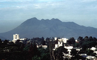
Geological Summary. Eruptions from Pacaya are frequently visible from Guatemala City, the nation's capital. This complex basaltic volcano was constructed just outside the southern topographic rim of the 14 x 16 km Pleistocene Amatitlán caldera. A cluster of dacitic lava domes occupies the southern caldera floor. The post-caldera Pacaya massif includes the older Pacaya Viejo and Cerro Grande stratovolcanoes and the currently active Mackenney stratovolcano. Collapse of Pacaya Viejo between 600 and 1,500 years ago produced a debris-avalanche deposit that extends 25 km onto the Pacific coastal plain and left an arcuate scarp inside which the modern Pacaya volcano (Mackenney cone) grew. The NW-flank Cerro Chino crater was last active in the 19th century. During the past several decades, activity has consisted of frequent Strombolian eruptions with intermittent lava flow extrusion that has partially filled in the caldera moat and covered the flanks of Mackenney cone, punctuated by occasional larger explosive eruptions that partially destroy the summit.
Information Contacts: T. Casadevall, USGS.

