Report on Iliboleng (Indonesia) — December 1982
Scientific Event Alert Network Bulletin, vol. 7, no. 12 (December 1982)
Managing Editor: Lindsay McClelland.
Iliboleng (Indonesia) Small ash eruption
Please cite this report as:
Global Volcanism Program, 1982. Report on Iliboleng (Indonesia) (McClelland, L., ed.). Scientific Event Alert Network Bulletin, 7:12. Smithsonian Institution. https://doi.org/10.5479/si.GVP.SEAN198212-264220
Iliboleng
Indonesia
8.342°S, 123.258°E; summit elev. 1659 m
All times are local (unless otherwise noted)
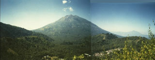
VSI reported that an ash eruption began on 17 November at 0615. The ash column rose ~ 1 km and was blown N, causing thin ashfalls on nearby villages. The eruption ended after several hours. As of mid-Jan, no additional activity had been reported. Press sources noted that the eruption was preceded by a moderately strong, felt earthquake on 15 November at about 2300.
Geological Summary. Iliboleng stratovolcano was constructed at the SE end of Adonara Island across a narrow strait from Lomblen Island. The volcano is capped by multiple, partially overlapping summit craters. Lava flows modify its profile, and a cone low on the SE flank, Balile, has also produced lava flows. Historical eruptions, first recorded in 1885, have consisted of moderate explosive activity, with lava flows accompanying only the 1888 eruption.
Information Contacts: A. Sudradjat and O. Mandraguna, VSI; M. Krafft, Cernay; SinarHarapan, Jakarta.