Report on Toya (Japan) — January 1983
Scientific Event Alert Network Bulletin, vol. 8, no. 1 (January 1983)
Managing Editor: Lindsay McClelland.
Toya (Japan) Decreased seismic activity; negligible ground deformation
Please cite this report as:
Global Volcanism Program, 1983. Report on Toya (Japan) (McClelland, L., ed.). Scientific Event Alert Network Bulletin, 8:1. Smithsonian Institution. https://doi.org/10.5479/si.GVP.SEAN198301-285030
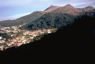
Toya
Japan
42.544°N, 140.839°E; summit elev. 733 m
All times are local (unless otherwise noted)
Seismicity and ground deformation at Usu ended in spring 1982, after 58 months of activity. The monthly number of recorded seismic events had gradually declined since the major eruption in 1977, but remained above background through 1981, when approximately 308 seismic events were recorded per month. Ground deformation had also continued since the eruption. The rate of uplift of the cryptodome decreased from about 2 cm/day in 1980 to about 0.8 cm in 1981. Northward lateral movement of the N flank also continued through 1981.
In 1982, seismic activity decreased to the background level of about 10 events per month by April; 496 events were recorded in January, 231 in February, 79 in March, 10 in April and 11 in May. Ground deformation has been negligible since April 1982.
Further References. Yokoyama, I. (ed.), 1984, Report of joint geophysical and geochemical observations of Usu volcano in 1982 and Tarumai volcano in 1983, 214 p.
Geological Summary. Usuzan, one of Hokkaido's most well-known volcanoes, is a small stratovolcano located astride the southern topographic rim of the 110,000-year-old Toya caldera. The center of the 10-km-wide, lake-filled caldera contains Nakajima, a group of forested Pleistocene andesitic lava domes. The summit of the basaltic-to-andesitic edifice of Usu is cut by a somma formed about 20-30,000 years ago when collapse of the volcano produced a debris avalanche that reached the sea. Dacitic domes erupted along two NW-SE-trending lines fill and flank the summit caldera. Three of these domes, O-Usu, Ko-Usu and Showashinzan, along with seven crypto-domes, were erupted during historical time. The 1663 eruption of Usu was one of the largest in Hokkaido during historical time. The war-time growth of Showashinzan from 1943-45 was painstakingly documented by the local postmaster, who created the first detailed record of growth of a lava dome.
Information Contacts: JMA, Tokyo.