Report on Tangkuban Parahu (Indonesia) — August 1983
Scientific Event Alert Network Bulletin, vol. 8, no. 8 (August 1983)
Managing Editor: Lindsay McClelland.
Tangkuban Parahu (Indonesia) Increased seismicity; thermal activity; inflation
Please cite this report as:
Global Volcanism Program, 1983. Report on Tangkuban Parahu (Indonesia) (McClelland, L., ed.). Scientific Event Alert Network Bulletin, 8:8. Smithsonian Institution. https://doi.org/10.5479/si.GVP.SEAN198308-263090
Tangkuban Parahu
Indonesia
6.77°S, 107.6°E; summit elev. 2084 m
All times are local (unless otherwise noted)
Tangkubanparahu has shown increased seismicity, thermal activity, and inflation during the past several months. A VSI seismograph recorded as many as seven shallow volcanic tremors/day in early June, 19/day by early August and 25/day the last week in August. At the beginning of September, seismicity increased sharply from an average of 14 to 60-74 events per day and by the middle of the month reached a daily average of 106-110. Epicenters were in the vicinity of Baru fumarolic field, on the W wall of Crater 3. No deep volcanic earthquakes have been detected. A telemetering seismograph (obtained through the VSI-USGS cooperative program) permitted monitoring from Bandung, 30 km S of the volcano.
Little change in surface activity was observed until September. Three fumarole fields (Baru, Ratu, and Upas) were monitored, with highest temperatures recorded at Baru, increasing to 98°C from an average of 94°C. On 13 September, a pair of white steam columns rose from Baru field for about 20 minutes each, reaching heights of 100-150 m. SO2 emission measured by COSPEC increased from 70 t/d in August to 80 t/d in September. Since July, dry tilt measurements have shown a consistent inflation centered on Baru fumarole field totaling about 20 µrad.
Civil authorities warned of the volcanic hazard and the National Park has issued an alert to tourists. Within a 3-km danger zone, camping and auto parking were forbidden.
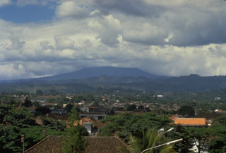
Geological Summary. Gunung Tangkuban Parahu is a broad stratovolcano overlooking Indonesia's former capital city of Bandung. The volcano was constructed within the 6 x 8 km Pleistocene Sunda caldera, which formed about 190,000 years ago. The volcano's low profile is the subject of legends referring to the mountain of the "upturned boat." The Sunda caldera rim forms a prominent ridge on the western side; elsewhere the rim is largely buried by deposits of the current volcano. The dominantly small phreatic eruptions recorded since the 19th century have originated from several nested craters within an elliptical 1 x 1.5 km summit depression.
Information Contacts: A. Sudradjat, VSI.

