Report on Iliwerung (Indonesia) — August 1983
Scientific Event Alert Network Bulletin, vol. 8, no. 8 (August 1983)
Managing Editor: Lindsay McClelland.
Iliwerung (Indonesia) Submarine explosions
Please cite this report as:
Global Volcanism Program, 1983. Report on Iliwerung (Indonesia) (McClelland, L., ed.). Scientific Event Alert Network Bulletin, 8:8. Smithsonian Institution. https://doi.org/10.5479/si.GVP.SEAN198308-264250
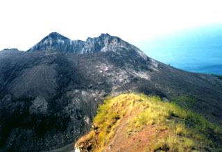
Iliwerung
Indonesia
8.532°S, 123.573°E; summit elev. 583 m
All times are local (unless otherwise noted)
Explosions occurred 17 and 18 August from a submarine vent (Hobal) S of Iliwerung. No casualties were reported.
Its previous eruption began with submarine activity in December 1973; by July 1974, there were two small islands at the eruption site and a third emerged in August. All have subsequently been eroded away. In July 1979, about 50 x 106 m3 of Iliwerung were removed by a landslide. About 1/3 of this material entered the sea, and (probably aided by additional submarine slumping) generated tsunami that killed hundreds of people.
Geological Summary. Constructed on the southern rim of the Lerek caldera, Iliwerung forms a prominent south-facing peninsula on Lembata (formerly Lomblen) Island. Craters and lava domes have formed along N-S and NW-SE lines on the complex volcano; activity has been observed at vents from the summit to the submarine SE flank. The summit lava dome was formed during an eruption in 1870. In 1948 the Iligripe lava dome grew on the E flank at 120 m elevation. Beginning in 1973-74, when three ephemeral islands were formed, submarine eruptions began on the lower ESE flank at a vent named Hobal; several other eruptions have since taken place at this vent.
Information Contacts: L. Pardyanto, VSI; AFP.