Report on Iliboleng (Indonesia) — November 1986
Scientific Event Alert Network Bulletin, vol. 11, no. 11 (November 1986)
Managing Editor: Lindsay McClelland.
Iliboleng (Indonesia) Renewed explosions after 12 days of seismicity
Please cite this report as:
Global Volcanism Program, 1986. Report on Iliboleng (Indonesia) (McClelland, L., ed.). Scientific Event Alert Network Bulletin, 11:11. Smithsonian Institution. https://doi.org/10.5479/si.GVP.SEAN198611-264220
Iliboleng
Indonesia
8.342°S, 123.258°E; summit elev. 1659 m
All times are local (unless otherwise noted)
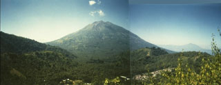
Explosions occurred 10, 15, and 24 November. A gas and ash column emitted on 24 November at 0712 reached 1,000 m height and was blown NNW, covering 18.7 km2 with ~1 mm of ash. There were no casualties. Shallow volcanic seismicity began 30 October, with as many as 60 events/day. Eruption tremor was recorded for 1.5 minutes on 10 November.
Geological Summary. Iliboleng stratovolcano was constructed at the SE end of Adonara Island across a narrow strait from Lomblen Island. The volcano is capped by multiple, partially overlapping summit craters. Lava flows modify its profile, and a cone low on the SE flank, Balile, has also produced lava flows. Historical eruptions, first recorded in 1885, have consisted of moderate explosive activity, with lava flows accompanying only the 1888 eruption.
Information Contacts: VSI; ANS.