Report on Gorely (Russia) — 18 June-24 June 2008
Smithsonian Institution / US Geological Survey
Weekly Volcanic Activity Report, 18 June-24 June 2008
Managing Editor: Sally Sennert.
Please cite this report as:
Global Volcanism Program, 2008. Report on Gorely (Russia) (Sennert, S, ed.). Weekly Volcanic Activity Report, 18 June-24 June 2008. Smithsonian Institution and US Geological Survey.
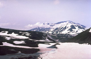
Gorely
Russia
52.5549°N, 158.0358°E; summit elev. 1799 m
All times are local (unless otherwise noted)
KVERT reported that seismic activity in the area of Gorely and Mutnovsky volcanoes decreased during 15-18 June. Moderate fumarolic activity was observed on 17 June; no activity was noted or cloud cover obscured views the other days during 14-20 June. The level of Concern Color Code was lowered to Green on 20 June.
Geological Summary. Gorely volcano consists of five small overlapping stratovolcanoes constructed along a WNW-ESE line within a large 9 x 13 km caldera. The caldera formed about 38,000-40,000 years ago accompanied by the eruption of about 100 km3 of tephra. The massive complex includes about 40 cinder cones, some of which contain acid or freshwater crater lakes; three major rift zones cut the complex. Another Holocene stratovolcano is located on the SW flank. Activity during the Holocene was characterized by frequent mild-to-moderate explosive eruptions along with a half dozen episodes of major lava extrusion. Early Holocene explosive activity, along with lava flows filled in much of the caldera. Quiescent periods became longer between 6,000 and 2,000 years ago, after which the activity was mainly explosive. About 600-650 years ago intermittent strong explosions and lava flow effusion accompanied frequent eruptions. Historical eruptions have consisted of moderate Vulcanian and phreatic explosions.