Report on Kusatsu-Shiranesan (Japan) — 17 January-23 January 2018
Smithsonian Institution / US Geological Survey
Weekly Volcanic Activity Report, 17 January-23 January 2018
Managing Editor: Sally Sennert.
Please cite this report as:
Global Volcanism Program, 2018. Report on Kusatsu-Shiranesan (Japan) (Sennert, S, ed.). Weekly Volcanic Activity Report, 17 January-23 January 2018. Smithsonian Institution and US Geological Survey.
Kusatsu-Shiranesan
Japan
36.618°N, 138.528°E; summit elev. 2165 m
All times are local (unless otherwise noted)
JMA reported that at 0959 on 23 January an eruption began at Kusatsu-Shiranesan coincident with the onset of volcanic tremor; there were no indications of an impending eruption. The Alert Level was raised to 3 (on a scale of 1-5). Skiers at the popular ski resort Kusatsu Kokusai took video showing a plume of tephra and ejected bombs rising from a vent on the Motoshiranesan edifice, about 2 km SSE of Yagama Crater on Shiranesan (where all previous historical activity has been). The eruption also caused what appeared to be an avalanche. Photos and video posted in news articles showed tephra drifting E and blanketing the nearby hillside; JMA noted ashfall in Nakanojo-machi, in the Gunma Prefecture. Tephra hit a gondola, shattering glass and injuring four skiers. Material crashed through the roof of a lodge, where about 100 people had already been evacuated. Ground Self-Defense Force troops were engaging in ski training at the time of the event; one member died and seven others were injured. Emergency responders gathered at the Sanroku Station to assist. On 24 January JMA noted that volcanic earthquakes were numerous but decreasing in number, and two 2-3-minute-long periods of volcanic tremor were detected at 1015 and 1049.
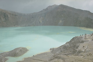
Geological Summary. The Kusatsu-Shiranesan complex, located immediately north of Asama volcano, consists of a series of overlapping pyroclastic cones and three crater lakes. The andesitic-to-dacitic volcano was formed in three eruptive stages beginning in the early to mid-Pleistocene. The Pleistocene Oshi pyroclastic flow produced extensive welded tuffs and non-welded pumice that covers much of the E, S, and SW flanks. The latest eruptive stage began about 14,000 years ago. Historical eruptions have consisted of phreatic explosions from the acidic crater lakes or their margins. Fumaroles and hot springs that dot the flanks have strongly acidified many rivers draining from the volcano. The crater was the site of active sulfur mining for many years during the 19th and 20th centuries.