Report on Laguna del Maule (Chile) — 17 June-23 June 2020
Smithsonian Institution / US Geological Survey
Weekly Volcanic Activity Report, 17 June-23 June 2020
Managing Editor: Sally Sennert.
Please cite this report as:
Global Volcanism Program, 2020. Report on Laguna del Maule (Chile) (Sennert, S, ed.). Weekly Volcanic Activity Report, 17 June-23 June 2020. Smithsonian Institution and US Geological Survey.
Laguna del Maule
Chile
36.058°S, 70.492°W; summit elev. 2162 m
All times are local (unless otherwise noted)
SERNAGEOMIN’s Volcanological Observatory of the Southern Andes (OVDAS) of Chile and SEGEMAR’s Argentine Observatory of Volcanic Surveillance (OAVV) reported anomalous activity at Laguna del Maule Volcanic Complex. Elevated levels of carbon dioxide were detected in an area SW of the caldera lake, along the lower part of the Cabecera de Troncoso River, about 5 km from the lake’s shore. Carbon dioxide emissions were measured in February 2020 and notably elevated relative to March 2019 measurements. An impacted area possibly stretched as far as 500 m from the point representing the highest carbon dioxide emission rate; observers noted areas of discolored brown and orange soil aonlg with dead or emaciated animals.
Three swarms of volcano-tectonic (VT) earthquakes recorded in mid-June were mainly located in the Las Nieblas area, SW of the lake, at depths of 2-8 km. The first began at 0340 on 11 June and totaled at least 400 events. The second swarm began at 2338 on 12 June was characterized by 121 events, located 8.8 km W of the crater. The third swarm began at 2334 on 15 June and was characterized by 190 events located 10.4 km SW of the crater. All of the earthquakes were small magnitudes; the largest event was a local M 2.5. On 18 June the Alert Level was raised to Yellow, the second lowest color on a four-color scale; ONEMI recommended restricting access within a radius of 2 km from the emission center. Seismic activity continued to be recorded, though at lesser magnitudes.
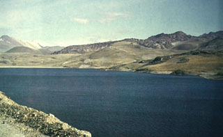
Geological Summary. The Laguna del Maule volcanic complex includes a 15 x 25 km caldera with a cluster of small stratovolcanoes, lava domes, and pyroclastic cones of Pleistocene-to-Holocene age. The caldera lies mostly on the Chilean side of the border, but partially extends into Argentina. Fourteen Pleistocene basaltic lava flows were erupted down the upper part of the Maule river valley. A cluster of Pleistocene cinder cones was constructed on the NW side of Maule lake in the northern part of the caldera. The latest activity produced an explosion crater on the E side of the lake and a series of Holocene rhyolitic lava domes and blocky lava flows that surround it.
Sources: Servicio Nacional de Geología y Minería (SERNAGEOMIN), Servicio Geológico Minero Argentino (SEGEMAR), Oficina Nacional de Emergencia-Ministerio del Interior (ONEMI)