Report on Wolf (Ecuador) — 5 January-11 January 2022
Smithsonian Institution / US Geological Survey
Weekly Volcanic Activity Report, 5 January-11 January 2022
Managing Editor: Sally Sennert.
Please cite this report as:
Global Volcanism Program, 2022. Report on Wolf (Ecuador) (Sennert, S, ed.). Weekly Volcanic Activity Report, 5 January-11 January 2022. Smithsonian Institution and US Geological Survey.
Wolf
Ecuador
0.02°N, 91.35°W; summit elev. 1710 m
All times are local (unless otherwise noted)
IG reported that a seismic swarm at Wolf began at 2100 on 6 January, followed by a M 2.4 earthquake recorded at 2135, and tremor at 2315. Fissures opened in an area SE of the summit caldera within five minutes of the onset of tremor and a new eruption began. At 0020 on 7 January satellite images showed ash-and-gas plumes rising to varying altitudes between 1.9 km (6,200 ft) and 3.8 km (12,500 ft) a.s.l., with the lower parts of the plume drifting NE and the higher parts drifting W. Thermal anomalies indicated advancing lava flows down the S and SE flanks. The Parque Nacional Galápagos and the Galapagos Conservancy evacuated eight people by helicopter, including park rangers and scientists that were working near the rim, as a precaution and noted that habitat for a population of critically endangered Pink Land Iguana was far from the eruption. Photos showed a line of lava fountains rising along the fissure and lava flows advancing over vegetation. Thermal anomalies continued to indicate advancing lava during 8-11 January. Plumes mostly consisting of gas rose as high as 1.3 km (4,300 ft) a.s.l. and drifted W and SW. The lava flows were not far from the ocean by 10 January. Photos posted on 11 January by Parque Nacional Galápagos showed lava fountaining at a growing cone and fluid lava flows advancing from the base of the cone. The lava flows had traveled 15 km SE, then E, by 11 January.
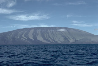
Geological Summary. Volcán Wolf, the highest volcano of the Galápagos Islands, straddles the equator at the north end of the archipelago's largest island, Isabela. The edifice has steeper slopes than most other Isabela volcanoes, reaching angles up to 35°. The summit caldera is 6 x 7 km across and 700 m deep. A prominent bench on the west side of the caldera rises 450 m above the caldera floor, much of which is covered by a lava flow erupted in 1982. Radial fissures concentrated along diffuse rift zones extend down the N, NW, and SE flanks, and submarine vents lie beyond the N and NW fissures. Similar unvegetated flows originating from a circumferential chain of spatter and scoria cones on the eastern caldera rim drape the forested flanks to the sea. The proportion of aa lava flows exceeds that of other Galápagos volcanoes. An eruption in in 1797 was the first observed and documented in the Galápagos Islands.
Sources: Instituto Geofísico-Escuela Politécnica Nacional (IG-EPN), Parque Nacional Galápagos, Galapagos Conservancy