Report on Davidof (United States) — 20 April-26 April 2022
Smithsonian Institution / US Geological Survey
Weekly Volcanic Activity Report, 20 April-26 April 2022
Managing Editor: Sally Sennert.
Please cite this report as:
Global Volcanism Program, 2022. Report on Davidof (United States) (Sennert, S, ed.). Weekly Volcanic Activity Report, 20 April-26 April 2022. Smithsonian Institution and US Geological Survey.
Davidof
United States
51.97°N, 178.33°E; summit elev. 328 m
All times are local (unless otherwise noted)
AVO lowered both the Aviation Color Code and the Volcano Alert Level for Davidof to Unassigned on 21 April, noting that the earthquake swarm which began in January had declined in the previous few weeks. It is unknown if the swarm was due to tectonic processes or volcanic unrest. The level “Unassigned” means that there is not sufficient instrumentation on the volcano for AVO to characterize a base level of activity; the closest seismometer was on Little Sitkin (15 km E).
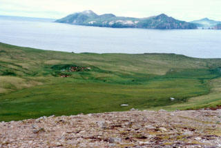
Geological Summary. A cluster of small islands between Segula and Little Sitkin in the western Aleutians, the largest of which is Davidof, are remnants of a stratovolcano that collapsed during the late Tertiary, forming a 2.7-km-wide caldera. The islands include Khvostof, Pyramid, Lopy, and Davidof; the latter three form the eastern rim of the mostly submarine caldera, sometimes referred to as the "Aleutian Krakatau." The islands were constructed above a roughly 100-m-deep submarine platform extending NW to Segula Island; the floor of the caldera lies 80 m below sea level. The islands are vegetated, but lava flows are recognizable, and Smith et al. (1978) suggested a possible Holocene age.
Source: US Geological Survey Alaska Volcano Observatory (AVO)