Report on Yasur (Vanuatu) — 25 October-31 October 2023
Smithsonian Institution / US Geological Survey
Weekly Volcanic Activity Report, 25 October-31 October 2023
Managing Editor: Sally Sennert.
Please cite this report as:
Global Volcanism Program, 2023. Report on Yasur (Vanuatu) (Sennert, S, ed.). Weekly Volcanic Activity Report, 25 October-31 October 2023. Smithsonian Institution and US Geological Survey.
Yasur
Vanuatu
19.532°S, 169.447°E; summit elev. 361 m
All times are local (unless otherwise noted)
The Vanuatu Meteorology and Geohazards Department (VMGD) reported that activity at Yasur continued at a high level of “major unrest,” as defined by the Alert Level 2 status (the middle level on a scale of 0-4) during October. Recent satellite observations indicated an increase in steam, gas, and ash emissions from the summit crater. Explosions continued, with some ejecting bombs that landed back in and around the crater. A significant landslide occurred inside the vent on 10 October. The public was reminded to not enter the restricted area within 600 m around the boundaries of the Permanent Exclusion Zone, defined by Danger Zone A on the hazard map.
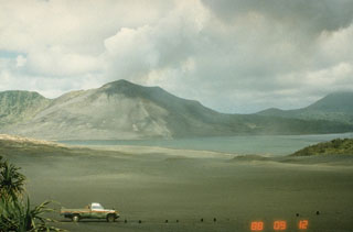
Geological Summary. Yasur has exhibited essentially continuous Strombolian and Vulcanian activity at least since Captain Cook observed ash eruptions in 1774. This style of activity may have continued for the past 800 years. Located at the SE tip of Tanna Island in Vanuatu, this pyroclastic cone has a nearly circular, 400-m-wide summit crater. The active cone is largely contained within the small Yenkahe caldera, and is the youngest of a group of Holocene volcanic centers constructed over the down-dropped NE flank of the Pleistocene Tukosmeru volcano. The Yenkahe horst is located within the Siwi ring fracture, a 4-km-wide open feature associated with eruption of the andesitic Siwi pyroclastic sequence. Active tectonism along the Yenkahe horst accompanying eruptions has raised Port Resolution harbor more than 20 m during the past century.
Source: Vanuatu Meteorology and Geohazards Department (VMGD)

