Report on Bamus (Papua New Guinea) — 12 July-18 July 2006
Smithsonian Institution / US Geological Survey
Weekly Volcanic Activity Report, 12 July-18 July 2006
Managing Editor: Sally Sennert.
Please cite this report as:
Global Volcanism Program, 2006. Report on Bamus (Papua New Guinea) (Sennert, S, ed.). Weekly Volcanic Activity Report, 12 July-18 July 2006. Smithsonian Institution and US Geological Survey.
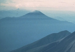
Bamus
Papua New Guinea
5.2°S, 151.23°E; summit elev. 2248 m
All times are local (unless otherwise noted)
RVO reported that white vapor emissions from Bamus were observed during 1000-1130 on 12 July. The emissions were forceful and slightly gray in color at 1110. The vapor plume drifted SSE.
Geological Summary. Symmetrical Bamus volcano, also referred to locally as the South Son, is located SW of Ulawun volcano, known as the Father. The andesitic stratovolcano is covered in rainforest and contains a breached summit crater filled with a lava dome. There is a cone on the southern flank, and a prominent 1.5-km-wide crater with two small adjacent cones halfway up the SE flank. Young pyroclastic-flow deposits are found on the flanks, and residents describe an eruption that took place during the late 19th century.
Source: Rabaul Volcano Observatory (RVO)