Report on Koryaksky (Russia) — 15 April-21 April 2009
Smithsonian Institution / US Geological Survey
Weekly Volcanic Activity Report, 15 April-21 April 2009
Managing Editor: Sally Sennert.
Please cite this report as:
Global Volcanism Program, 2009. Report on Koryaksky (Russia) (Sennert, S, ed.). Weekly Volcanic Activity Report, 15 April-21 April 2009. Smithsonian Institution and US Geological Survey.
Koryaksky
Russia
53.321°N, 158.712°E; summit elev. 3430 m
All times are local (unless otherwise noted)
During 10-17 April, KVERT reported that seismic activity at Koryaksky was above background levels. Gas-and-ash plumes were seen on satellite imagery and drifted 30-680 km in multiple directions. The Level of Concern Color Code remained Orange. Based on information from the Yelizovo Airport and analysis of satellite imagery, the Tokyo VAAC reported that during 18 and 21 April ash plumes rose to altitudes of 3.7-4.6 km (12,000-15,000 ft) a.s.l. and drifted S, SW, W, and NE.
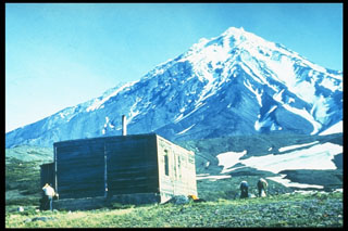
Geological Summary. The large symmetrical Koryaksky stratovolcano is the most prominent landmark of the NW-trending Avachinskaya volcano group, which towers above Kamchatka's largest city, Petropavlovsk. Erosion has produced a ribbed surface on the eastern flanks of the 3430-m-high volcano; the youngest lava flows are found on the upper W flank and below SE-flank cinder cones. Extensive Holocene lava fields on the western flank were primarily fed by summit vents; those on the SW flank originated from flank vents. Lahars associated with a period of lava effusion from south- and SW-flank fissure vents about 3900-3500 years ago reached Avacha Bay. Only a few moderate explosive eruptions have occurred during historical time, but no strong explosive eruptions have been documented during the Holocene. Koryaksky's first historical eruption, in 1895, also produced a lava flow.
Sources: Tokyo Volcanic Ash Advisory Center (VAAC), Kamchatkan Volcanic Eruption Response Team (KVERT)

