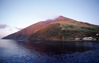
Report on Stromboli (Italy) — 6 July-12 July 2011
Smithsonian Institution / US Geological Survey
Weekly Volcanic Activity Report, 6 July-12 July 2011
Managing Editor: Sally Sennert.
Please cite this report as:
Global Volcanism Program, 2011. Report on Stromboli (Italy) (Sennert, S, ed.). Weekly Volcanic Activity Report, 6 July-12 July 2011. Smithsonian Institution and US Geological Survey.
Stromboli
Italy
38.789°N, 15.213°E; summit elev. 924 m
All times are local (unless otherwise noted)
Sezione di Catania - Osservatorio Etneo reported that on 5 July a high pyroclastic jet formed in the S part of Stromboli's crater terrace producing tephra that fell back onto the Pizzo sopra la Fossa. Seismic data indicated that other craters on the terrace were also active. A similar but less powerful explosion occurred from the same vent on 10 July.
Geological Summary. Spectacular incandescent nighttime explosions at Stromboli have long attracted visitors to the "Lighthouse of the Mediterranean" in the NE Aeolian Islands. This volcano has lent its name to the frequent mild explosive activity that has characterized its eruptions throughout much of historical time. The small island is the emergent summit of a volcano that grew in two main eruptive cycles, the last of which formed the western portion of the island. The Neostromboli eruptive period took place between about 13,000 and 5,000 years ago. The active summit vents are located at the head of the Sciara del Fuoco, a prominent scarp that formed about 5,000 years ago due to a series of slope failures which extends to below sea level. The modern volcano has been constructed within this scarp, which funnels pyroclastic ejecta and lava flows to the NW. Essentially continuous mild Strombolian explosions, sometimes accompanied by lava flows, have been recorded for more than a millennium.

