Report on Puyehue-Cordon Caulle (Chile) — 6 July-12 July 2011
Smithsonian Institution / US Geological Survey
Weekly Volcanic Activity Report, 6 July-12 July 2011
Managing Editor: Sally Sennert.
Please cite this report as:
Global Volcanism Program, 2011. Report on Puyehue-Cordon Caulle (Chile) (Sennert, S, ed.). Weekly Volcanic Activity Report, 6 July-12 July 2011. Smithsonian Institution and US Geological Survey.
Puyehue-Cordon Caulle
Chile
40.59°S, 72.117°W; summit elev. 2236 m
All times are local (unless otherwise noted)
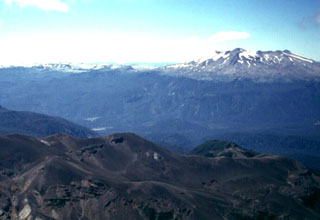
OVDAS-SERNAGEOMIN reported that during 6-8 July cameras installed around the Puyehue-Cordón Caulle volcanic complex recorded eruption plumes that rose no higher than 2 km above the Cordón Caulle rift zone and drifted N and NE. On 6 July satellite imagery indicated that the plume drifted 75 km NE. During 7-8 July explosions recorded by the seismic network corresponded to increases in the plume height and, on 7 July, caused windows in Riñinahue to vibrate. According to news articles, numerous flights in and around Argentina and Uruguay were cancelled on 8 July and some airports had remained closed.
On 9 July seismicity indicated that lava flows had ceased. During 9-11 July weather conditions prevented views of the eruption plume by cameras installed around the volcano. Based on analysis of satellite imagery, the Buenos Aires VAAC stated on 9 July that, although ash plumes rose to an altitude of 3 km (10,000 ft), activity was weakening. Ash was again detected by satellite during periods of clear weather the next day. The Alert Level remained at Red.
Geological Summary. The Puyehue-Cordón Caulle volcanic complex (PCCVC) is a large NW-SE-trending late-Pleistocene to Holocene basaltic-to-rhyolitic transverse volcanic chain SE of Lago Ranco. The 1799-m-high Pleistocene Cordillera Nevada caldera lies at the NW end, separated from Puyehue stratovolcano at the SE end by the Cordón Caulle fissure complex. The Pleistocene Mencheca volcano with Holocene flank cones lies NE of Puyehue. The basaltic-to-rhyolitic Puyehue volcano is the most geochemically diverse of the PCCVC. The flat-topped, 2236-m-high volcano was constructed above a 5-km-wide caldera and is capped by a 2.4-km-wide Holocene summit caldera. Lava flows and domes of mostly rhyolitic composition are found on the E flank. Historical eruptions originally attributed to Puyehue, including major eruptions in 1921-22 and 1960, are now known to be from the Cordón Caulle rift zone. The Cordón Caulle geothermal area, occupying a 6 x 13 km wide volcano-tectonic depression, is the largest active geothermal area of the southern Andes volcanic zone.
Sources: Buenos Aires Volcanic Ash Advisory Center (VAAC), Agence France-Presse (AFP), Servicio Nacional de Geología y Minería (SERNAGEOMIN)