Report on Nyamulagira (DR Congo) — 9 November-15 November 2011
Smithsonian Institution / US Geological Survey
Weekly Volcanic Activity Report, 9 November-15 November 2011
Managing Editor: Sally Sennert.
Please cite this report as:
Global Volcanism Program, 2011. Report on Nyamulagira (DR Congo) (Sennert, S, ed.). Weekly Volcanic Activity Report, 9 November-15 November 2011. Smithsonian Institution and US Geological Survey.
Nyamulagira
DR Congo
1.408°S, 29.2°E; summit elev. 3058 m
All times are local (unless otherwise noted)
According to GORISK (an initiative of the National Museum of Natural History, Luxembourg and Royal Museum for Central Africa, Belgium), the eruption at Nyamuragira that began on 6 November, after two days of intense seismic activity, was located along a fissure 11-12 km ENE of the main crater, close to one of the 1989 eruption sites.
Virunga National Park staff had previously been observing the eruption from a hilltop in Rumangabo, but on 9 November the staff and rangers traveled to the site. After a 3-hour hike, the team viewed the eruption from the S and noted roaring and lava fountains, as well as thunder and lightning. The observers also noted that the ground was covered by black pumice. On 11 November about 100 people, including staff, rangers, carpenters, porters, and volcanologists, traveled to a similar but safer location to set up a camp for visitors. The eruption site was described as a flat area with a 500-1,000-m-long fissure, oriented perpendicular to the Albertine (Western) rift. Lava fountains rose as high as 300 m above a cinder cone. Slow-moving lava traveled N.
GORISK noted that radar images acquired on 11 November showed the largest deformation ever detected by the method (InSAR) since the early 1990's over Nyamuragira. A very preliminary analysis of the observed deformation suggested an affected area of more than 250 square kilometers. The ground rose more than 50 cm at the eruptive site where the spatter cone was developing. Another 15 cm of deformation was detected within the Nyamuragira caldera accompanied by deflation on the flanks. Satellite images acquired on 12 November showed that the lava flow had traveled approximately 11.5 km during the six days of the eruption.
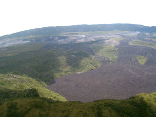
Geological Summary. Africa's most active volcano, Nyamulagira (also known as Nyamuragira), is a massive high-potassium basaltic shield about 25 km N of Lake Kivu and 13 km NNW of the steep-sided Nyiragongo volcano. The summit is truncated by a small 2 x 2.3 km caldera that has walls up to about 100 m high. Documented eruptions have occurred within the summit caldera, as well as from the numerous flank fissures and cinder cones. A lava lake in the summit crater, active since at least 1921, drained in 1938, at the time of a major flank eruption. Recent lava flows extend down the flanks more than 30 km from the summit as far as Lake Kivu; extensive lava flows from this volcano have covered 1,500 km2 of the western branch of the East African Rift.
Sources: GORISK, Virunga National Park

