Report on Cumbal (Colombia) — 25 July-31 July 2012
Smithsonian Institution / US Geological Survey
Weekly Volcanic Activity Report, 25 July-31 July 2012
Managing Editor: Sally Sennert.
Please cite this report as:
Global Volcanism Program, 2012. Report on Cumbal (Colombia) (Sennert, S, ed.). Weekly Volcanic Activity Report, 25 July-31 July 2012. Smithsonian Institution and US Geological Survey.
Cumbal
Colombia
0.95°N, 77.87°W; summit elev. 4764 m
All times are local (unless otherwise noted)
According to INGEOMINAS, the Observatorio de Pasto reported that during 25-31 July seismic signals related to movement of fluid decreased compared to the previous week; earthquake swarms were detected on 26, 27, 29, and 30 July. The number and magnitude of earthquakes generated by fracturing rock increased. Four of the events were located SW of the volcano at a depth of 10 km, and less than M 2.1. Weather conditions prevented observations of the volcano. The Alert Level remained at III (Yellow; "changes in the behavior of volcanic activity").
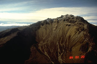
Geological Summary. Many youthful lava flows extend from the glacier-capped Cumbal volcano, the southernmost historically active volcano of Colombia. The volcano is elongated in a NE-SW direction and is composed primarily of andesitic-dacitic lava flows. Two fumarolically active craters occupy the summit ridge: the main crater on the NE side and Mundo Nuevo crater on the SW. A young lava dome occupies the 250-m-wide summit crater, and eruptions from the upper E flank produced a 6-km-long lava field. The oldest crater lies NNE of the summit crater, suggesting SW-ward migration of activity. Explosive eruptions in 1877 and 1926 are the only known historical activity. Thermal springs are located on the SE flanks.