Report on Tangkuban Parahu (Indonesia) — 13 March-19 March 2013
Smithsonian Institution / US Geological Survey
Weekly Volcanic Activity Report, 13 March-19 March 2013
Managing Editor: Sally Sennert.
Please cite this report as:
Global Volcanism Program, 2013. Report on Tangkuban Parahu (Indonesia) (Sennert, S, ed.). Weekly Volcanic Activity Report, 13 March-19 March 2013. Smithsonian Institution and US Geological Survey.
Tangkuban Parahu
Indonesia
6.77°S, 107.6°E; summit elev. 2084 m
All times are local (unless otherwise noted)
CVGHM reported that phreatic eruptions from Tangkubanparahu's Ratu Crater occurred on 28 February and during 4-6 March, and generated ash plumes that rose up to 100 m above the crater. Sulfur dioxide emissions increased to a high level on 24 February and then decreased through 3 March. Sulfur dioxide emissions again increased during 5-9 March; CVGHM speculated that the increase was due to an enlargement of the eruptive vent, which had grown to a diameter of 20 m. Gas emissions decreased abruptly on 10 March and emission sounds stopped.
Seismicity had significantly increased on 22 February, marked by a growing number of daily events. A significant decrease was detected on 9 March. Deflation was detected from 24 February through early March, but was then stable during 7-14 March. On 18 March the Alert Level was lowered to 1 (on a scale of 1-4).
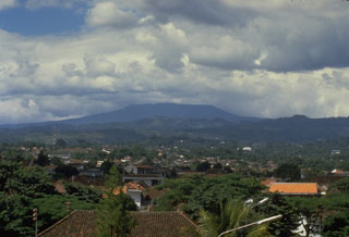
Geological Summary. Gunung Tangkuban Parahu is a broad stratovolcano overlooking Indonesia's former capital city of Bandung. The volcano was constructed within the 6 x 8 km Pleistocene Sunda caldera, which formed about 190,000 years ago. The volcano's low profile is the subject of legends referring to the mountain of the "upturned boat." The Sunda caldera rim forms a prominent ridge on the western side; elsewhere the rim is largely buried by deposits of the current volcano. The dominantly small phreatic eruptions recorded since the 19th century have originated from several nested craters within an elliptical 1 x 1.5 km summit depression.
Source: Pusat Vulkanologi dan Mitigasi Bencana Geologi (PVMBG, also known as CVGHM)