Report on Tongariro (New Zealand) — 27 March-2 April 2013
Smithsonian Institution / US Geological Survey
Weekly Volcanic Activity Report, 27 March-2 April 2013
Managing Editor: Sally Sennert.
Please cite this report as:
Global Volcanism Program, 2013. Report on Tongariro (New Zealand) (Sennert, S, ed.). Weekly Volcanic Activity Report, 27 March-2 April 2013. Smithsonian Institution and US Geological Survey.
Tongariro
New Zealand
39.157°S, 175.632°E; summit elev. 1978 m
All times are local (unless otherwise noted)
On 25 March GeoNet reported that Tongariro remained quiet with no eruptive activity being detected since the explosion on 21 November 2012. Steam-and-gas plumes rose from the Te Maari Craters. The Aviation Colour Code was lowered to Green (second lowest on a 4 four-color scale) and the Volcanic Alert Level remained at 1 (on a scale of 0-5).
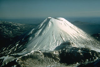
Geological Summary. Tongariro is a large volcanic massif, located immediately NE of Ruapehu volcano, that is composed of more than a dozen composite cones constructed over a period of 275,000 years. Vents along a NE-trending zone extending from Saddle Cone (below Ruapehu) to Te Maari crater (including vents at the present-day location of Ngauruhoe) were active during several hundred years around 10,000 years ago, producing the largest known eruptions at the Tongariro complex during the Holocene. North Crater stratovolcano is truncated by a broad, shallow crater filled by a solidified lava lake that is cut on the NW side by a small explosion crater. The youngest cone, Ngauruhoe, is also the highest peak.
Source: GeoNet