Report on Copahue (Chile-Argentina) — 22 May-28 May 2013
Smithsonian Institution / US Geological Survey
Weekly Volcanic Activity Report, 22 May-28 May 2013
Managing Editor: Sally Sennert.
Please cite this report as:
Global Volcanism Program, 2013. Report on Copahue (Chile-Argentina) (Sennert, S, ed.). Weekly Volcanic Activity Report, 22 May-28 May 2013. Smithsonian Institution and US Geological Survey.
Copahue
Chile-Argentina
37.856°S, 71.183°W; summit elev. 2953 m
All times are local (unless otherwise noted)
OVDAS-SERNAGEOMIN reported that a gradual increase of seismicity at Copahue had been detected since 15 May. A camera recorded periodic small explosions and corresponding ash emissions, along with nighttime incandescence. On 19 May satellite images detected increased sulfur dioxide emissions, which produced a plume that rose 300 m above the crater and drifted SE. Images from 20 and 22 May showed large plumes drifting 100 km SE that appeared translucent gray, suggesting a significant presence of volcanic gases. On 23 May the Alert Level was raised to Orange.
On 24 May cameras recorded white plumes that mostly rose 250-400 m; at 1900 a plume rose 1.9 km, and another drifted NE. Seismicity increased sharply during 24-25 May. The seismic network detected 8,556 low-magnitude earthquakes with an average of 356 events per hour, and a gap of a few seconds between events. Seismicity increased again during 25-26 May, with an average of 455 events per hour, and then decreased to 269 events per hour during 26-27 May. An explosion on 26 May generated crater incandescence and a plume that rose 400 m. Weather conditions often prevented views during 25-27 May.
On 27 May OVDAS-SERNAGEOMIN noted that the intensity and type of seismicity observed in recent days, in conjunction with the deformation data, suggested the rise of a magmatic body to shallow depths. The Alert Level was raised to Red. According to ONEMI, the government ordered a precautionary evacuation of the 2,440 people living within a radius of 25 km. During 27-28 May seismic signals were detected at an average rate of 130 events per hour. Cloud cover prevented visual observations. ONEMI noted that 44 people had evacuated by 28 May.
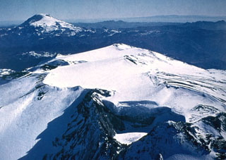
Geological Summary. Volcán Copahue is an elongated composite cone constructed along the Chile-Argentina border within the 6.5 x 8.5 km wide Trapa-Trapa caldera that formed between 0.6 and 0.4 million years ago near the NW margin of the 20 x 15 km Pliocene Caviahue (Del Agrio) caldera. The eastern summit crater, part of a 2-km-long, ENE-WSW line of nine craters, contains a briny, acidic 300-m-wide crater lake (also referred to as El Agrio or Del Agrio) and displays intense fumarolic activity. Acidic hot springs occur below the eastern outlet of the crater lake, contributing to the acidity of the Río Agrio, and another geothermal zone is located within Caviahue caldera about 7 km NE of the summit. Infrequent mild-to-moderate explosive eruptions have been recorded since the 18th century. Twentieth-century eruptions from the crater lake have ejected pyroclastic rocks and chilled liquid sulfur fragments.
Sources: Servicio Nacional de Geología y Minería (SERNAGEOMIN), Oficina Nacional de Emergencia-Ministerio del Interior (ONEMI)

