Report on Sinarka (Russia) — 12 November-18 November 2014
Smithsonian Institution / US Geological Survey
Weekly Volcanic Activity Report, 12 November-18 November 2014
Managing Editor: Sally Sennert.
Please cite this report as:
Global Volcanism Program, 2014. Report on Sinarka (Russia) (Sennert, S, ed.). Weekly Volcanic Activity Report, 12 November-18 November 2014. Smithsonian Institution and US Geological Survey.
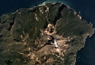
Sinarka
Russia
48.873°N, 154.182°E; summit elev. 911 m
All times are local (unless otherwise noted)
SVERT reported that satellite images of Sinarka showed steam-and-gas emissions drifted 40 km E on 11 November. The next day a weak thermal anomaly was detected. Gas-and-steam activity became more robust; emissions drifted NE. A weak thermal anomaly was again detected on 16 November. The Aviation Color Code was raised to Yellow.
Geological Summary. Sinarka volcano, occupying the northern end of Shiashkotan Island in the central Kuriles, has a complex structure. A small, 2-km-wide depression open to the NW has been largely filled and overtopped by an andesitic postglacial central cone that itself contains a lava dome that forms the high point of the island. Another lava dome, Zheltokamennaya Mountain, lies 1.5 km to the SW along the buried SW rim of the caldera, and a smaller dome lies along the northern caldera rim. Historical eruptions have occurred during the 17th and 18th centuries. The last and largest of these, during 1872-78, was once thought to originate from Kuntomintar volcano at the southern end of the island, but is now attributed to Sinarka (Gorshkov, 1970).